Le Toit and the Sept Laux

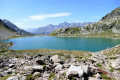
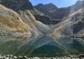
Around fifteen lakes, two peaks over 2,800 metres, and breathtaking views: this hike deserves every superlative.
The route takes in almost all the lakes of the Allevard massif on either side of the Col des Sept Laux and culminates at the two summits of the Toit, from where the view takes in a magnificent landscape.
Please note: crampons and an ice axe are essential in all seasons.

Details

n°2229166
Creation:
Last update:
Last review:
  • Walking
    Activity: Walking
  • ↔
    Distance: 13.26 mi
  • ◔
    Duration according to the author: 8 hrs 
  • ▲
    Difficulty: Very difficult

  • ⚐
    Back to start: Yes
  • ↗
    Ascent: + 6,460 ft
  • ↘
    Descent: - 6,608 ft

  • ▲
    Highest point: 9,219 ft
  • ▼
    Lowest point: 4,134 ft

Photos

Description of the walk

Introduction: See the practical information for the starting point. Please read all of this information carefully before setting out on the walk.

(S/E) At the car park, a yellow sign points towards the Lacs des Sept Laux. The path is aGRP® trail marked in red and yellow. It climbs eastwards, passing several concrete steps – some of which have handrails – before reaching the Ruisseau des Sept Laux.

(1) Cross the wooden footbridge, which only spans half the width of the stream during the snowmelt. The path climbs steeply in switchbacks to the north-east, crossing a few other minor streams. It leads to a small clearing, above which a sign has been erected.

(2) At the Lac de la Sagne signpost, head towards Lac de la Corne, following the red and yellow markings along the left bank of the lake. Continue towards the northern end of the lake until you reach the tributary stream of the Ruisseau des Sept Laux.

(3) Just before crossing the Ruisseau des Sept Laux, turn sharply right (due east) and climb off-trail through the weathered rocks and rhododendrons to enter a wide cirque. With a bit of luck, you may spot some ibex there. The cirque opens out onto an unnamed pass, marked at 2,356 on the IGN map.

(4) From the pass, Lac de l’Agnelin is clearly visible. Head towards it, keeping slightly to the north at the start of the descent. Walk round the lake to admire the scenery.

(5) From the western end of the lake, head down northwards to cross the Ruisseau de l’Agnelin below, then climb back up and follow the base of the rocky spur that runs alongside the south-western ridge of Le Toit. Climb the grassy slopes dotted with boulders, continuing northwards, until you reach a step in a shoulder descending beneath the north-western ridge of Le Toit (see IGN topographical map, elevation 2381).

(6) Then cross a small grassy valley and climb up to the next shoulder (less than 50m from the altitude point), still heading north. Refer to the photo of Le Toit and the photo showing the ascent route (taken from the Lacs de la Ratoune, approximately 1.1km to the north) to clearly identify the key waypoints.
Now head due east, climbing up the northern flank of the ridge almost to the foot of the steep rocky outcrop at the western end of the Toit’s north-western ridge. If there is snow, put on your crampons here, as the slope then becomes very steep.
Go round the rocky outcrop to the north, ascending the gully which is usually covered in snow until late summer. A snow couloir (see photo mentioned above) is then visible to the south; ascend it in a circular manner towards the south until you reach the pass on the north-west ridge of Le Toit. Caution: the exit from the couloir is steeper than 45° (100% gradient).

(7) At the pass, step onto the ridge and follow its line of large, fairly stable boulders to the northern summit of Le Toit.

(8) From the northern summit, head towards the southern summit along the ridge separating them.
Important note: If you do not feel comfortable on the ridge, it is possible to take a slightly lower route down the western slope of the Toit.

(9) From the southern summit, either retrace your steps back to (7), or cut diagonally (see track) north-west across rocky scree and snowfields. If the snow has melted, stick to the ridge and the route taken on the way up.

(7) Descend first down the southern couloir, then over the snowfields and/or scree to the west, until you reach a cirque that runs northwards towards Lac Blanc. Descend this cirque to the lake.

(10) Cross its tributary to head eastwards and go round the rocks bordering it from above. Once you reach a small plateau above the rocks, head northwards, following the contour lines, until you reach a magnificent little lake with one or two central islets, depending on the water level.

(11) Go round this lake on its eastern and then northern sides, then head briefly westwards to reach a ridge where a cairn-marked path runs towards a huge cairn on a hillock. Do not go all the way to it: as soon as Lac de la Ratoune comes into view below on the left, veer right towards the north to follow the contour lines once more; pass two small lakes before reaching athird, slightly larger one, Lac de l’Île.

(12) Go round it and then head west, crossing a ridge to reach the dykes that dam Lac de la Motte to the north.

(13) Cross these dykes and join the path that runs along the western shore of the lake before reaching its junction with the Cottepens path. From there, follow the path westwards leading to the Refuge des Sept Laux and its tiny adjoining lake.

(14) Turn back to this junction of lakes. Cross the dyke separating the two lakes (de la Motte and Cottepens) and head south on theGRP® path, or (see the GPS track), take a detour via the large cairn seen earlier.

(15) If you’ve chosen the cairn option, continue along the western flank of the ridge on which it stands, heading south, whilst aiming to get closer tothe GRP® trail below (the slopes are quite steep).
Rejoin theGRP® to the south until you reach the dam at Lac du Cos.

(16) TheGRP® heads off to the right, but it is more interesting to walk along the eastern shore of Lac du Cos, which presents no difficulty. This takes you to a small plateau at the southern end of the lake, dotted with beautiful small lakes set amongst alpine meadows.
Cross this plateau heading south until you reach some steep, rounded rocks. Go round these to the west, descending alongside the streams flowing from the small lakes, and cross the main stream of the Sept Laux to rejoin the GRP®. This route goes round Lac de la Corne to the west and then to the south before veering southwards to reach the junction where you crossed the Ruisseau des Sept Laux on the way up.

(3) Then follow the ascent route in the opposite direction to pass the signpost again.

(2) Then descend the seemingly endless hairpin bends leading to the footbridge and the car park on the old dam road (S/E).

Waypoints

  1. S/E : mi 0 - alt. 4,321 ft - Old dam road. Near the - Eau d'Olle (torrent)
  2. 1 : mi 0.44 - alt. 4,849 ft - Footbridge
  3. 2 : mi 1.43 - alt. 6,762 ft - Sign - Lac de la Sagne (2060m)
  4. 3 : mi 1.73 - alt. 6,808 ft - Ruisseau des Sept Laux. Overhanging the - Lac de la Corne (2100m)
  5. 4 : mi 2.34 - alt. 7,713 ft - Unnamed pass
  6. 5 : mi 2.82 - alt. 7,608 ft - Lac de l'Agnelin
  7. 6 : mi 3.65 - alt. 7,789 ft - Altitude
  8. 7 : mi 4.21 - alt. 8,757 ft - Pass at the top of the access couloir
  9. 8 : mi 4.45 - alt. 9,147 ft - North Summit - Le Toit
  10. 9 : mi 4.6 - alt. 9,209 ft - Southern summit - Le Toit
  11. 10 : mi 5.67 - alt. 7,405 ft - Lac Blanc (Massif d'Allevard)
  12. 11 : mi 6.43 - alt. 7,549 ft - A superb little unnamed lake
  13. 12 : mi 7.36 - alt. 7,365 ft - Lac de l'Île
  14. 13 : mi 7.83 - alt. 7,005 ft - Lac de la Motte (2130m) - 7 Laux
  15. 14 : mi 8.36 - alt. 7,011 ft - Between Lac Carré and Cottepens - Refuge des Sept Laux
  16. 15 : mi 9.39 - alt. 7,402 ft - Huge cairn
  17. 16 : mi 10.17 - alt. 7,142 ft - Dam and embankment at the - Lac du Cos (2170m)
  18. S/E : mi 13.26 - alt. 4,167 ft - Old dam road

Notes

?️ Park at the car park on the old D526 dam road, past the IGN elevation point 1261. As the site faces due south, it’s best to park under the trees lining the road on the downstream side, preferably to the east of them, to avoid your car getting scorching hot on your return.

? There is plenty of water along the entire route, in the form of snow as you climb to Le Toit. A water filter is, of course, recommended.

? Dogs are allowed in Belledonne, but the ascent to Le Toit is too difficult for most of them, and the length of the hike will exhaust those who are less fit.

?‍♀️ This hike is classified as ‘very difficult’ due to the presence of steep snow slopes (a 45° couloir), easy climbing sections stretching over 200 metres, the lack of a marked path for half the route, and the route’s length.

? As the hike is long, it is possible to complete it over two days.

If you wish to avoid the crowds, it is possible to camp near the lakes; the small lake between Lac Jeplan and Lac de la Corne is relatively quiet and allows you to leave your camping kit there, but this requires you to head back down to (3) in the morning. Another option is Lac de l’Île (12) or the unnamed lake (11), but you’ll need to carry a sleeping bag and mat to the summit.

A less solitary option is to spend the night at the Refuge des 7 Laux (14).

? Essential kit in all seasons includes crampons, an ice axe and gaiters (obviously, trousers are preferable to shorts). A rope is of little use unless you wish to reassure someone who feels uneasy in the couloir (7) or on the Toit ridge. A helmet is optional; there is no significant risk of rockfall (though there’s no such thing as zero risk…). Don’t forget your head torch, which will ensure you reach the base of the couloir in good time.

⏰ At the start of the season, it’s essential to set off very early to ensure the snow is firm on the descent. The couloir leading to the pass is bathed in sunlight around 9.00 am at the summer solstice; it’s best to exit it around 8.30 am, which means setting off from the car by 4.00 am at the latest.

? The IBP statistics for the route give an index of 221, a distance of 22.1 km, a total elevation gain of 2,133 m, a walking time of 6:09:40 and an average speed of 3.59 km/h. The VisuGPX statistics are slightly different.

? Finding your way is easy; you simply need to orientate yourself using the north-south axis of Lake Cottepens to Lake Cos, or the ridges forming a right angle at the Pic de la Belle Étoile (Crête des Îlettes – the ridge towards the Pics de l’Apparence and the Pics des Cabottes). The IGN topographical map is fairly accurate, which is rare in the mountains.

Worth a visit

? Alpine wildlife is, of course, present. During my hike in late June 2019, around fifteen ibex were frolicking in the valley rising from Lac de la Sage towards the pass (4).

? The views from the summits are splendid. This annotated panorama gives an idea of the visible peaks, even though the photo was taken on an exceptionally hot day, in very misty conditions. To explore and zoom in on it, visit the online version on Google Photos.The full album from the trip is also available there.

The following photos are spherical and interactive:

? Several route options are possible. If you’re pressed for time, it’s easy to shorten the circular route, for example by taking a shortcut between (11) and (15), or even between (10) and (16).

For the first shortcut at (11), a cairn-marked track runs alongside Lac de la Ratoune and heads towards the enormous cairn situated on an ancient moraine. Cross the moraine and descend by sight to the path below.

To take the shortcut from (10), you must climb up the rounded rocks bordering Lac Blanc to the south, to reach its spillway, and then follow its outlet to theGR® path. Please note that in both cases, the grassy slopes are relatively steep.

See also the option for wild camping or a mountain refuge in the practical information section.

Always be cautious and plan ahead when you're outdoors. Visorando and the author of this route cannot be held responsible for any accidents occurring on this route.

The GR® and PR® markings are the intellectual property of the Fédération Française de Randonnée Pédestre.

Reviews and comments

4.7 / 5
Based on 1 review

Reliability of the description
5 / 5
Ease of following the route
4 / 5
Route interest
5 / 5
smashdc
smashdc
• Edited:

Overall rating : 4.7 / 5

Date of your route : Sep 05, 2023
Reliability of the description : ★★★★★ Very good
Ease of following the route : ★★★★☆ Good
Route interest : ★★★★★ Very good
Very busy route : No

Some absolutely stunning lakes to discover. Breathtaking views 👌

Machine-translated

Other walks in the area

For more walks, use our search engine .

The GPS track and description are the property of this route's author. Please do not copy them without permission.