


 Country:

 City:
City:


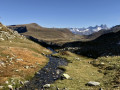
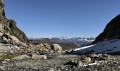
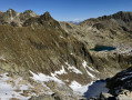
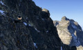
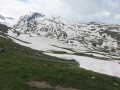
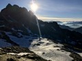
Please note: read the practical information carefully regarding the difficulty, weather and essential kit for this hike. As with any hike, you should read the description and look at the orientation photos in advance, particularly reference photos 1, 2 and 3, which give an idea of the route off the beaten track.
The markings are yellow on a green background as far as Lac de la Combe, then completely absent until the bottom of the Combe de la Croix, and yellow on a green background again between Lac de la Croix and the Col du Glandon.
(S/E) From the Col du Glandon car park, follow the direction (west) indicated by the signpost for Lac de la Croix and Lac de la Combe. The path along the hillside leads after 500m to a grassy clearing where there is another signpost.
(1) Turn left (south-west) to follow the direction of Lac de la Combe, as indicated by the yellow sign. The path climbs up the side of the grassy Carrelet dome and, beyond it, joins the route coming from the “Source du Glandon” at the Mollard du Gai clearing (sign).
(2) Continue climbing towards Lac de la Combe (west). After a hairpin bend to the right, pass the Chalet de la Combe (a stone chalet, unfortunately covered in rusty sheet metal), and after another hairpin bend to the left, you’ll reach Lac de la Combe, where there is another alpine chalet (new, made of wood).
(3) From the lake, head north-east up gently sloping grassy slopes until you reach a ridge running parallel to the Petites Aiguilles (do not go as far as the moraine at the bottom of the valley, as this is less comfortable for the ascent). This ridge, initially grassy and then consisting of large boulders, runs north-west towards the foot of the Col de la Combe (the photos of the grassy ridge and the peaks will help you find your bearings). Climb (north-west) up the ridge, keeping to the eastern flank to avoid the two rocky outcrops, following the cairns marking the route.
Leave the shoulder to reach the foot of the pass, traversing upwards over steeper and less pleasant scree, still heading north-west.
The route leading to the pass itself is only visible at the very last moment (do not confuse it with the Grand Coup de Sabre du Piniollet, further to the east) as it is hidden by the Aiguille Jérome Gaillard: the pass has two ascending couloirs, separated by a small, unnamed rocky peak; the right-hand couloir (orographic left) is not used.
Get kitted out at the top of the scree marking the base of the left-hand couloir; at the very least, stow your poles in your rucksack and put on your helmet. Then climb up the left-hand couloir (on the orographic right), belaying yourself if necessary on the three bolts/quickdraws that equip the route (a few very short sections are grade 3 and require the use of your hands).
(4) At the pass, take a moment to admire, on the left, the start of the route across the Grandes Aiguilles (mountaineering F-PD), then head north-west to cross the large cirque beneath the Aiguille d’Olle, which is littered with large, often unstable boulders (difficult terrain, especially in the presence of ice or snow). This will take you to the steep rocky shoulder extending from the north-east ridge of the Aiguille d’Olle. A steep, straight couloir descends due north along the eastern flank of this shoulder (my GPS track shows a detour just before this into a small couloir to the north-east; there’s no need to follow it to the letter unless you fancy prolonging the fun of exploration).
Descend this straight couloir (due north), using an ice axe and crampons where there is snow, to reach the bottom of the valley coming from the Glacier de l’Argentière. See the location photos and the photo of the couloir.
(5) From the bottom of the valley, head up the opposite side, first over moraine scree and then across grass, towards a broad shoulder of terrain covered in rounded boulders (generally heading north, up to the crest of the shoulder). Lac de la Croix is then visible to the north, on the other side of a narrow valley.
Note: to get the most out of the walk, do allow yourself to wander along this shoulder and explore its countless small lakes.
Then head up this shoulder, generally heading west. My GPS track veers away from the ridge of the shoulder on the north side, but it is more direct and obvious to stay close to the ridge. As you approach the Col de la Marmottane (this pass is not named on the IGN map; it lies on the Crête de la Marmottane, just below the Rocher Armorié at 2,602m – do not confuse it with the pass of the same name, which lies much further south), head northwards to reach the low point on the hillside.
(6) From the pass, descend the very steep couloir to the east, which quickly turns into an easier valley floor heading east-north-east. Follow the valley floor until you reach a pile of large boulders marking the bottom of the Combe de la Croix, where you’ll come across a cairn-marked path.
(7) For a round trip, follow the cairn-marked path back up to reach the magnificent Lac de la Croix, 60 metres higher up.
(8) Return from the lake via the route you took up.
(7) Follow the well-marked (yellow on a green background) and well-cairned path leading to the Combe de la Croix. This path then heads east-southeast along the valley floor and crosses a narrow gorge in the stream bed via the right bank; if the stream is too swift, cross to the left bank and follow the alternative cairned route. You will then reach the plateau of the Plan des Trois Eaux.
(9) Continue along the relatively flat Trois Eaux path (still heading east-southeast), ignoring the paths leading to the summit of Sambuis and the one heading ‘below the pass’ on the left, and follow the route towards the Col du Glandon. The path veers southwards, descending slightly, then veers eastwards and climbs again as it crosses the Glandon.
Continue along the hillside to reach the pass (1) and the car park (S/E).





 Visorando Member

 Moderate
 Difficult
 Very difficult
