


 Country:

 City:
City:


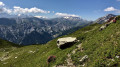
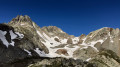
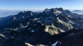
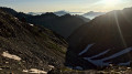
Introduction: see the practical information section for details on parking and recommendations for undertaking this hike.
(S/E) From Les Granges, take the easy path – sometimes marked in yellow – which climbs westwards on the left bank along the Torrent du Merlet. This will take you to Les Chalets de la Loze, where you’ll find a signpost indicating the Cols de la Lavoire and du Merlet.
(1) From Les Chalets, continue westwards, either on the left-bank path, the right-bank track, or – as shown on the map – by following the thalweg along the torrent until you reach the hamlet known as La Vieille Route.
(2) Cross the Vieille Route heading west, then turn south-west onto vague sheep tracks to climb up a morainic ridge. Stay on the ridge or its eastern flank, then head south until you reach a cluster of large boulders, which can be easily bypassed. Continue climbing due south up the scree-filled valley of the “Croza” (see IGN map). Take care not to veer off to the right (west) towards the Col de la Colombière. Climb up the scree, staying at the bottom of the valley, and pass through a rocky narrows (IGN elevation 2,283 m).
Do not take the faint cairn-marked path leading up to the Col du Villonet, but follow the stream southwards, then turn into a scree-filled cirque to the west to emerge via rocky terraces onto a plateau bordered by rounded boulders, upstream of the Col du Villonet.
(3) From the plateau, the Brèches de la Passoire are then visible due west, with two couloirs flanking the one leading to the geographical pass; see the reference photo. Head west towards the left-hand couloir, which is generally clear of snow by the end of the season.
Climb the steep couloir up to the pass.
(4) At the pass, follow the few cairns marking the ridge south-south-west to the summit. The route first skirts the ridge to the west (descend a little on the western side of the pass) then runs mainly through a sort of couloir on the eastern flank of the ridge. The easiest way is to stay on the left-hand side (right-hand side as you ascend) of this couloir and make good use of the rocks rather than staying on the loose scree at the bottom of the couloir.
You will then reach the summit without much difficulty.
(5) From the summit, after exploring the surrounding cairns, retrace your steps back to the pass and then to the plateau.
(3) From there, continue eastwards along the rocky shoulder towards the Col du Villonet, marked by a signpost.
(6) From the pass, follow the track along the hillside beneath the Rocher des Trois Doigts, which runs on level ground south-eastwards to the Col des Balmettes.
(7) At the pass, turn slightly back to the right, descending north-west, to find a faintly cairned track to the right of a small rocky spur, which plunges down into the Combe Rousse. Be careful, it is very easy to lose the track!
Continue along this path to reach the valley floor of the Combe Rousse, keeping to the left-hand side, until you reach a large cairn on a flat rock.
(8) At the cairn, take the path which climbs up the grassy slopes to the left, heading south-east. This path crosses a small rocky section just before reaching a flat area below the ridge descending to the south of the Pointe des Balmettes. A signpost marks the spot.
(9) Turn eastwards to follow the well-marked path along the contour line. When the path begins to descend, look out for a junction on the left (altitude approx. 2,240 m) which branches off north-eastwards along the contour line beneath the Combe de la Pointe des Balmettes; see the reference photo.
(10) Follow this very gently descending path, which turns due east after reaching a scree slope, thereby skirting a rocky spur to the south. When this path joins another ascending from the Planard de Combe Rousse, turn left, heading due north across a fairly wide plateau. As it reaches the steeper slopes, the path then cuts across to the left (west) to climb up towards a small pass (in summer, sheep pens mark the top of the pass). Climb up to the Collet des Balmettes, from where you can see the lake of the same name.
(11) Cross the small pass of Collet des Balmettes and descend the scree slopes to the north, following a few cairns, to reach the western end of Lac des Balmettes. Go round the lake to the north to reach a signpost on the path.
(12) At the signpost, take the path leading down to the north-east on the left bank of the lake’s outlet. Follow this path to a junction at the IGN elevation of 1,915 m. Then turn left (north) to follow the contour path leading to the Chalets du Balais and the Croix de la Charmette, set amongst beautiful mountain pastures.
Continue along the path northwards, descending slightly and crossing a small valley (le Balais) to reach a small, recently built shepherd’s chalet sheltered by coniferous trees.
(13) Pass the shelter and descend the steep path to the north, which turns left (west) after a spring. The path then descends along the hillside through semi-open terrain until it reaches the area above Les Granges. You will then arrive back at the starting point (S/E).
 Tourism professional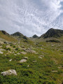

 Visorando Member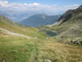
 Moderate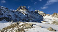
 Difficult
 Easy
Easy 
