Country:

 City:
City:


Park at the sixth hairpin bend above Le Perron; there are plenty of parking spaces available.
Warning: some sections of the route may be difficult to locate; study the reference photos mentioned in this description carefully.
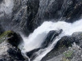
(S/E) From the car park, follow the track heading north-north-east, which descends slightly towards the Pont Ferrand. At the bridge, signposts indicate the Lac des Quirlies and the path is marked in yellow. Cross the bridge and follow the winding path up the schist slope (east). When the path becomes less steep and heads north, passing directly below the main Ferrand waterfall, look out for a faint track on the right that climbs south (behind you) through the grass. This track is difficult to find; see the location photo and its explanations.
From here onwards, there will be no further path and very few tracks along the entire route up to the junction (16).
(1) Turn back to leave the path and head south along this track, towards the ridge descending from the Échine de Praouat, then follow a few switchbacks eastwards through the grass to reach a gentler slope. Turn left to cross this grassy slope northwards beneath signs of erosion in the black schist. Once past these erosion marks, wind your way up through the grass towards the east until you spot herd tracks crossing the schist to the south. Follow these tracks and cross the schist to reach a triangular marker at the promontory of the Échine de Praouat.
(2) From the promontory, head off in the opposite direction, north-north-east, to follow the (flat) line of the grassy ridge which climbs up to the Serre du Chargeoir, the highest point of the ridge. Continue a little further in the same direction until you reach a small pass where a path runs through and from where you can see the Col de la Valette.
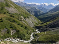
(3) From the small pass, follow the path for 50 metres as it climbs northwards, then leave it to the left (north-west) to follow the grassy shoulder leading up to the Col du Fond du Ferrand. This pass on the Crête des Sauvages is very poorly marked but offers a fine view of the stream and the eroded valley of La Valette.
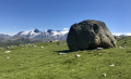
(4) From the pass, look westwards towards the point where the rocky foothills descending from the Cimes des Sauvages meet the mountain pastures. A large stone lying in the grass is the landmark to aim for, whilst remaining at almost the same altitude. Continue westwards towards this landmark.
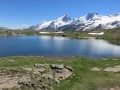
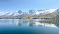
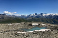
(5) After passing this stone, descend the fairly steep grassy slopes to skirt around the base of the rocky escarpments, then climb back up towards the west-south-west over stable moraine scree to reach Lac des Quirlies via its left bank.
(6) Walk round the lake along its left bank until you reach the central moraine descending from the Quirlies Glacier (it rests on the ice and a stream flows out of it through a cave). Climb up this moraine on the left (south-west) to find a place where you can cross the lake’s main tributary (see photo).
(7) Once you have crossed the glacial torrent, head due east along the crest of the moraine barrier bordering the lake’s right bank, amongst scree and rounded boulders (see photo), until you reach rocky ledges in the grass.
(8) Once you reach these ledges, take the time to locate your target point on a barely visible ridge to the south. Use the orientation photo and its explanations to do this: the ridge in question is the one extending from the Râteau des Rousses but is difficult to distinguish from the one just above it, descending from the Serre des Plonges.
Then set off on level ground to cross the valley, first over rounded boulders and then over moraine scree, heading generally south-south-west.
(9) Once you reach the ridge’s shoulder, turn right and head westwards up the (scant) stream, across grassy slopes, then veer left (south then south-west), climbing between beautiful weathered rocks whose colour gradually turns to red. This leads to the small ponds of the Serre des Plonges, overlooked by meadows looking out over the Meije ridge towards the Lans glaciers.
(10) From the lake, head off to the right to climb due west then west-north-west up the rocky valley. The slope is gentle; follow the lines of least resistance through numerous weathered rocks. In doing so, you will pass above two other small lakes marked on the IGN map, before reaching the ridge of the Râteau des Rousses, near the gentle pass between the Malatres and Quirlies glaciers.
(11) Follow the ridge due east to reach the clearly visible central peak of the Râteau des Rousses (see photo). This is easy climbing; stay on the southern side of the ridge.
(12) From the peak, retrace your steps to the gentle pass between the Malatres and Quirlies glaciers.
(11) Follow a gentle slope down towards the south to Lac des Malatres, beneath the imposing glacier of the same name.
(13) Pass the lake’s spillway and descend (east) to the secondary lake, then veer right (south) to cross and descend the valley of the Malatres stream. Cross all the branches of this stream and head for a cairn marking a passage over a beautiful, dark moraine shoulder.
(14) Below this cairn, several other cairns spaced out along the route indicate a descent route to the south-east beneath the Côte Séverail ridge. Follow these cairns through the scree, without trying too hard to find every single one, until you reach the top of the grassy plateau north of the Clos du Bœuf. Head for this stone and descend in a wide circular loop down onto the plateau.
(15) At this stone, descend southwards through the weathered rock for about a hundred metres, before crossing to the right (south-west) towards a shoulder sloping down from the Clos du Bœuf.
Once at this ridge, veer left towards the south-east to follow the numerous sheep tracks down to the main Sarenne path (level path).
(16) Join the path and continue along it northwards (to the left) until you come within sight of the Clos Chevaleret shelters. Do not continue along the level path but turn right (east-southeast) onto the Clos Chevaleret. A signpost indicates the direction to follow to reach Pont-Ferrand and Le Perron. The markings are yellow once again. Head down this path, generally southwards, until you reach the junction with the path running alongside the Ferrand, then turn right onto this path to reach the concrete footbridge crossing the torrent.
Then head down the main path to Pont-Ferrand. Walk slightly uphill along this path to reach the track you took on the way there, and follow it back up to the car park (S/E).

 Visorando Member
 Difficult
 Moderate