Vallée Étroite and the Rochers du Tru

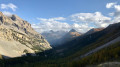
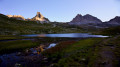
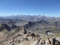
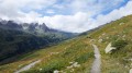
A magnificent route around the Tours du Vallon, exploring numerous lakes and viewpoints offering unique views of the summits of Mont Thabor, Séru and Rois Mages.

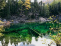
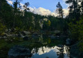
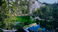
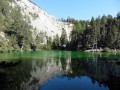
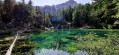
This walk is ideal when the golden larch trees stand out against the deep blue of the clear autumn skies and are reflected in the emerald waters of the famous Lac Vert, the highlight of the outing.

More than two-thirds of the walk is off-trail, but it is easy to find your way.

Details

2664711
Creation:
Last update:
Last review:
  • Walking
    Activity: Walking
  • ↔
    Distance: 13.89 mi
  • ◔
    Duration according to the author: 8 hrs 
  • ▲
    Difficulty: Extremely difficult

  • ⚐
    Back to start: Yes
  • ↗
    Ascent: + 5,020 ft
  • ↘
    Descent: - 5,003 ft

  • ▲
    Highest point: 8,865 ft
  • ▼
    Lowest point: 5,748 ft

Photos

Description of the walk

⚠️ See the Practical Information section for details on difficulty, car park and starting point.

(S/E) From the car park, cross the small bridge on the road over the stream in the Combe de la Miglia and immediately turn left (west) onto the path climbing through meadows towards a large, isolated house. Turn left behind it and climb the track that leads straight up to the Terzo Alpini refuge. The path has a fork in the road to the left towards the stream, which you cross again before tackling the switchback climb through the larch trees. The route is marked with theGR®®5, red and white.

The path soon emerges from the larch forest, heading south-east and crossing open, level stretches before reaching Lac Chavillon, just below the Col des Thures.

(1) At the Col des Thures, turn right at a right angle and head off-trail up a grassy ridge, due west. You will soon reach the small Lac Bellety.

(2) Go round the lake to the left and continue along the level ground, heading west, across grassy and rocky terrain until you reach the foot of a wide stone-strewn bed, that of the Thures stream, which is often dry by the end of the season. Climb up this stone-strewn bed on the most accessible bank (often the left bank).

When the slope steepens beneath small rocky spurs, the scree becomes denser and is criss-crossed by sheep tracks following the contour lines. Turn right here to follow any one of these tracks north-westwards, thereby skirting the base of these rocky spurs. This takes you onto a grassy ledge beneath the Roche Pertuse (see this photo or the next one to identify it).

(3) At the pass, cross over to the western slope, which consists of scree, and descend the thalweg to the south towards a small flat area bordering a very steep ravine. Descend into this ravine, where the ground is very unstable, to reach the stream bed, which is dry in summer. You have a choice: either descend this bed, scrambling down a few large boulders, or follow the GPS track – that is, head south up the opposite bank of the ravine to reach a scree slope, then descend its ridge to the west to reach more stable rocks, which you should bypass to the south. In any case, choose the rocks over the gravelly scree. The reference photo was taken from the southern flank of the rocks to be bypassed and shows the Chalets du Vallon opposite, as well as the upper path to be joined later.

Once past these rocks, continue by sight towards the bottom of the valley before heading up towards the Chalets du Vallon. Continue climbing behind the chalets towards the GRP®®.

(4) Cross theGRP®® to follow the upper path shown in the photo for a short while. However, leave this path as soon as the slope becomes slightly less steep to head south, cutting across the contour lines, and reach the stream flowing from Lac Noir (Ravin du Content). Follow the stream upstream to the lake.

(5) Go round the lake and head due north to cross a grassy plateau and climb up to the stony ridge of Les Aupettes (see IGN). Cross this ridge level, heading north-north-west, at the foot of the steeper slopes on the left, and you’ll reach the small Lac du Châtelard.

(6) Walk round the lake to the left (west) and head westwards up the bed of the dry stream that feeds it in spring. Follow this stream bed to Lac Long.

(7) After going round the lake, continue on level ground to the north-east, towards a small grassy hillock, and follow the edge of this hillock north-north-west, above the rocky escarpments that underpin it.

When these cliffs disappear, look out for the path 150 m to the north-east, situated below and marked by cairns, which generally continues northwards through a scree slope of boulders. Make your way to one of these cairns.

(8) Climb up along this cairn-marked path, first north-west and then north, to reach the rocky ridge of Lac Blanc.

(9) At the lake, look out for the rocky hillock on the left bank of its spillway. Cross the spillway to the north and go round this hillock on its eastern flank, over rocky but easy slopes. Look out for the level path heading due east across the scree below the Rocher Blanc towards Les Tours and the Col du Vallon.

Join this path and continue to the Col du Vallon.

(10) From the pass, descend northwards along theGRP®® Tour du Mont Thabor trail (red and yellow), which runs through the rocky boulders facing the Grand and Petit Séru (see the photo and its annotations to identify the various peaks serving as landmarks). When the ridge descending from the Rocher Blanc (the peak to the west of the Col du Vallon) offers a clear view of the Roc de Valeminier and Mont Thabor, it is time to leave the path.

(11) Turn left here, heading west-north-west, and follow the contour lines towards the Rochers du Tru (the ridge directly below the Roc de Valeminier in the previous reference photo).
The route is straightforward as far as the Rochers du Tru, over fairly steep scree slopes. Once you reach the valley floor beneath the small pass just before the Rochers du Tru, climb up it to the pass, then follow the ridge to reach the summit and enjoy the view.

(12) From the summit, retrace your steps a few metres back to the small pass, then descend by sight towards the valley floor to the west of the Rochers du Tru, amongst rhododendrons and blueberry bushes. You’ll easily reach the streams flowing towards Lac Lavoir to the north, and follow them to the lake.

(13) Make your way to the lake’s spillway, from where a good path leads down towards the east-north-east. Follow this path to reach the footbridge at Prat du Plan, where it joins the Thabor path.

(14) Continue the descent, now heading east then south-east, until you reach the wide, vehicle-accessible track at the Maison des Chamois, in the Vallée Étroite. Follow this track, where marked paths allow you to cut across its overly wide bends until you reach the valley floor and the stream in the Vallée Étroite. Then leave theGR®® track to cross the stream via a footbridge to the east, clearly visible from the GR®®.

(15) Behind the footbridge, a path rises straight up the slope and climbs a few metres up a tree-dotted ridge bordering the stream to the east. Follow the crest of this gently sloping ridge south-southeast, passing numerous picnic and camping spots along the way. When the slope becomes a little steeper, signposts indicate the direction of Lac Vert.

(16) Then head towards the lake, due east. Walk round this magnificent lake, a veritable emerald gem, and exit via the small pass that closes it off to the south. Return south-west through the woods along a rough track to climb back up to the ridge you left earlier and rejoin the path leading down from the lake. Follow this path along the Vallée Étroite stream, then cross the torrent at the first available bridge to return to the right bank.

Continue along one of the good, vehicle-accessible tracks leading down to Les Granges, to return to the starting point (S/E).

Waypoints

  1. S/E : mi 0 - alt. 5,748 ft - Granges de la Vallée Étroite car park
  2. 1 : mi 1.96 - alt. 7,188 ft - Lake Chavillon and Col des Thures - Lac Chavillon
  3. 2 : mi 2.44 - alt. 7,507 ft - Lac Bellety
  4. 3 : mi 3.55 - alt. 8,163 ft - Col de l'Étroit du Vallon
  5. 4 : mi 4.28 - alt. 7,178 ft - Chalets du Vallon and GRP
  6. 5 : mi 5.01 - alt. 7,844 ft - Lac Noir (Névache)
  7. 6 : mi 5.94 - alt. 8,064 ft - Lac du Châtelard (Névache)
  8. 7 : mi 6.43 - alt. 8,668 ft - Lac Long (Névache)
  9. 8 : mi 7.54 - alt. 8,399 ft - Cairn
  10. 9 : mi 7.94 - alt. 8,858 ft - Lac Blanc (Névache)
  11. 10 : mi 8.54 - alt. 8,675 ft - Col du Vallon
  12. 11 : mi 9.08 - alt. 7,923 ft - Leave GR
  13. 12 : mi 9.49 - alt. 8,140 ft - Rochers du Tru
  14. 13 : mi 10.1 - alt. 7,480 ft - Lac Lavoir (Névache)
  15. 14 : mi 10.75 - alt. 7,241 ft - Prat du Plan
  16. 15 : mi 12.09 - alt. 6,211 ft - Footbridge
  17. 16 : mi 12.55 - alt. 6,063 ft - Signpost - Lac Vert (Névache . Hautes-Alpes)
  18. S/E : mi 13.89 - alt. 5,748 ft - Granges de la Vallée Étroite car park

Notes

?️ Park at the Granges de la Vallée Étroite car park, N 45.068512° / E 6.625439°. By clicking on this Waze link, you can enter these coordinates directly into your sat-nav app. There are two mountain huts just a few metres from the car park, where you can spend the night before the hike.

? There are numerous lakes where you can fill up with water, but you’ll need to bring a filter.

? Dogs are allowed in this part of Les Cerces, but herds of livestock are present along the entire route. You must therefore be able to recall your dog.

?♀️ The difficulty of this hike lies mainly in the descent over loose scree from the Col de l’Étroit du Vallon towards the Chalets du Vallon, as well as the lack of a marked path for more than half of the circular route. However, it is easy to find your way, with excellent landmarks. For seasoned walkers, the ‘extremely difficult’ rating may seem exaggerated, but it helps avoid surprises for summer walkers. To navigate the loose scree, the easiest technique is the ‘crouch’ (as on a snowfield), with one rear foot planted firmly in the scree to control speed and maintain balance.

? The Vallée Étroite is frequently shrouded in cloud drifts from Italy, so you may have to make your way through the mist (a compass or GPS is useful).

? It is possible to split the hike into two stages and camp near one of the lakes, for example Lac Noir (5) or Lac du Châtelard (6). It is also possible to stay at one of the huts in the Vallée Étroite so you can set off early in the morning.

? Standard hiking kit is sufficient. Trekking poles are very useful on the descent from the Col de l’Étroit du Vallon, and an ice axe is even more advisable (even in the absence of any snow). For those who enjoy watching the sunrise or sunset, a head torch is essential.

⏰ The hike is relatively long, so you should plan to set off early.

? According to IBP statistics for the route, the index is 179HKG, the distance is 22.79 km, the total elevation gain is 1,603 m, the walking time is 6:02:11 and the average speed is 3.78 km/h.

? Finding your way is straightforward, but a GPS – or, of course, the Visorando app – is recommended in case of fog.

Worth a visit

? Alpine wildlife is present; in particular, chamois inhabit the east-facing slopes below the Roche Pertuse and the Sommet Rond.

? The views are spectacular; see this interactive photo of Lac Noir or the one taken from the Rochers du Tru.The album for this outing is public.
As is often the case in the Cerces, autumn offers the most beautiful scenery, with crystal-clear, deep-blue skies and the rich colours of golden larch trees blending with the emerald reflections of Lac Vert.

? Several alternative routes are possible. If you’re in a hurry, you can shorten the route between (6) and (8) by skipping Lac Long. It’s also possible to descend directly from the Col du Vallon to the Maison des Chamois (below the Tête du Chien), by staying on the path at (11), but that’s a real shame. Finally, if you stay on theGR®®57without crossing the Vallée Étroite stream (15), you can reach the car park without passing by the magnificent Lac Vert (16). These alternative routes are only recommended if you are very tired.

Always be cautious and plan ahead when you're outdoors. Visorando and the author of this route cannot be held responsible for any accidents occurring on this route.

The GR® and PR® markings are the intellectual property of the Fédération Française de Randonnée Pédestre.

Reviews and comments

2.8 / 5
Based on 2 reviews

Reliability of the description
2.5 / 5
Ease of following the route
3 / 5
Route interest
3 / 5
bouvierjr
bouvierjr ★

Hello,

No, the route from Lac Blanc to the Col du Vallon is straightforward; you just need to stay at the same altitude, as the pass is visible practically the whole way. Generally speaking, it’s easy to find your way as the route follows a natural path.

However, the descent from the Col de l’Étroit du Vallon down to the Chalets du Vallon is quite steep. At the moment, there’s still quite a lot of snow, which means you can comfortably walk in a snowshoe formation (if you’re confident doing so), but the rest of the hike will be slowed down by this snow.

Enjoy the hike!

Machine-translated

Ruben b
Ruben b

Hello, is the route from Lac Blanc to Col du Vallon tricky in terms of navigation and the level of difficulty involved?
Kind regards

Machine-translated

bouvierjr
bouvierjr ★

Seek advice from a guide or an AMM (I’m in the final stages of my training); you’ll see that this is the best way to tackle this sort of terrain, even where there are rocky outcrops. This technique is particularly reliable, even though it means I have to have my soles replaced every year. Here’s a reference.

Try it out first on gentler slopes if you’re feeling a bit unsure (but not too gentle, otherwise you won’t be able to get down). You’ll see that there’s nothing reckless about it.

PS: I’m not trying to stir up controversy, but simply to share some experience I’ve gained over the years; I’ve been hiking in the mountains for about 40 years, averaging over 100 trips a year (more like 120 at the moment).

Machine-translated

Julie Dumeyniou
Julie Dumeyniou

Overall rating : 3 / 5

Date of your route : Jul 06, 2022
Reliability of the description : ★★★☆☆ Average
Ease of following the route : ★★★☆☆ Average
Route interest : ★★★☆☆ Average
Very busy route : No

Thank you for your reply.

As I said earlier, I think we’re seasoned walkers, as you put it. We do walks classified as ‘very difficult’, but this one isn’t one of them. It’s far too dangerous. We had the right boots and walking poles. We need to be realistic.

Putting one foot in front of the other and letting yourself slide down? On such a steep slope with no visibility below, that’s reckless.

Kind regards.

Machine-translated

bouvierjr
bouvierjr ★

Thanks, Julie, for the feedback. I’ve classified this as an ED route, even though other ED hikes are significantly more difficult than this one. The practical information is also up to date.

A tip for negotiating loose scree – well known to mountaineers and off-trail hikers: scree made up of small pebbles is very easy to walk on if you’re wearing proper hiking boots (high-top) and, ideally, have walking poles, and if you tackle it facing the slope as if you were ‘ploughing’ across a snowfield. Simply let one foot trail behind to keep your balance, and you’ll glide down effortlessly. If you’re going too fast, widening the stance between your legs will help you slow down and stop easily. In fact, seasoned hikers will typically seek out this type of scree (rather than boulder fields) to spare their knees on the descent.

Give it a go!

Happy hiking.

- jr

Machine-translated

Julie Dumeyniou
Julie Dumeyniou
• Edited:

Overall rating : 2.7 / 5

Date of your route : Jul 02, 2022
Reliability of the description : ★★☆☆☆ Disappointing
Ease of following the route : ★★★☆☆ Average
Route interest : ★★★☆☆ Average
Very busy route : No

Hello,

When you reach point 3 on the walk, there is an extremely dangerous section: you have to cross a pass with a very steep scree slope. The walk is rated ‘very difficult’, but I’d call it ‘extreme’ as we had to turn back when we realised just how dangerous the section was. It wasn’t scree made up of large boulders, but what I’d call scree consisting of small stones – completely unstable, with no visibility for hundreds of metres down below.

Please be careful!

We’ve been going to the mountains for years.

It’s important to make things very clear about this section of the circular mountain loop.

Kind regards,

Machine-translated

Other walks in the area

For more walks, use our search engine .

The GPS track and description are the property of this route's author. Please do not copy them without permission.