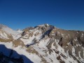
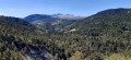
Almost the entire route is off-trail.


 Country:

 City:


Warning!
Information on how to reach the starting point, as well as details regarding difficulties, alternative routes and precautions to take, is summarised in the ‘Practical Information’ and ‘During the Walk’ sections. Any difficult walk requires preparation, and this one – which is extremely difficult – is no exception.
Signposting
There is virtually no signposting on this route, and very few cairns. The paths followed are those used by chamois.
(S/E) At the end of the Combe du Loup forest road, continue due east along the road’s extension, which is now blocked by a scree slope (the IGN has still not updated this on their maps). The track climbs slightly and turns into a path as it enters the forest. Upon reaching a ridge, it veers sharply south to climb it and reach a small pass where other paths intersect.
(1) At the small pass, take the path on the right to climb south-west up the ridge leading to the flat area of the Pré Rond clearing. Continue the ascent, now heading south, until you emerge from the forest. The path runs level through scree and winds round the ridge descending from the Tête des Ombres.
(2) Leave the path and head due west up the scree slope on the left bank of the Pivallon, aiming for a grassy ‘pass’ which actually marks a flat area in the valley: see this reference photo.
(3) At the flat section, head southwards to follow the ridge ascending towards the grassy Samaroux ridge, where the chamois may well be finishing their breakfast. Once on the ridge, begin a circular loop to the right to ascend the Crête de Samaroux to the north-west. The grass gradually gives way to stacks of flint-bearing limestone slabs, and after a few humps that are easily bypassed, the ridge culminates at the main summit of the Tête de Lapras.
(4) From the summit, continue along the ridge as it descends to the south-west to admire the Agards and the Ravin du Couravou below, then make a wide circular loop along the sheer cliffs to return to the south-east above a weakness in the cliff face, shaped like a steep amphitheatre.
(5) Descend the steep terraces to the snowfield (or scree, depending on the season) below via an easy downclimb (no need to use your hands). Once at the foot of the obstacle, head due west at the foot of the cliff, then descend on sight towards the Col de Lapras, clearly visible to the north-west.
(6) Cross the wide pass and head up, following the terrain, towards the Col du Courtet, to the west-north-west. A slight narrowing of the valley serves as an intermediate landmark; the route follows the right-hand side, which is less steep.
(7) At the Col du Courtet, head right up the ridge due north towards the summit of Le Nid. There’s no need to zigzag in switchbacks; the slope is easy.
(8) From Le Nid, descend south-southeast down the grassy slope and then over loose scree, aiming to skirt round the base of Le Nid to the north as soon as possible. As soon as the slope allows, head north again to pass beneath the rocky spurs of Le Nid and enter the upper reaches of the Combe de la Prison, facing the Tête de la Cavale.
Head north-west up the right-hand bank of the Combe de la Prison until you reach a junction where the northern ridge from Le Nid meets the southern ridge coming from La Cavale. Enter the gorge between the two cliffs (following the one coming from the north) to reach the Col du Portail a few metres further south.
(9) After admiring the view over Tréminis, head north again, aiming for the base of a shoulder of the Tête de la Cavale, separated from the western ridge by a scree slope and a steep, stepped rocky slope; see the reference photo. Climb up this shoulder, which consists of grassy terraces and easy but steep rocky sections, generally heading north-east. Once on the summit ridge, veer left (north-west) along it and easily reach the summit.
(10) From the Tête de la Cavale, follow the northern ridge leading to the barely marked hump of the Bonnet de l’Évêque. Be careful: the view and the photo are misleading; it is a little longer than it appears.
(11) From the Bonnet de l’Évêque, head south at first, then more directly up the eastern slope to reach a series of rocky ledges, between which a wide scree path continues down towards the valley below.The Arche aux Saxifrages is then clearly visible to the north-east.
Turn your back on it and follow the base of the rocky ledges, which quickly give way to small cliffs. This brings you to the foot ofthe ‘Arche de la Fuvelle’, a magnificent Babylonian-style archway.
(12) Climb up the snowfield (or scree, very late in the season) beneath the arch to admire it from every angle, then turn back and return to the foot of the arch. From there, head for the faintly marked Col de la Fuvelle to the east-southeast.
(13) Once you reach the pass’s plateau, continue south, between Cavale on the right and Agards on the left, to reach the break in the terrain above the Combe de la Prison. Head south into the valley, bearing in mind that you’ll need to climb up the opposite side: so keep to the right-hand bank to make the most of the contour lines once you’ve cleared the rocky obstacles.
(14) From the Combe de la Prison, head due south up the valley floor leading to the Col de Lapras, which you visited earlier.
(6) At the pass, continue south, then south-south-east towards a small pass, beyond which the slope steepens slightly.
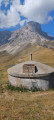
(15) At the small pass, head down into this little valley, still heading south-southeast, and go round the base of the ‘rognon’ (kidney-shaped outcrop) closing off its left bank, via a circular loop ascending north-east through the typical ‘assiettes dévoluardes’ rock formations. As soon as you’ve crossed the shoulder of the ‘rognon’, a grassy plateau is visible to the north-east. Head for this, still following the contour lines rather than taking a direct route. Make your way to the shepherd’s hut that appears on the plateau.
(16) From the hut, follow one of the many paths descending the Vallon du Mas. A few changes in terrain may require you to descend in switchbacks. After the last of these, a flat area blocked by a hillock signals the exit from the valley. Pass to the right (south) of the hillock and head for the large boulder known as the Pierre Baudinard below.
(17) At the Pierre Baudinard, head north-east along the main track leading towards the Pierre Oisel. Above a clearing in the pine trees, the track veers eastwards and reaches a junction.
(18) Do not continue down the slope, but turn left to head north-north-west up another track. After passing through some meadows, it crosses a wooded area and emerges into another meadow.
(19) Caution! Orientation is tricky at this point: the IGN map is incorrect as it shows a track on the left that does not exist. However, there is a footpath, though it does not follow the route shown on the IGN map. Consult OpenTopoMap for the correct route.
As soon as you emerge from the wooded area, turn left at a right angle to head north-west up the path that runs alongside the woodland. This path then climbs northwards through the forest. Numerous cattle tracks make the route confusing. If in doubt, take the upper track, but once you have crossed the ridge descending from the Crête de Samaroux (Aiguilles du Mas), stay at the same level. Make your way back through scree, meadows and scrub to the Épaule de la Pointe de la Tête des Ombres and rejoin the route you have already taken.
(2). From there, follow the ascent route in reverse to reach the end of the Route de la Combe du Loup (S/E).


 Visorando Member
 Difficult

 Easy
 Moderate
 Very difficult