


Bob Didi

 Visorando Member
 Premium user
 Sign up:
Published route(s)
 From La-Valla-en-Gier, circular through the discreet Ban valley and Le Bessat
 11.56 mi
 +2,369 ft
 -2,359 ft
 7h 25
7h 25
 Moderate
 Departure from La Valla-en-Gier (Loire)
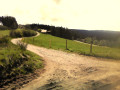
Most of the hike is in the woods, which is very pleasant in summer. From La Valla-en-Gier, a pretty village that has retained its authentic character, take a small road and then a footpath to reach the Ruisseau du Ban stream, nestled at the bottom of a bucolic valley. The path runs alongside this stream for almost 3 km before climbing up to the Bessat plateau. TheGR®®42 trailtakes you to Le Bessat, a tourist village with low, squat houses reminiscent of the nearby Massif Central. The return journey is a descent through the woods.
From Véranne, Chapelle Saint-Sabin and the traverse of the Trois Dents ridge
 10.54 mi
+3,117 ft
-3,087 ft
7h 35
10.54 mi
+3,117 ft
-3,087 ft
7h 35
 Difficult
Departure from Véranne (Loire)
Difficult
Departure from Véranne (Loire)
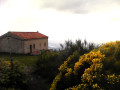
A hike with a tourist attraction, featuring the Saint-Sabin Chapel and its remarkable view of the Alps. This medieval chapel is not the original building; an earlier chapel dating from the 4th century is thought to have stood on a prehistoric site, the ramparts of which, built from large blocks of rock, bear witness to this presence and to the site’s significance since time immemorial. There is also a fun aspect to the easy traverse of the ridges of the Trois Dents.
Circular route of Saint-Chamond via the lakes of Soulages, La Rive and Rochetaillée
 18.32 mi
+3,442 ft
-3,445 ft
11h 25
Difficult
Departure from Saint-Chamond (Loire)
18.32 mi
+3,442 ft
-3,445 ft
11h 25
Difficult
Departure from Saint-Chamond (Loire)
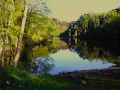
A long and beautiful circular route that begins in a small valley, at the bottom of which lies a hermitage. After a climb, the view opens up onto the Soulages Dam and La Rive lakes. You follow the latter to climb up to the Sapey woods plateau and reach Rochetaillée. A magnificent village dominated by its 12th-century castle. The path leads to the Auberge de Salvaris, which invites you to take a break and enjoy the beautiful view.
Cirque de Saint-Même: a bit of an adrenaline rush
 4.44 mi
+2,651 ft
-2,664 ft
4h 20
Difficult
Departure from Saint-Pierre-d'Entremont (Savoie) (Savoie)
4.44 mi
+2,651 ft
-2,664 ft
4h 20
Difficult
Departure from Saint-Pierre-d'Entremont (Savoie) (Savoie)
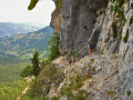
A superb circular walk featuring waterfalls, a natural tunnel, a cave, climbing sections, an exposed ledge and a mountain pasture, topped off with some stunning views throughout the route.
⚠️ Part of this route is unmarked, unmaintained and presents significant risks. Hikers undertake this route at their own risk. Please refer to the officially marked trails.
⚠️ The ‘Pas de la Mort’ between (5) and (9) is classified as dangerous and is strongly discouraged. See practical information.
On all vertical sections, do not rely on the GPS track but follow the route description.
Crossing the Lances de Malissard ridges
 10.23 mi
+4,829 ft
-4,836 ft
10 hrs
10.23 mi
+4,829 ft
-4,836 ft
10 hrs
 Extremely difficult
Departure from Isère
Extremely difficult
Departure from Isère
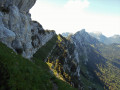
To reach the Fontanieu chimney, the classic route climbs through the forest on the western slope of the Mallissard valley. It is difficult to find your way here due to a maze of forest paths created by logging. In addition, the maps are often out of date.The proposed hike avoids this wooded valley and passes through a little-used area where the route is easy to follow with very few intersections. It consists of a single track, climbing up a valley to the Col de Fontanieu. However, this adds 2 km to the hike and 50 m to the elevation gain. From the pass, the trail climbs to the foot of the cliff and follows it to reach the Fontanieu chimney. Then there is a long aerial traverse followed by a ridge crossing. From the summit of the Lance Sud de Malissard, the return is via the Col de Bellefont and the Col de la Saulce. 4/12/2023: Some sections may be closed (see practical information).
Traversée du Pic du Grand Doménon
 12.36 mi
+5,305 ft
-5,315 ft
10h 20
12.36 mi
+5,305 ft
-5,315 ft
10h 20
 Very difficult
Departure from La Combe-de-Lancey (Isère)
Very difficult
Departure from La Combe-de-Lancey (Isère)
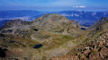
This route begins with the classic ascent to the Refuge de La Pra. From the refuge, the route takes you off the beaten track into a magnificent high-mountain setting. Head towards Lac David via the western slope of the Grande Lauzière, which offers a beautiful view of the Claret, Longet and Bernard lakes. Shortly afterwards, you look out over Lac David. The path crosses a small pass, descends into a small valley and climbs up a rocky ridge with views of the rugged eastern slope of the Grande Vaudaine. You follow the southern ridge of the Grande Lauzière up to its pass. From there, you can see the route leading to the Pic du Grand Doménon.At the summit, there is a superb view of the Alps. The descent to the Col du Bâton follows its northern ridge. Then, via a scree cone, the route joins the Croix de Belledonne path. You walk alongside the Grand and Petit Doménon lakes to reach the Col de La Pra, from where the ascent path leads back to the car park.
This route is reserved for mountaineers in good physical condition.
Circular Thurins via Saint-Laurent-de-Vaux and Yzeron
 14.33 mi
+2,795 ft
-2,772 ft
9h 00
Difficult
Departure from Thurins (Rhône)
14.33 mi
+2,795 ft
-2,772 ft
9h 00
Difficult
Departure from Thurins (Rhône)
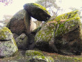
Located in the Monts du Lyonnais, this circular route runs mainly through the woods of the Yzeron and Garon valleys. From Thurins, the trail climbs the hill separating the two valleys and descends to Saint-Laurent-de-Vaux. It climbs back up to the source of the Garon via Châteauvieux and Yzeron, then through the woods to Thurins. Along the route, take some time to visit the dolmen and chapel in Châteauvieux.
The sangles of Fouda Blanc and Le Pinet and finally the Grotte à l'Échelle
 7.22 mi
+3,986 ft
-3,960 ft
7 hrs
Extremely difficult
Departure from Saint-Pierre-d'Entremont (Savoie) (Savoie)
7.22 mi
+3,986 ft
-3,960 ft
7 hrs
Extremely difficult
Departure from Saint-Pierre-d'Entremont (Savoie) (Savoie)
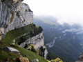
Please note that this exposed route is not suitable for people who are prone to vertigo and have no experience of aerial crossings and climbing steps. It should not be attempted in wet weather due to the risk of slipping.This circular hike crosses the very aerial sangles of Fouda Blanc and Le Pinet, which, at over 3 km, is the longest in the Chartreuse. The Fouda Blanc sangle is slightly less exposed and busier than the Pinet. The latter is narrower, often grassy, slippery in wet weather, and has a few unstable earthy passages that must be crossed with caution. Access to this crossing is via the Varvats trail at Pas de l'Échelle. At the end of the ridges, you reach the summit of Pinet, also known as Truc, then the ridge trail joins Pas de Fouda Blanc, which you descend before crossing the Grotte à l'Échelle. The descent down a scree slope and then through the woods takes you back to the return path.GPX track required.
Le Moucherotte via its eastern slope
 8.86 mi
+3,537 ft
-3,530 ft
7h 10
Difficult
Departure from Claix (Isère) (Isère)
8.86 mi
+3,537 ft
-3,530 ft
7h 10
Difficult
Departure from Claix (Isère) (Isère)
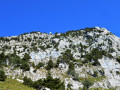
From the Drac valley, the approach to the Moucherotte via its eastern slope may seem vertiginous, yet this is not the case. The view from the front is deceptive; the average gradient at the top is only 30 per cent. The little-used path is relatively well marked with blue markings. It skilfully navigates the rocky terraces by making the most of their natural features. The climbing sections remain easy with good handholds, but some exposed passages may put off those prone to vertigo.The ascent takes place through woodland up to 1,500 m, then over scree and limestone rock amidst sparse vegetation. Throughout this second section, you can enjoy magnificent views of the valley and the surrounding mountains. The return journey follows theGR®® 91 to join the East Balcony path, which leads back to the car park.
The Grand Som loop via the south ridge and the Monastère de la Gde Charteuse
 7.86 mi
+4,009 ft
-4,029 ft
7h 05
Difficult
Departure from Saint-Pierre-de-Chartreuse (Isère)
7.86 mi
+4,009 ft
-4,029 ft
7h 05
Difficult
Departure from Saint-Pierre-de-Chartreuse (Isère)
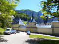
A magnificent hike that combines a natural section starting with a climb through the forest, continuing over the pleasant Pas de La Suiffière and then the easy but aerial ascent of the south ridge of the Grand Som, with a cultural section exploring the Monastère de la Grande Chartreuse, a veritable work of architectural art.
Crossing the Grande Lance de Domène
 10.38 mi
+4,751 ft
-4,760 ft
8h 55
Difficult
Departure from La Combe-de-Lancey (Isère)
10.38 mi
+4,751 ft
-4,760 ft
8h 55
Difficult
Departure from La Combe-de-Lancey (Isère)
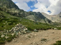
The ascent to the Col de la Pra follows the very busy path to the Refuge de la Pra. From the pass just before the refuge, the path leads towards the Doménon lakes. It joins the spillway of the first lake, the start of this traverse.Although strenuous, the ascent up the western slope, which is well marked with paint and cairns, presents no technical difficulties or exposed sections. The descent down the eastern slope is not as easy to follow, but the route remains clear. The return journey follows the shores of Lac du Grand Doménon and then Lac du Petit Doménon to rejoin the outbound path.
The Vercors Barrier via the Pas Ernadant and Morta
 6.55 mi
+3,169 ft
-3,196 ft
5h 45
Very difficult
Departure from Saint-Andéol (Isère) (Isère)
6.55 mi
+3,169 ft
-3,196 ft
5h 45
Very difficult
Departure from Saint-Andéol (Isère) (Isère)
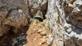
This hike in the superb eastern ridge of the Vercors begins in the small village of Saint-Andéol, ascending through the forest on the eastern slope, and via the Tour du Vercors trail, approaches the Pas Ernadant pass. The exposed climb is not technical, but takes place on loose rock. After passing a small exposed ledge, the path goes through a natural arch and reaches the ridges, via which it joins the Pas Morta. The route, although somewhat exposed, presents no difficulty. We rejoin the Tour du Vercors trail and, after a descent through scree and then through woodland, we reach the road leading back to the car park.
This route includes exposed sections that may unsettle those prone to vertigo; it must be avoided at all costs in wet weather due to the risk of slipping and fog rolling in.
The Bec de l'Orient from Le Coing via the Pas Brochier and the Pas de la Clé
 4.88 mi
+2,556 ft
-2,530 ft
4h 30
Difficult
Departure from Montaud (Isère) (Isère)
4.88 mi
+2,556 ft
-2,530 ft
4h 30
Difficult
Departure from Montaud (Isère) (Isère)
The route leading to the Bec de l’Orient via the Pas Brochier is relatively quiet, unlike the Pas de la Clé, which we will take on the return journey. Although this hike is at a moderate altitude, taking place deep in the forest on the northern slope of the Vercors mountain range, it remains pleasant even in the height of a heatwave. From the viewpoint at the Bec de l'Orient cross, try to make out the route through the woods and the climb to the Pas Brochier.
This route includes exposed sections that may cause discomfort for those prone to vertigo; it must be avoided at all costs in wet weather due to the risk of slipping.
Le Cornafion from La Conversaria via the Col Vert and the Col de l'Arc
 8.58 mi
+3,343 ft
-3,317 ft
6h 50
Very difficult
Departure from Villard-de-Lans (Isère)
8.58 mi
+3,343 ft
-3,317 ft
6h 50
Very difficult
Departure from Villard-de-Lans (Isère)
This beautiful loop trail starts at La Conversaria, a hamlet in Villard-de-Lans. The trail through the woods climbs to the Roybon Refuge and then up rocky slopes to the Col Vert. It crosses to the opposite side to follow the eastern ridge of the Vercors. Along the way, a winding trail climbs the slope below the Roc du Cornafion. A short climb takes you to the ridge of the secondary summit, then through a gap to the summit, where you can enjoy a magnificent, vertiginous panorama. The return to the eastern balcony of the Vercors is in the opposite direction. The trail reaches the Col de l'Arc and drops down the western slope to the starting point.Please follow the recommendations in the practical information carefully.
The Pas de l’Écharasson round trip
 6.17 mi
+2,569 ft
-2,572 ft
5h 05
Extremely difficult
Departure from Saint-Bernard (Isère) (Isère)
6.17 mi
+2,569 ft
-2,572 ft
5h 05
Extremely difficult
Departure from Saint-Bernard (Isère) (Isère)
Starting from the Col de Marcieu, this hike to the Pas de l’Écharasson begins with a walk through the forest before continuing along a path that leads to the foot of the Crête de l’Alpette at a scree slope. After negotiating its narrow gap and climbing two rocky outcrops, you’ll discover a magnificent cirque in a breathtaking setting. The route continues along a ledge sheltered by rock; climbing through a gap, then over a small, cable-secured rock barrier and finally along a ridge takes you to the crest and its magnificent viewpoint.
The Col de la Mine de Fer and Lac de Crop loop from Pré Marcel
9.81 mi
+4,039 ft
-4,045 ft
8h 00
Difficult
Departure from Sainte-Agnès (Isère) (Isère)
A lovely hike in the Belledonne massif, allowing you to appreciate all the mountain levels, from forest to alpine meadows and up to the mineral levels of high altitude. From Pré Marcel, climb to the Refuge Jean Small Pass, then cross the Col de la Mine de Fer. Descend the opposite slope to Lac de Crop, then after a descent into its glacial cirque, reach the car park via a discreet path.There are several ravines and steep passages, some of which are secured by cables, before reaching the Refuge Jean Small Pass (altitude 1,950 m).
A circular route via the Pas de Montbrun and Pas de Rocheplane, starting from Les Massards
 5.57 mi
+3,383 ft
-3,383 ft
5h 30
Difficult
Departure from Saint-Hilaire (Isère) (Isère)
5.57 mi
+3,383 ft
-3,383 ft
5h 30
Difficult
Departure from Saint-Hilaire (Isère) (Isère)
A hike to explore the secluded Pas de Montbrun, which leads to the ridge of the Rochers de Bellefont via a route of moderate exposure and without any major difficulty, apart from finding your way in the upper section. From Les Massards, the path heads towards the Source du Sanglier and then the Col de Marcieu, leaving it opposite the Pas de Montbrun. A narrow track climbs up a scree slope and, via a few short scrambling sections, reaches the ridge leading to the Pas de Rocheplane. A well-marked path crosses a few rocky outcrops and, after a section through the forest, returns to the car park.
Le Col de la Vache depuis le parking du Muret
 9.48 mi
+4,278 ft
-4,275 ft
8h 05
Difficult
Departure from Laval (Isère)
9.48 mi
+4,278 ft
-4,275 ft
8h 05
Difficult
Departure from Laval (Isère)
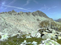
A pleasant hike in the magnificent Belledonne massif. The path begins by climbing towards the charming Habert d’Aiguebelle refuge. Once near it, it ascends the Pas de la Coche, passes above the pretty lake of the same name, then crosses a field of blueberry bushes. It passes the flank of the Roches Jaunes, joins theGR®®738and crosses mountain pastures. As you walk along the cliffs of the Crête des Îlettes, the pass comes into view against a rocky backdrop and can be reached after a steep scree slope, with a magnificent view of Lac du Cos and the peaks of the Allervard massif as a reward.
Long circular from Saint-Martin-en-Haut
 21.02 mi
+3,773 ft
-3,786 ft
12h 55
Difficult
Departure from Saint-Martin-en-Haut (Rhône)
21.02 mi
+3,773 ft
-3,786 ft
12h 55
Difficult
Departure from Saint-Martin-en-Haut (Rhône)
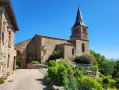
This hike allows you to discover some pleasant and cultural sites near Saint-Martin-en-Haut. The route begins by crossing the leisure park, then passes by the Signal Saint-André viewpoint. It descends into the Artilla valley and climbs back up to Crêt de la Poipe to reach the medieval hamlet of Rochefort, then the village of Duerne. Shortly before Montromant, it runs alongside the Brévenne aqueduct, crosses Duerne and returns to Saint-Martin-en-Haut.
Longue boucle des Croix depuis La Terrasse-sur-Dorlay
 20.56 mi
+4,518 ft
-4,514 ft
13h 25
Difficult
Departure from La Terrasse-sur-Dorlay (Loire)
20.56 mi
+4,518 ft
-4,514 ft
13h 25
Difficult
Departure from La Terrasse-sur-Dorlay (Loire)
Cette randonnée longue et vallonée se déroule majoritairement en forêt ce qui la rend particulièrement agréable en été malgré sa faible altitude. Le parcours en boucle depuis la Terrasse-sur-Dorlay débute par une montée sur la ligne de crête dominant la retenue du Dorlay pour rejoindre la Croix du Planil. Le parcours vient jouxter la Jasserie avant de rejoindre Doizieux et remonter vers le Collet de Doizieux. Le circuit se prolonge par un passage à la Croix de Montvieux, à la Croix du Mazet puis à celle du Pendu. Enfin par le vallon de la Mornante on retrouve la Terrasse-sur-Dorlay.
Le Mont Granier en boucle par le Pas des Barres et celui de Tencovaz
8.79 mi
+3,369 ft
-3,383 ft
7h 00
Very difficult
Departure from Entremont-le-Vieux (Savoie)
La montée emprunte le parcours le plus fréquenté de l'accès au Granier, celui par le Col de l'Alpette et le Pas des Barres. La descente par le Pas de Tancovaz reste beaucoup plus secrète, la désescalade de deux étroitures nécessitant une certaine agilité doublée d'un bon sens d'orientation dans la descente hors sentier d'un pierrier pentu. Mais ces difficultés font tout le charme de ce retour atypique.
Circular from Vaugneray via Col de la Luère, Sain-Bel, La Croix du Ban
 14.69 mi
+2,785 ft
-2,792 ft
9h 10
Moderate
Departure from Vaugneray (Rhône)
14.69 mi
+2,785 ft
-2,792 ft
9h 10
Moderate
Departure from Vaugneray (Rhône)
The route takes place in a green setting. It passes through small hamlets nestled in valley hollows, crosses mountain passes and goes through woods. The route starts in Vaugneray, passes through the Col de la Luère, descends to Saint-Pierre-la-Palud, a former pyrite mining town. At Sain-Bel, it climbs back up to Sourcieux-les-Mines to cross the Col de la Croix du Ban and return to Vaugneray.
Circular from Yzeron via Croix de Pars, Montromant and the dam.
 15.59 mi
+3,320 ft
-3,294 ft
10h 05
Difficult
Departure from Yzeron (Rhône)
15.59 mi
+3,320 ft
-3,294 ft
10h 05
Difficult
Departure from Yzeron (Rhône)
Route passing by the imposing statue of the Madonna overlooking Yzeron, the ruins of the Saint-Clair Chapel, the Col de la Croix de Pars, the bucolic Rossand valley, the peaceful and charming little village of Montromant, the Brosses plateau, the dam on the Garon and its reservoir, popular with fishermen.
Circular route from Thurins via the Col de Malval and Yzeron
 18.11 mi
+3,323 ft
-3,323 ft
11h 15
Difficult
Departure from Thurins (Rhône)
18.11 mi
+3,323 ft
-3,323 ft
11h 15
Difficult
Departure from Thurins (Rhône)
This long but lovely walk takes you through the hills and valleys of the Monts du Lyonnais, passing through woods and meadows. It goes via Saint-Laurent-de-Vaux, the Col de la Croix de Malval, the woods of Courzieux, the ruins of the Chapelle Saint-Clair, the imposing statue of the Madonna, Yzeron, the Bois de la Vourne and the Croix des Barons.
Sainte-Croix-en-Jarez circular route, Couzon reservoir, Le Chirat Rochat
16.31 mi
+3,179 ft
-3,199 ft
10h 15
Difficult
Departure from Sainte-Croix-en-Jarez (Loire)
This walk begins in one of the most culturally significant spots in the Pilat region, the pretty, tourist-friendly medieval village of Saint-Croix-en-Jarez and its 13th-century Chartreuse monastery. It follows the Couzon valley, then runs alongside the river and the left bank of its reservoir before taking the ridge path via the Croix du Cerisier, du Mazet and de Montvieux. The undulating, wooded route continues to the Chirat Rochat, the highest point of the walk, then descends to the hamlet of L’Eau-qui-bruit and returns to the start via the Crêt de Montivert.
Circular route from Trèves via the Croix de Crème, Croix du Trève and Croix de Longes
 18.08 mi
+3,612 ft
-3,602 ft
11h 30
Difficult
Departure from Trèves (Rhône) (Rhône)
18.08 mi
+3,612 ft
-3,602 ft
11h 30
Difficult
Departure from Trèves (Rhône) (Rhône)
This hike near Givors winds through the many wooded valleys and rural hills of the south-eastern Pilat region. It begins by passing through the Grand Malval valley and climbs up to the Croix de Crème, then the Croix du Trêve, to cross the Petit Malval valley. It climbs to the Croix de Longes after passing through the village of the same name, then crosses the successive valleys of the Ruty, the Mézerin, the Jannoray and the Mézerin once more to return to the village of Trèves.
From Sainte-Catherine to Valfleury (circular)
 18.95 mi
+2,556 ft
-2,539 ft
10h 55
Difficult
Departure from Sainte-Catherine (Rhône) (Rhône)
18.95 mi
+2,556 ft
-2,539 ft
10h 55
Difficult
Departure from Sainte-Catherine (Rhône) (Rhône)
This hike takes place in the southern part of the Monts du Lyonnais. It is not very busy, although it follows theGR®®7along the ridges between Sainte-Catherine and Valfleury. A pilgrimage dedicated to the Virgin Mary used to take place in this village. Remnants bear witness to this era, which is gradually fading away: Stations of the Cross, statues, and reconstructed grottos. The return route takes you through the Durèze valley before climbing up through small hamlets, including Lachal with its imposing 18th-century neoclassical château, then crosses the Bois des Feuilles to return to Sainte-Catherine.
La Grande Sure via the Jusson Chimney and the Pas de Pierre Taillée
 7.19 mi
+4,629 ft
-4,649 ft
7h 20
Difficult
Departure from Pommiers-la-Placette (Isère)
7.19 mi
+4,629 ft
-4,649 ft
7h 20
Difficult
Departure from Pommiers-la-Placette (Isère)
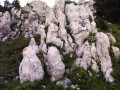
Randonnée en huit partant des Trois Fontaines, un lieu baigné de fraicheur où il fait bon s'attarder en plein été.Le sentier commence dans la forêt en s'élevant dans une rude pente par de nombreux lacets. Il franchit des gradins rocheux pour rejoindre une bergerie d'alpage, le Chalet de Jusson. En haut de la prairie se présente la Cheminée de Jusson qui s'escalade sans difficulté pour parvenir au sommet et profiter d'un magnifique panorama. Descendre la crête et une partie du vallon de l'Hérétang puis remonter la Combe des Veaux pour retrouver le Chalet de Jusson. La descente par le Pas des Rochers de Pierre Taillée s'effectuant sur une sente en déshérence puis dans la forêt pour retrouver le parking conviendra aux randonneurs en quête de lieu secret.
GPS ou application Visorando recommandé.Ce parcours s'adresse à des randonneurs bien préparés physiquement.
Le Grand Sorbier via the Arselle plateau
 10.25 mi
+4,072 ft
-4,072 ft
8h 15
Difficult
Departure from Vaulnaveys-le-Haut (Isère)
10.25 mi
+4,072 ft
-4,072 ft
8h 15
Difficult
Departure from Vaulnaveys-le-Haut (Isère)
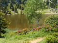
On the outskirts of Grenoble, Belledonne is a mountain range easily accessible for a day’s hike, offering all altitudes and numerous lakes. The Grand Sorbier, situated near the Chamrousse resort, overlooks the Romanche Valley from 1,800 m and, beyond that, looks out over the Grandes Rousses and the Alps.The first part of the route, which is very popular, starts at the Plateau d’Arselle, the cross-country skiing area of Chamrousse, and leads to the magnificent Lac Achard in the heart of a protected area. The second part, less frequented, leads to the Lacs Robert via the Col de l’Infernet and the Col de la Botte, an area favoured by ibex. The final section, secluded and off the beaten track, winds through a rocky scree landscape where the difficult and tiring climb is rewarded by the magnificent view from the summit of the Grand Sorbier.
Charmant Som circular loop
 2.49 mi
+978 ft
-1,004 ft
2h 00
Moderate
Departure from Saint-Pierre-de-Chartreuse (Isère)
2.49 mi
+978 ft
-1,004 ft
2h 00
Moderate
Departure from Saint-Pierre-de-Chartreuse (Isère)
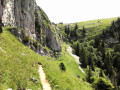
A lovely little hike that extends the climb to the magnificent, very popular viewpoint at the summit with a more secluded detour around Charmant Som. This leads to the promontory with a beautiful view of the Grande Chartreuse Monastery, returning to the car park via the western balcony.
La Grande Moucherolle via the Fenêtre ridge and the east ridge
 11.15 mi
+4,160 ft
-4,177 ft
8h 45
Extremely difficult
Departure from Villard-de-Lans (Isère)
11.15 mi
+4,160 ft
-4,177 ft
8h 45
Extremely difficult
Departure from Villard-de-Lans (Isère)
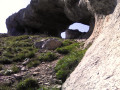
Although located within a ski resort, this circular route avoids deforested and lunar landscapes as much as possible. The ascent is mostly through forest on little-used tracks. The crossing of the north-west ridge is superb, culminating in the magnificent Arche de la Fenêtre. The aerial descent of the east ridge leads to the Col des Deux Sœurs.The return journey to the Pas de l'Œil is via a little-used path that continues along the foot of the Gerbier ridges. Via the Combe Charbonnière, the route joins theGR®®91, which takes you back to the Balcon de Villard.
Lac Blanc and the Freydanne Glacier via the waterfalls
 7.92 mi
+5,059 ft
-5,059 ft
8h 05
Difficult
Departure from Saint-Mury-Monteymond (Isère)
7.92 mi
+5,059 ft
-5,059 ft
8h 05
Difficult
Departure from Saint-Mury-Monteymond (Isère)
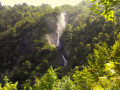
Lac Blanc is undoubtedly the jewel among Belledonne’s many lakes. Its popularity lives up to its reputation. The vast majority of hikers set off from Pré Comté (on the IGN map, La Souille at 1,365m) rather than from Chenevrey (alt. 910m), no doubt due to the extra elevation gain. Yet this route, though more strenuous, is enchanting. The ascent takes place in the shade of the Saint-Mury forest, following the turbulent Ruisseau de Vorz, then opens out into a clearing revealing the superb Cirque du Boulon and its high cliffs, cascaded over by a spray of waterfalls. At the top of the cirque, the path joins the Pré Comté trail to reach Lac Blanc. Against a backdrop of high mountains, the hike continues towards the Pic Central de Belledonne, reaching the foot of the Freydanne Glacier and the vertiginous north face of the Grand Pic de Belledonne
Depuis les Quatre Chemins, Le Grand Colon, son couloir Est et le Lac Crozet
8.68 mi
+3,724 ft
-3,724 ft
7h 15
Difficult
Departure from Revel (Isère) (Isère)
Assez fréquentée, la randonnée au Grand Colon se prolonge habituellement par la descente sur le charmant Lac Merlat, pour rejoindre le refuge et le Col de la Pra, puis par le Vallon Mercier, le Lac Crozet. Le parcours, ici proposé, est une alternative moins belle, mais plus secrète, présentant un raccourci à cette descente classique.
Du Grand Colon un sentier longe une éminence rocheuse, légèrement plus haute (cote 2402), située au Nord-Est, puis passe un col pour descendre un pierrier encaissé, entre La Roche Fendue et le Galeteau, avant de retrouver le Vallon Mercier et le Lac Crozet.
Hidden Lake
 5.14 mi
+1,329 ft
-1,302 ft
3h 30
Moderate
Departure from United States
5.14 mi
+1,329 ft
-1,302 ft
3h 30
Moderate
Departure from United States
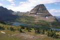
This hike to Hidden Lake, nestled in the mountains, is one of the most popular in Glacier National Park in Montana, undoubtedly due to its magnificent, easily accessible scenery. From Saint Mary, the beautiful road along Saint Mary Lake adds to the charm of this walk.
The Maligne Canyon
 2.36 mi
+328 ft
-328 ft
1h 20
2.36 mi
+328 ft
-328 ft
1h 20
 Easy
Departure from Canada
Easy
Departure from Canada
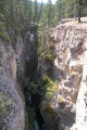
This is a superb walk in Jasper National Park (in Alberta, Canada), offering magnificent views along the Maligne River and across footbridges, where the fury of the waters in a high, narrow gorge is striking.
The waterfalls of Yoho Valley
 10.49 mi
+1,257 ft
-1,247 ft
5h 55
Moderate
Departure from Canada
10.49 mi
+1,257 ft
-1,247 ft
5h 55
Moderate
Departure from Canada
Explore the wild Yoho Valley with its stunning waterfalls. The hike is not physically demanding and the route is easy to follow. With three campsites, you can stay overnight to enjoy the beautiful starry sky, far from light pollution, preferably during the new moon.
The hot springs of Hveradalir and Kerlingarfjöll
 8.37 mi
+1,942 ft
-1,929 ft
5h 30
Moderate
Departure from Iceland
8.37 mi
+1,942 ft
-1,929 ft
5h 30
Moderate
Departure from Iceland
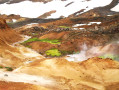
The hikes from the Kerlingarfjöll base are superb, among the most beautiful in Iceland. The terrain is rugged, the colours incredible, with the brightest and most fluorescent tones contrasting with the darkest and the white snowfields. Fumaroles and bubbling streams, giving off sulphurous smells, inhabit these unforgettable places that one imagines as the early days of the earth.
Circular route via Saut du Gier, Crêt de la Perdrix and Toile
 13.21 mi
+2,733 ft
-2,730 ft
8h 25
Difficult
Departure from La Valla-en-Gier (Loire)
13.21 mi
+2,733 ft
-2,730 ft
8h 25
Difficult
Departure from La Valla-en-Gier (Loire)
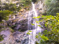
Very pleasant in summer, this circular route, mostly through the forests on the northern slope of the Pilat, culminates at the Saut du Gier. From the Scie du Bost, the path leads to the beautiful Gier waterfall, then climbs a rocky escarpment to reach the shepherd's hut and the Crêt de la Perdrix, the highest point of the Pilat at an altitude of 1,432 m. Following the GR®7 and then the GR®42, which crosses the village of Le Bessat, you approach the village of La Tarentaise before descending into the Vallon du Ban and climbing up to Le Rot, then through the Vallon de La Fare to return to the starting point.
Landmannalaugar - Álftavatn
 13.11 mi
+1,991 ft
-2,142 ft
7h 45
Difficult
Departure from Iceland
13.11 mi
+1,991 ft
-2,142 ft
7h 45
Difficult
Departure from Iceland
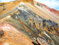
Thisfirst stage crosses sublime, unforgettable landscapes in flamboyant shades of yellow, red, orange and black, contrasting with the fluorescent green of the mosses and the white of the snowfields. Numerous sulphurous fumaroles give this scene a feeling of the beginning of the world; the spectacle is breathtaking.
Álftavatn - Thorsmork
 21.79 mi
+1,565 ft
-2,428 ft
11h 25
Difficult
Departure from Iceland
21.79 mi
+1,565 ft
-2,428 ft
11h 25
Difficult
Departure from Iceland
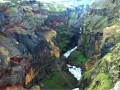
This second stage, although less colourful, offers vast views that express the solitude of these wild places. From Lake Alftaven, the trail passes a wide ford, crosses green plateaus and plains with sparse vegetation where a few flocks of sheep graze, crosses a desert of ash bordered by volcanoes, and overlooks the vertiginous canyon of the Markarfljot River with its dazzling colours. After the Emstrur base and crossing the wide and impressive ford of the River Þröngá, you reach Thorsmork, the end point of this crossing.
From Landmannalaugar to Thorsmork in two stages
 34.89 mi
+3,556 ft
-4,570 ft
2 days
Difficult
Departure from Iceland
34.89 mi
+3,556 ft
-4,570 ft
2 days
Difficult
Departure from Iceland
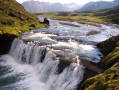
Landmannalaugar, a volcanic landscape par excellence, offers spectacular scenery with rugged relief. Close to active volcanoes, you can hear and smell the earth breathing, exhaling sulphurous fumes from its fumaroles, bubbling waters and hot mud. It's a complete change of scenery in a rugged, unspoilt and daring natural environment with an explosion of incredible colours. The Laugavegur trek, linking the base of Landmannalaugar to that of Thorsmork (Þórsmörk), is reputed to be the most beautiful in Iceland. It can be done in several stages, as there are plenty of campsites and refuges along the way.
Wainui Falls
 2.07 mi
+292 ft
-292 ft
1h 10
Easy
Departure from New Zealand
2.07 mi
+292 ft
-292 ft
1h 10
Easy
Departure from New Zealand
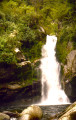
A short but exotic hike leading to a beautiful waterfall, through tree ferns, feathery Nikau palms and Rata trees with creeping roots and exuberant red flowers, species endemic to New Zealand's rainforests.
Circular Duerne route via Pomeys, Lake Gimond and Aveize
 16.37 mi
+2,306 ft
-2,306 ft
9h 30
Difficult
Departure from Duerne (Rhône)
16.37 mi
+2,306 ft
-2,306 ft
9h 30
Difficult
Departure from Duerne (Rhône)
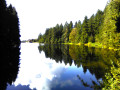
A little-used walk on the western slope of the Monts du Lyonnais, more rugged than wooded, where the landscape is open and offers beautiful views throughout the route. From Duerne, the route winds across a plateau, then descends gradually into the Orzon valley before climbing up to Pomeys and crossing a ridge. It descends at a steady gradient into the La Gimond valley and its lake, from where it climbs up to Aveize, then plunges into the Orjolle valley before returning to Duerne.
The Chasm Walk
 0.48 mi
+220 ft
-220 ft
0h 25
Easy
Departure from New Zealand
0.48 mi
+220 ft
-220 ft
0h 25
Easy
Departure from New Zealand
On the South Island, among all the beauties of the SH 94 road, a stop at Chasm is a must, located about ten kilometres before its terminus at Milford Sound. This short hike begins in a rainforest filled with the sound of water and birdsong, which gradually gives way to a thunderous noise announcing the waterfalls and whirlpools of the Cleddau River as it carves its way through the bottom of a chasm. From above, in a misty atmosphere, the view of the turbulent river is breathtaking. After this lovely walk, an unforgettable cruise on Milford Sound is a must to discover the iconic sights of this remote corner of the world: Bowen Falls, Mitre Peak, Stirling Falls and the sea lions of Seal Rock.
Jack's Blowhole
 1.85 mi
+381 ft
-364 ft
1h 10
Easy
Departure from New Zealand
1.85 mi
+381 ft
-364 ft
1h 10
Easy
Departure from New Zealand
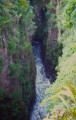
Jack's Blowhole is an open cave on the coast which, invaded by the ocean, collapsed 200 m further on, forming a huge rectangular abyss 140 m long and 70 m wide. At high tide, and even more so in heavy weather, the sea water and air trapped in the narrowing cavity are expelled through this natural vent and projected in jets of water and spray with impressive roars. Nearby, a platform allows you to see the bottom of the karstic cave 55 m below.
Huka Falls
 0.46 mi
+69 ft
-66 ft
0h 15
Easy
Departure from New Zealand
0.46 mi
+69 ft
-66 ft
0h 15
Easy
Departure from New Zealand
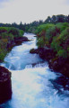
Lake Taupo, New Zealand's largest lake, is nestled in a caldera, the remnant of a supervolcano explosion. Its outlet, the Waikato River, the longest in the country, flows through a narrow gorge only 15 m wide with an average flow of 340 m³/s, almost that of the Seine. These figures give an idea of the fury and turbulence of these beautiful turquoise waters as they plunge down a ten-metre waterfall.
Thurins circular route via the slopes of the Garonne valley
 16.21 mi
+3,123 ft
-3,123 ft
10h 10
Difficult
Departure from Thurins (Rhône)
16.21 mi
+3,123 ft
-3,123 ft
10h 10
Difficult
Departure from Thurins (Rhône)
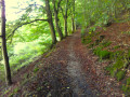
This circular path, which winds between the slopes of the wide Garon Valley, offers beautiful views whilst having the advantage of being relatively dry even after rainy spells. From Thurins, the path briefly crosses the north-facing slope before returning to the opposite side and climbing towards Quinsonnas. Staying close to the ridge, it reaches Yzeron, from where it skirts the top of the valley and returns to the north-facing slope. Passing by the Garon dam, it returns to the south-facing slope, then winds its way up to the top of this slope before descending to Thurins.
Circular route from Yzeron via Courzieu, St-Bonnet le Froid and St-Laurent-de-Vaux
 17.04 mi
+4,255 ft
-4,245 ft
11h 35
Difficult
Departure from Yzeron (Rhône)
17.04 mi
+4,255 ft
-4,245 ft
11h 35
Difficult
Departure from Yzeron (Rhône)
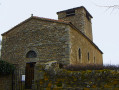
From Yzeron, this lovely, very hilly route climbs towards the imposing statue of the Madonna overlooking the village, then passes by the Saint-Clair Chapel, the peaceful village of Courzieu, the hamlets of Lafont and Les Vechères, ascends to the Courzieu wildlife park and the Château de Saint-Bonnet-le-Froid before descending to Cunieux. To complete the circular route, it crosses the Col de la Fausse, traverses the Yzeron valley via Saint-Laurent-de-Vaux and then the Châteauvieux Chapel, and via the Crêt de Py Froid returns to the starting point.
Circular Rontalon route via Saint-André-la-Côte, Riverie and Saint-Didier
 17.69 mi
+3,091 ft
-3,074 ft
10h 50
Difficult
Departure from Rontalon (Rhône)
17.69 mi
+3,091 ft
-3,074 ft
10h 50
Difficult
Departure from Rontalon (Rhône)
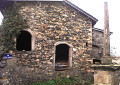
From Rontalon, this beautiful and pleasant walk, situated in the heart of the Monts du Lyonnais, climbs towards La Croix Forest and Saint-André-la-Côte before descending to the remarkable medieval village of Riverie and its magnificent panorama, then on to Saint-Didier-sous-Riverie and the Missilieu bridge. After fording the La Fondagny stream, it climbs back up to La Fillonnière and Vendessieux before setting off on the long traverse through a beautiful deciduous forest and valleys dotted with the hamlets of L’Adret, La Ferrandière, La Julanière and Les Hautes Garennes, finally returning to its starting point.
De Saint-Maurice-sur-Dargoire, boucle des ruisseaux Bezançon
 16.66 mi
+3,107 ft
-3,084 ft
10h 20
Difficult
Departure from Saint-Maurice-sur-Dargoire (Rhône)
16.66 mi
+3,107 ft
-3,084 ft
10h 20
Difficult
Departure from Saint-Maurice-sur-Dargoire (Rhône)
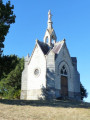
This circular hike in the Monts du Lyonnais between the Rhône and Loire rivers takes place in a little-visited and rather secret area around the Bezançon valleys and its tributaries, including the Grand Bezançon and Petit Bezançon, passing through a few isolated hamlets. It allows you to discover three arches, remnants of the Roman aqueduct of the Gier, and a high bridge pier of a railway line, intended to connect Rive-de-Gier to Mornant, whose construction was halted by the war of 1914. This route can be shortened to 23 km with an 800 m elevation gain by taking a shortcut (see practical information).