Country:

 City:
City:


(S) From the Refuge de Longon, follow the GR®5 (East) along the left bank of the Ruisseau de Longon. After a few hairpin bends, cross the stream at the top of the steep valley floor. Descend its right-hand slope diagonally across the slope and reach a junction.
(1) At the signpost, ignore the path heading in the opposite direction to the left and continue straight ahead. Go round the Crête Autcellier and, on almost level ground, enter the ravine of a torrent, the Ruisseau de l’Arcane. Cross it via a footbridge.
(2) On the hillside, reach the clearing where the Rougios chalets stand. Follow a path on your right. About 200 m further on, at the Fork in the road, leave this path and take a trail on the left. Cross a stream and reach a junction.
(3) At the signpost, leave the path on the left and the track on the right. Turn onto the track well to the right. After 100 m, you’ll reach the Route Forestière de la Fracha, which is almost level.
(4) At the signpost, follow the road to the left (east-southeast) and cross two ravines. On the Crête de La Rays (elevation 1452), ignore the ascending path to the right. Cross another ravine (southeast). At the ruins of La Traverse, do not take the path to the right. Reach a tangential junction.
(5) At the signpost, ignore the path heading in the opposite direction to the right and keep to the road straight ahead. Pass under a high-voltage power line. You will reach a junction at the Barre car park.
(6) At the signpost, ignore the path leading in the opposite direction to the left and the road straight ahead. Follow the road on your right along a descending path (south-southeast). Further down, cross the road.
(7) Continue along the descending path straight ahead. When you reach a chalet, ignore the path to the left (alt. 1200 m). You’ll reach a junction with the Route du Pla on leaving the hamlet of Le Plan.
(8) At the signpost, cut across the hairpin bend via the path opposite. Head down the road to the left until you reach a fork just before its wide right-hand bend. Leave the road and take the shortcut to the left. Join the road again and follow it to the left until you reach a junction at the next bend.
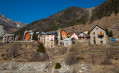
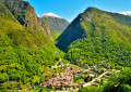
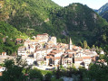
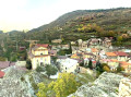
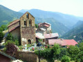
(9) Cut across the hairpin bend via the path on the right. Join the road again at a hairpin bend. Immediately, leave the road and take a path on the right. Straight away, go down the steps on the left. At the bottom, turn right to reach Place Jules Mallet in the beautiful Provençal village of Roure.
(10) At the sign, turn left and, straight away, go down the steps on the right. At the bottom, turn left. At the end of Place André Ségur, you’ll reach a junction.
(11) Keep straight on along Rue Buguadière and, on the right, head onto the Chemin des Vignes, which runs along the lower edge of the village. Ignore the side paths. Leave the village and you’ll come out onto the M130 road. Follow it to the right until you reach a hairpin bend.
(12) Leave the road and take the path opposite. After a few hairpin bends, cross the road (alt. 865 m). Continue along the path opposite and, immediately at its hairpin bend, ignore the path straight ahead. Further down, you’ll reach a junction in the hamlet of Serre.
(13) At the signpost, ignore the path on the right and continue along the GR®5 to the left until you reach a track.
(14) At the signpost, cross the track and then cross the M30 road three times. Enter Saint-Sauveur-sur-Tinée, walking alongside the cemetery along the Chemin de l’Égalité. Turn left onto the Chemin de Salvaire. At the crossroads, cross the bridge over the Tinée and reach a Fork in the road.
(15) Leave Rue du Champs de Foire on your right and head up Rue du Collège on your left. At the top, follow the M2205 straight ahead (Avenue des Blavets), passing Place de la Mairie and then the stopover lodge. On leaving the village, turn left after Rue Blavette to reach a fork in the road.
(16) At the signpost, leave the M2205 and head up the road on the left towards the Chapelle Saint-Roch. As you come out of the hairpin bend, take the shortcut on the right, follow the road and, further up, cross it (alt. 600 m). Go round the chapel and, immediately afterwards, head for a junction.
(17) At the signpost, ignore the path on the left and continue along the track opposite. At the fork in a right-hand bend (alt. 670 m), leave the track and keep left onto the ascending path through the woods. Cross a small valley and reach a junction at a place called Roubinastre.
(18) At the signpost, ignore the path leading down to the right and stay on the GR® 5 to the left. About 500 m further on, ignore the turn-off to the left. Continue straight ahead. After a long bend, enter the village of Rimplas via the Chemin des Canebiers. You will come out onto the M66 road.
(19) At the signpost, head down the road to the left, passing the town hall. Ignore the street on the left and head for a fork in the road in front of the Chapelle Saint-Roch.
(20) At the sign, leave the road and head down the path on the right. At the sign, 50 m further on, ignore the path on the right and carry on straight ahead until you reach a junction in the hairpin bend of a path.
(21) Take the track on the right and immediately leave it at its right-hand bend to take the path opposite. After a sharp left-hand bend, ignore a path leading in the opposite direction on the right and you’ll come to a hairpin bend on the Route de la Colmiane, M2565.
(22) Walk down the road to the next hairpin bend. Leave the road and take a path running alongside it; 30 m further on, you’ll reach a Fork in the road.
(23) At the signpost, keep to the path on the right. After 250 m, at the junction signpost, ignore the Chemin du Planet on the right (alt. 810 m). Cross the Ruisseau Gros Vallon via a footbridge and head up the opposite slope to a junction.
(24) At the signpost, continue along the ascending path to the left. At the junction signpost on the ridge (alt. 920 m), ignore the Chemin du Villar on the right. Opposite, you’ll reach a junction at the corner of the secondary school in the hamlet of La Bolline.
(25) At the signpost, ignore the road on the left and turn right. Immediately at the Fork in the road, follow the path on the left alongside the school (east) and head towards a crossroads.
(26) At the signpost, leave the M2565 on your left and the Route du Bois Noir on your right. Take the path leading uphill opposite, the Route des Galles. In Valdeblore, at the junction, turn right onto the Route Sainte-Catherine. Ignore the path on the right and proceed to a crossroads.
(27) Ignore the Chemin Saint-Bernard on the right and, after passing a junction on the left, reach another junction. Turn right onto the M2565 and, 50 m further on, reach a Fork in the road.
(28) At the sign, leave the road and take the Chemin du Savelet on the right. Ignore a path on the right and another on the left. Cross a stream and reach a junction with the M2565.
(29) Cross the road and head up the path opposite. Cut across a bend in the M2565 and rejoin it further up at a junction.
(30) At the signpost, follow the road to the right, passing the Camping de la Ferme. Enter Saint-Dalmas Valdeblore, cross the bridge over the Ruisseau Vallon de Bramafam. You’ll reach a fork in the road opposite the church.
(31) Leave the M2565 and, in the car park, ignore the road to the left and also Rue de la Madone, which is right at the far end. Follow the road opposite for 30 m before reaching the Lodge des Marmottes on the right (E) .
 Visorando Member
 Moderate