


 Country:

 City:
City:


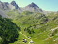
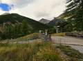
(S) From the Ô Clarée lodge in La Vachette, retrace your steps from the previous day, crossing the bridge over the Durance. At the junction, turn right and cross the N94. Opposite, follow the forest road, ignoring the path on the left. At the Fork in the road, leave the road straight ahead and take the path on the right, which joins the GR® 5 at the bridge over the Torrent du Vallon.
(1) Turn right and cross the bridge (south-west). Immediately ignore a path on the right and continue straight ahead. About 1.3 km further on (alt. 1450 m), pass a path on the left. After 200 m, you’ll come to a junction.
(2) Leave the path straight ahead and turn onto the track on the right (west-north-west), which bends off (south-west) before reaching a tangential junction (elevation 1,348). Ignore the path on the left and the path heading in the opposite direction on the right; continue straight ahead. Cross a stream and head (west-south-west) to a junction in the centre of the hamlet, l’Envers du Fontenil.
(3) At the signpost, keep left onto the Chemin des Davins, ignoring the side paths. At the Fork in the road, leave the wide path on the right and, 200 m further on, reach a junction.
(4) Leave the track to the left and continue to the right. Immediately pass a path on the right. After 70 m, at the junction, keep left (west-south-west). About 220 m further on, ignore the path leading in the opposite direction to the left. Another 80 m on, and at the fork, take the left-hand path to reach the hairpin bend on the wide path to Fort des Trois Têtes.
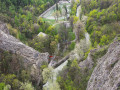
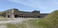
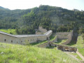
(5) Follow it up to the right. Cross the Durance from the top of the impressive 55-metre-high Pont d’Asfeld. Climb up to the Cité Vauban via a path carved into the rock face and enter the citadel through the Porte de la Durance.
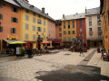
(6) Head down Rue Aspirant Jan to the left, ignoring the streets on the right leading to the Old Town. Walk along the ramparts and, at the bottom, pass through the two Portes d’Embrun. You’ll immediately notice a flight of steps on the left-hand side of the street.
(7) At the sign, go down the steps and continue along the Chemin Vieux. Walk past a nursery school. After the barriers on either side, turn left onto the Chemin des Pommiers d’Antan. In the Parc de la Schappe, you’ll reach a junction on the banks of the Durance.
(8) Keep to the right, then ignore the footbridge on the left. Walk past a car park on your left and, once you reach the car park at Place Galice Bay, turn left to cross the footbridge over the Durance
(9) Turn right onto Route du Queyras. At the Queyras roundabout, take the first left onto Avenue du Col d’Izoard. Leave this road and take the first right onto Route des Toulousannes. Ignoring any side streets, continue along this road until you reach a roundabout.
(10) Turn left immediately towards Villar-Saint-Pancrace onto the D36, Rue Joseph Sylvestre. At the next roundabout, stay on the same road and continue along the D36. Cross the Pont de Cervière. Carry on straight ahead to the small roundabout at the fork.
(11) Keep left towards Villar-Saint-Pancrace. At the junction, at the end of the straight stretch, turn left off the DR36 and, opposite, follow Rue du Rencurel. Cross a canal and rejoin the D36, then follow it for 30 m. At the fork in the road, leave the road straight ahead and keep left onto the D136A, Rue du Mélezin. Shortly afterwards, you’ll come to a junction.
(12) On the left, ignore Rue Roche Motte and carry straight on. Pass the small Saint-Roche chapel and, at the Fork in the road, leave Rue de la Vibourelle on your right. Straight ahead, stay on the D136A until the junction in the hamlet of La Mourande.
(13) Ignore Rue de la Cressonnière on the left, then immediately at the fork, leave the D136 straight ahead. Head left towards Les Ayes via the D236, Rue de la Croix. At the crossroads, turn left onto Rue des Ayes, D236. Pass through the hamlet of Sachas. Cross the small bridge over the Torrent des Ayes. At the right-hand bend, look out for a footpath on the left-hand side.
(14) Leave the D236 and take the Chemin du Serre opposite. Cross a small canal, then follow the riverside path to rejoin Rue des Ayes. Follow it to the left. About 200 m after a hairpin bend, you’ll reach a junction.
(15) At the signpost, leave Rue des Ayes straight ahead and turn left (east-southeast) onto an unpaved road closed to traffic. After a right-left bend, leave the road (alt. 1400 m) and, on the right, follow the path uphill through the woods. After 250 m, ignore a path on the right. Pass the entrance to the Lauzin farm on your left (alt. 1500 m) and come out onto a path.
(16) Take this path to the left (east) to reach the Route Hautes des Ayes.
(17) At the signpost, turn right. On a gently ascending stretch (south-east), ignore the side paths and reach the Route Basse des Ayes.
(18) Follow it straight ahead (south) alongside the Torrent des Ayes. Walk alongside a rocky outcrop and, at the car park, ignore a path crossing the torrent. Further on, cross the torrent via a bridge and reach a junction at the entrance to the hamlet of Les Chalets des Ayes.
(19) Keep to the right (south) and cross the bridge over the torrent. On leaving the hamlet, turn left then immediately right (south-south-east). Return to the Torrent des Ayes and ignore the path that crosses it. Follow the torrent and, further on, cross a path that crosses it. After 300 m, turn left onto another path. Cross the bridge over the torrent.
(20) Ignore the path along the riverbank on the right and, at the hairpin bend, the one on the left. Head up the Vallon des Brusas (south-south-east) to reach the Col des Ayes.
(21) Descend to the opposite slope, join the Torrent du Vallon and then leave it behind, following the ridge of the valley. You’ll come out onto a track in front of the Eychaillon chalets (elevation 2139).
(22) Take this track to the left, skirt a rocky outcrop and, via a series of switchbacks, descend a scree slope to the junction at the edge of the Torrent de la Rivière.
(23) Do not take the footbridge that crosses it. After 150 m, leave the track and take a shortcut to the right that cuts across its hairpin bends. Join the track again at a car park (alt. 1970 m). Head down the road opposite, crossing ski runs, and make your way to the Camping de l’Izoard.
(24) At the junction, do not take the path on the right which crosses the Torrent de la Rivière. In the hamlet of Brunissard, stay on the road alongside the Torrent without crossing it, and head for the Route de l’Izoard, D902.
(25) Take this road straight ahead. At the entrance to the hamlet of La Chalp, turn right onto the Impasse de la Teppe to reach the Lodge le Teppio. (E)
 Visorando Member
 Moderate
 Easy
Easy 
