Country:

 City:


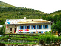


(S) From the Bousiéyas municipal lodge, take the Route de la Bonnette (M64) north-west and, just after the hairpin bend to the left, you’ll reach a junction.
(1) At the signpost, leave the M64 and take a gently ascending track running in the opposite direction to the right (north-west). Cross the Tinée via a bridge (altitude 1,861). Follow the river for 100 metres and turn left.
(2) Follow the forest track up the hillside. Cross the Combe de Male torrent and the Rio torrent. On the northern shoulder of the Rochers du Prêtre, reach a Fork in the road.
(3) Leave the forest road and cut across its bends via the path on the right, which climbs straight up the slope. Rejoin the road further up at a junction by the small lake of Lauzarouotte.
(4) At the signpost, ignore the GR®52 to the right (west) and continue straight on along the GR®5 (south). After 150 m, pass a narrow track on the left and, 100 m further on, a path branching off in the opposite direction to the right. Cross the Vallon de l’Issias in a wide, one-kilometre arc until you reach a hairpin bend. Opposite, follow the shortcut which leads directly to the Col de la Colombière.
(5) At the signpost, ignore the path on the right and the two others on the left, and head down the opposite side via numerous hairpin bends to the bottom of the Vallon de la Combe. Continue along the hillside (south-east) on its left-hand side. At the Rochepin chalets, you’ll reach a hairpin bend.
(6) Head back up the descent in the opposite direction (north-west). Cross the torrent and then, on the opposite side of the slope, continue descending southwards and then south-west. Ignore a path on the left and proceed to a junction.
(7) Ignore the nature trail heading off to the left in the opposite direction, and carry on straight ahead. Enter Saint-Dalmas-le-Salvage, a charming Provençal-style village.
(8) At the sign, turn left onto Rue de la Colombière. Walk past the ‘Chez Philippe’ stopover lodge. Ignore Rue du Pontet on the right. At the junction, leave Place de la Mairie on your right and head left onto the M63.
(9) At the sign, cross the M63 and follow the path towards the church. Go round it on the right and, after a hairpin bend, join the Route d’Anelle. Turn left to cross the bridge over the river and reach a Fork in the road.
(10) Keep to the right, staying on the same road. Ignore the two turn-offs to the right and cross three streams in quick succession. Climb two hairpin bends and, about 500 m further on, at the hairpin bend, ignore the path opposite; shortly afterwards, you’ll reach a junction.
(11) Ignore the road on the right and turn left onto the Col d’Anelle track. Pass two chalets before heading up alongside the stream, then reach the Col d’Anelle and its shelter.
(12) At the signpost, ignore the two paths on the right and the one heading in the opposite direction on the left. Stay on the Col d’Anelle path, which turns sharply left. Ignore two paths on the left in succession and, 50 m after the second, you’ll reach a fork opposite two chalets.
(13) Leave the track and take the shortcut down to the right (south-east). Return to the track and cross it. First turn left then right and, immediately at the Fork in the road, take the path on the left (south-south-east) which winds downwards. Join the track again.
(14) Follow it for 200 m, keeping the same direction, before leaving it for a path leading down to the right. Cross two tracks in succession. Turn right (south-east) and walk alongside the hairpin bend on the Route d’Ublan. Further down, cut across one of its hairpin bends (alt. 1,255 m) and come out onto the Route de Demandols at the entrance to Saint-Étienne-de-Tinée.
(15) At the sign, turn left and, opposite the school chapel, turn right onto Rue d’Ublan. Cross the Ardon. Immediately at the junction, carry straight on along the M2205 towards Nice. After 20 m, leave it and take the small Rue du Val Gelé on the left. Continue along this road, ignoring the two side streets, until you reach a junction.
(16) Turn right onto Rue du Pourtalet. Shortly afterwards, at the fork, keep right onto Rue Gayolle, which narrows shortly afterwards. At the end of the street, you’ll reach the church square. Head to the right and go round it to the left onto Avenue Général de Gaulle. Pass by the foot of the bell tower and arrive at a small roundabout.
(17) Carry on straight ahead for a few dozen metres, then take the first street on the right to reach the petite route de Belloire. Follow it to the left, ignoring any side roads. After about a kilometre, you’ll reach a Fork in the road.
(18) At the signpost, leave the road as it bends left and take an ascending path to the right. Cross a stream, join the M2205 (Boulevard de l’Oron), and follow it to the left. At the roundabout, turn right onto the M39 towards Auron. Immediately after a two-way road on the right, look out for a low wall supporting a path.
(19) At the signpost, follow this path diagonally (south) up the wooded slope. Cross the Combe du Drogon, then climb a seemingly endless series of small hairpin bends, heading south-west. At the top, cross a track and emerge onto the Chemin du Puy d’Auron at the entrance to Auron.
(20) Follow it to the left, ignoring a wide track on the right, and pass a hairpin bend. On both sides of the road, ignore the dead-end lanes leading to private properties. After a few hairpin bends, you’ll reach Boulevard Georges Pompidou.
(21) Head towards the roundabout, go round it on the left, then turn right towards the Tourist Office tower. At the sign, walk past the rear of the building. Continue along the path running alongside the car park and, at the end, turn left.
(22) In front of the Riou ski lift station, keep to the left-hand street, run parallel to the M39 road and cross a car park lengthways.
(23) In front of the ski lift station, turn left onto the street, ignoring the two other roads on the right. After the riding centre, turn onto the path on the right. Just before the ski lift, leave the path and take the track on the left. Pass under a chairlift and reach a junction on a flat stretch.
(24) Ignore the side paths and continue straight ahead. After 150 m, ignore a path leading down to the left and cross the Ruisseau de Blainon valley. At the Fork in the road, turn right and you’ll immediately reach a crossroads.
(25) At the signpost, carry on straight ahead and, after 400 m, cross a ravine. Further on, turn right (south-west) to climb straight up the slope. Cut across a transverse path and come to a track. Follow it to the left until you reach a junction 100 m further on.
(26) At the signpost, leave the track and head up the path on the right. Join the track again (alt. 1,945 m) and follow it to the right for about fifty metres. Then leave it to head up the path on the left and reach the Col du Blainon.
(27) Ignore the ridge path (east–west) and, opposite, descend diagonally across the slope, first south-east then south. Go round a ridge and head along the hillside (west). Gradually turn south, ignoring a path on the left. Shortly afterwards, pass the Clot Giordan chalets and quickly reach a Fork in the road.
(28) At the signpost, turn left and walk past the chalets. At the fork by the third chalet (alt. 1710 m), turn left then right to reach the Chalets de la Salle. Ignore the side paths and, at the last two chalets, you’ll come to a junction.
(29) Head down the path to the left (south-east). You’ll reach another junction at the foot of a wayside shrine and near a telecoms mast.
(30) Take the path on the right. Pass close to a hairpin bend on the Route de Roya and continue left to join the road in Roya. Follow it to the left as far as the “Ma Vieille École” lodge (E).
 Visorando Member
 Difficult
 Moderate