Country:

 City:
City:


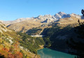
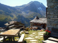
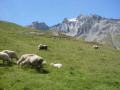
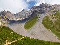
(S) From the refuge, continue along the GR®5 (south-west) then descend gradually (south-south-east). Cross the Ruisseau de l’Île via a footbridge. Pass a few ruins, then the Chapelle St-Laurent, built of dry stone and slate (alt. 2200 m). Cross two more streams via footbridges. Go round a rocky outcrop and reach a junction amongst the ruins of the hamlet of Le Mont.
(1) Ignore the path on the left towards the Pont du Châtelard and, opposite, stay on the GR®5 (south-west). Walk through La Combe d’Enfer and cross the gorge of a torrent via a footbridge replacing the one washed away in 2023 (elevation 2212). Climb (south) up the opposite slope, then traverse (south-east) above a rocky ridge. Go round the ridge and reach a junction in front of some ruins.
(2) Ignore the path on the left towards Chalet Montafia. Climb to the right (south-west) across the scree slopes of the Crête de Belle Place. At around 2,470 m, descend gently into the valley of the Ruisseau de Bonne Nuit. Cross the stream, then immediately ignore the path descending to the left (elevation 2,357) and climb back up (south-east) to a junction.
(3) Ignore the paths on the left leading to the chalet and the ruins of La Loza. Turn right (south-west) to overlook a ravine. Cross a funnel-shaped cirque on a ledge below the Pointe de Belle Côte. Descend via switchbacks to the junction at the foot of the ruins of La Turra.
(4) Ignore the path to the left (east) and head south-south-west. Descend a rocky ridge via a few switchbacks, then follow the hillside to reach a junction just before the bottom of the Ruisseau de Saint Pierre ravine.
(5) Cross the path and descend via a series of switchbacks to a junction at the edge of the torrent. Ignore the path running straight along the torrent (south) and cross over to the right (west). Follow the contour of the Bellecôte valley, keeping almost level. Pass under a chairlift from the Aussois resort and, at a place known as Le Djoin, reach a junction before the upper stations of two other chairlifts.
(6) Ignore the paths opposite and to the left as they pass beneath the chairlifts. Head up to the right to join the access path to the stations. Turn left, then immediately right. At the junction 70 m further on, follow the level path to the right. Pass beneath a ski lift and arrive at a junction below the picturesque Plan Sec Refuge.
(7) On the right, ignore the access routes to the refuge and continue straight ahead along the level path (north-north-west). Leave this path after it bends to the right, taking a track (north-north-east) instead. Ignore the track on the left and keep to the right. Cross two streams in succession to reach a junction.
(8) Ignore the path to the Refuge de La Fournache on the right. Turn left and, at the Fork in the road 30 m further on, ignore the path on the right leading to the Refuge de la Dent Parrachée. Go round the far end of the lake, Plan d’Amont, heading downwards (west). Ignore two paths on the right leading to the Fond d’Aussois and cross the Pont de la Sétéria to reach a junction immediately afterwards.
(9) Ignore the path on the left which follows the lakeshore along the hillside and climb diagonally (south-west) up the slope to reach a junction.
(10) Ignore the path on the right towards the Fond d’Aussois refuge and continue 70 m straight ahead to a junction. Ignore the path straight ahead (west) towards the Col de la Masse and take the one on the left (south-south-east) downhill. Continue round the top of Lac du Plan d’Amont, then skirt past Lac du Plan d’Aval (south) to reach a junction.
(11) Ignore the path descending in the opposite direction to the left towards the lake. Carry straight on to the Col du Barbier and leave the path on the left leading to the Moure Cobroute ridge. Opposite, after about 200 m, you’ll reach a junction at the foot of a scree slope.
(12) Ignore the path descending to the left and, opposite, head up the slope (west). At an altitude of approximately 2,350 m, descend gently towards the three Barbier chalets, then, on almost level ground (alt. 2,340 m), go round a steeply sloping valley. Descend (south-west) along the flank of the rocky ridge of the Rateau d’Aussois and reach a junction.
(13) Ignore the path on the left towards Rimollard. After about 500 m, pass another path on the left. Continue for a further 500 m and leave the access to the former Refuge de l’Aiguille Doran on your left; this is marked on the IGN map but has been closed since 2019. Opposite, climb the path skirting the spur of the Rateau d’Aussois ridge. Reach a junction at the top of the hamlet of l’Orgère
(14) Ignore the path on the left leading down towards the hamlet and the one furthest to the right heading towards the edge of a wood. Follow the second path on the right, which leads into the clearing. Cross the Ruisseau de Povaret and you will immediately come to a fork.
(15) Ignore the path descending the Orgère valley to the left (south-west) and instead head up the opposite slope (north-west). Make your way to the Refuge de l’Orgère. (E)
 Visorando Member
 Moderate
 Tourism professional
 Very difficult