


 Country:

 City:
City:



(S) From the Lodge de la Vieille École in Roya, head down the road towards the church (south) and reach the church square.
(1) At the signpost, walk along its long side to the right. Keep to the path on the right. After 100 m, ignore the path opposite and turn left. Cross the footbridge over the Vallon de Roya stream, then immediately cross the one over the Torrent de la Maïris and reach a junction.
(2) Leave the path opposite and, turning right, head up the deep Vallon de la Maïris, which gradually narrows as you cross the Barres de Roya. Note the waterfall opposite. Pass through the narrowest point, then cross a footbridge to reach the other bank.
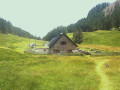
(3) Climb up alongside the stream through the Vallon de Sallevieille until you reach an X-shaped junction near an alpine chalet.
(4) At the signpost, ignore the path to the right and the one to the left. Opposite, continue (south-east) up the valley. Head east. Climb the steep slope of the cirque at the bottom of the valley via a series of switchbacks, keeping the Barre de Sallevieille on your right. Reach a junction.
(5) Ignore the path on the left and go round the top of the ridge to the right. Continue (south) along a flat section. Climb up a scree slope and reach the Col de Crousette.
(6) At the signpost, ignore the path on the right descending into the Ravin de la Lanche (south-south-west) and ascend diagonally up its left-hand slope (south-south-east) to reach the Stèle Valette. Continue to the left (north-east) until you reach the ridge.
(7) At the signpost, leave the ridge path to the left (north). Turn right into the Ravin du Démant. Descend gradually (south-east), staying slightly below the ridge. Cross a small pass (east-south-east), the Baisse du Démant (elevation 2438), and, shortly afterwards, reach a fork in the path.
(8) At the signpost, leave the path to the right and continue straight on. Cross a ravine. After 250 m, reach a junction.
(9) Leave the path on the left and turn right, traversing the slope (south-southeast). Descend in numerous switchbacks (southeast) down the shoulder of Mont Démant. Further down, reach a flat area (elevation 2133) and descend to the Col du Refuge.
(10) On the hillside, go round Mont des Moulinès on the left to reach the Col des Moulinès.
(11) At the signpost, ignore the three paths to the right and turn onto the GR®5 to the left. Descend diagonally (north-west) down the side of the Ravin du Démant and reach a junction halfway down the slope.
(12) Leave the path heading straight on and take the one on the right. Descend in switchbacks along the right-hand side of a scree slope (north-east). Cross the torrent and then a scree slope at the Pierre du Démant before reaching a Fork in the road.
(13) At the signpost, ignore the path to the right and take the gently sloping path to the left. Cross the Riou Fabre (alt. 1,770 m) and arrive at a junction in the Vallon de la Gourgette. On this stretch, you may spot bearded vultures nesting in the crevices of the rock faces above the hamlet of Vignols.
(14) At the signpost, ignore the path leading in the opposite direction to the right and, taking the one opposite, cross the torrent. Immediately, ignore the shortcut to the right and head up the valley floor. Turn right to climb up beneath the Charmettes rocks and rejoin the shortcut leading in the opposite direction to the right.
(15) Go round the rocky spur of the Granréon ridge. Cross a stream (alt. 1920 m) on the right. Turn left and head up the valley floor. Reach a junction at the small pass of the Portes de Longon.
(16) At the signpost, ignore both the path on the right and the one on the left. Continue along the middle route, winding your way up the right bank of the Ruisseau de Longon. After 800 m, you’ll come to a Fork in the road.
(17) Leave the path straight ahead and head left to cross the stream; then, on the left bank, make your way to the Refuge de Longon (or Vacherie de Roure) (E).
 Visorando Member
 Moderate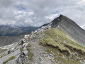
 Very difficult
