Country:

 City:
City:


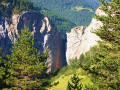
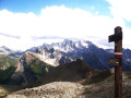
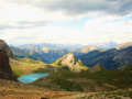
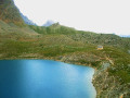
(S) Off the GR®5, from the Cime du Mélezet Refuge, leave the D60 road and head down the path to your right (south-east). Cross the Torrent du Mélezet and, at the signpost where the path forks, do not take the path you took the previous day to the right, but follow the ascending track to the left. At a hairpin bend, ignore the path on the right and, at the next bend, head towards a junction.
(1) At the signpost, ignore the path to the left and continue along the track. Wind your way beneath the Girardin chairlift and, at the top station, continue straight ahead to the junction near the ski lifts (alt. 2140 m).
(2) Leave the track opposite (south) and, taking the path on the right (south-west), cross the Pré Girardin torrent and then the tunnel under the ski lifts. After 200 m, you’ll reach a fork.
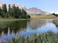
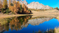
(3) At the signpost, leave the path as it bends to the left and continue along the path opposite. Further up, near Lac Miroir, you’ll reach a junction.
(4) At the signpost, take the GR®5 to the left. Cross the Torrent de Pré Girardin and, immediately afterwards, ignore the path to the right. Walk alongside a track and reach a path beneath the Sainte-Anne ski lift. Follow it to the right (south-east) to reach a junction 200 m further on.
(5) Ignore the path on the right (south-west) and take the track opposite (south-east). Immediately afterwards, at the Fork in the road, leave it on the right and take the parallel path on the left. Reach the Small Pass de Sainte-Anne (elevation 2407) and, on almost level ground, come to a crossroads by the shores of Lac Sainte-Anne and its small chapel.
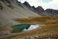
(6) At the signpost, turn left and, after 50 m, at the junction, continue right for a further 50 m. At the Fork in the road, ignore the lakeside path and, turning left, head up the slope of the valley (south-east). The path then heads south-west (alt. 2,580 m) to climb the switchbacks across the scree slope. Ignore the side tracks and, amidst the rocky landscape, make your way to the Col Girardin.
(7) Descend (south-east) via numerous hairpin bends down the steep opposite slope to reach the plateau at the top of Les Bâchasses. Descend alongside the Torrent des Séchoirs and arrive at the Cabane de Girardin
(8) Without straying from the torrent, continue the descent, ignoring the paths to the left, until you reach a Fork in the road.
(9) At the signpost, do not take the Via Alpina to the left towards the hamlet of Maljasset and its refuge; instead, cross the torrent to the right. Continue the descent (south-west) along the side of the steep slope. Follow a series of hairpin bends down the slope and join the D25, Route du Vallon de Maurin.
(10) At the signpost, turn right and pass the hamlet of La Barge. After the bridge (altitude 1860), leave the road and take the path on the left. Follow the right bank of the Ubaye and arrive at the hairpin bend of a service road.
(11) Ignore the climb to the right and, straight ahead, walk past the Blachière Hydroelectric Power Station. Continue along the path that follows, ignoring the footbridge over the Ubaye on the left, and return to the road. Follow the road down to the left and, after the bridge, reach a junction.
(12) At the signpost, ignore the path on the right. Stay on the road (south-southeast). Further on, cross to the left bank of the Ubaye. At the Pont Vouté, return to the right bank. Afterwards, 250 m on, you’ll reach a Fork in the road.
(13) At the signpost, leave the road and, taking the path on the left, follow the Ubaye. Further on, rejoin the D25 and, on leaving the charming hamlet of Saint-Antoine, reach a Fork in the road.
(14) At the signpost, leave the D25 and take the path on the left which runs alongside it below. After a good kilometre, rejoin the D25 at the junction marked by a lime kiln.
(15) At the signpost, ignore the path leading uphill to the right and, following the D25, cross the bridge over the Vallon du Châtelet torrent. Pass a path on the right, then a track on the left, and reach a fork in the road.
(16) At the signpost, leave the D25 straight ahead and keep left onto the Route de Fouillouse. Cross the magnificent and vertiginous Pont du Châtelet, whose stone arch spans the narrow Gorge de l’Ubaye, which is over 100 m deep, then go through the tunnel. Ignore the path on the right towards Champ Long and continue to a junction.
(17) At the signpost, ignore the road straight ahead and the path on the right; take the path on the left uphill. At the Chalet de la Meire, cross a track and continue straight ahead on the ascending path (east), then turn south to reach a junction.
(18) At the signpost at the junction, ignore the path on the left towards the Refuge du Chambeyron and head straight ahead downhill (south) towards the hamlet of Fouillouse. Turn left onto the road to reach the Les Granges lodge (alt. 1,890 m) immediately (E) .
 Visorando Member
 Moderate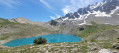
 Very difficult