Country:

 City:
City:


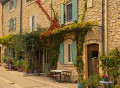
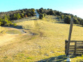
(S) From the stopover lodge or Lou Badareu campsite, head back onto the D27 and follow it to the right for 400 m before turning left onto the Chemin d’Apt (GRE 7 and GR®9 variant). Continue to a junction (elevation 344)
(1) At the signpost, continue straight ahead on the same path, veering slightly to the right. Cross a road and, ignoring any side paths, after 1 km, you’ll reach a crossroads.
(2) At the signpost, join the GR®9. Follow the track straight ahead up the valley floor.
(3) At the Fork in the road (elevation 471), keep to the right, then at the next Fork in the road turn left, following a stream until you reach a junction (elevation 536) at La Tuilière.
(4) At the signpost, head uphill to the right, still on the Chemind’Apt, to reach a junction.
(5) At the signpost, stay on the GR®9 and GRE7 to the right along the Chemin de la Coustière, which winds its way up the south-facing slope of the Grand Lubéron (east-north-east). After 2.4 km, at an altitude of approximately 790 m, cross the Ruisseau du Vabre and arrive at a junction.
(6) Head down the right-hand (southern) side of the valley, then at an altitude of around 700 m, go round it to the north-east and reach a junction (elevation 677). Continue the descent to the right (south-east) to reach a path (alt. 650 m).
(7) Head back up the path in the opposite direction to the left. Cross the Ruisseau de Saint-Jean and, after 100 m, reach a T-junction.
(8) Head up the Piste des Courbons opposite (north-east). Pass a high point (alt. 700 m) and stay on the track as it descends to the right (south-east). Cross the stream, Ravin de l’Escalette, then join the Piste des Méritants (marker 580). Take this track to the left and, 200 m further on, reach a junction (marker 586).
(9) At the signpost, leave the tracks to the right and, following the GR® to the left, climb the Gamates hillside via a few hairpin bends. Reach a crossroads on the ridge (elevation 1027)
(10) At the signpost, ignore the DFCI track and continue along the GR® route, which turns right. Pass a high point (altitude 1072) and, at a small pass, reach a junction with the track.
(11) At the signpost, keep to the GR® path straight ahead. Follow it alongside before rejoining it at another small pass (elevation 1016).
(12) At the signpost, continue along the GR® trails which take the track to the right. Leave the track just after the Jasse du Gros Collet hut and continue along the path to the right which follows the ridge. Pass an aerial (elevation 1064) and descend to a junction at the Col du Pas de Marseille (elevation 1009).
(13) At the signpost, ignore the track and the first path on the left (east) and take the next one (south-east). Pass below the summit of the Coteau de la Combe, then on the descent, ignore a path on the right before reaching a junction at a small pass (elevation 939).
(14) At the signpost, cross the track and head for the second path on the left, which slopes gently downwards (north-east). Ignoring the side paths, cross the Vallon de St-Jean. Join a track (elevation 838) at its right-hand bend and, as you come out of it, leave it for a path that runs alongside it on the left. Immediately, ignore a path on the left and arrive at a Fork in the road.
(15) At the signpost, stay on the GR® route, which descends to the left. Follow a track on your right and, at a junction, join the Route de Céreste, D33 (elevation 696).
(16) At the signpost, walk against the flow of traffic to the left. Pass a hairpin bend and, at the Fork in the road 200 m further on, leave the road for a path running alongside it to the right. At the bottom of a small valley, you’ll reach a junction.
(17) At the signpost, continue along the GR® trails heading straight down into the Vallat de la Combe d’Apt. You’ll reach a track (elevation 575) and follow it straight on until you reach a junction.
(18) At the signpost, take the track descending to the right, which further down runs alongside the Route de Cereste (D33) before joining it at the entrance to a hamlet (elevation 507).
(19) At the signpost, follow the D33 to the right. Enter the village of Vitrolles-en-Luberon. Turn onto Rue de la Mairie, the second on the right, and head for the stopover lodge at No. 12 (E).
 Visorando Member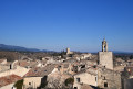
 Moderate
 Easy
Easy