Country:

 City:


(S) From Les Granges de la Vallée Étroite, walk past the Terzo Alpini refuge. On the GR®5, head towards Col des Thures via the Combe de la Miglia (south-west) and cross the stream.
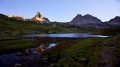
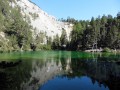
(1) Climb the hairpin bends up the slope of Pointe Muratière. At an altitude of around 1,980 m, continue the ascent diagonally (south-east), passing Tête Ronde on the left. Walk along the right-hand side of the pretty little Lac Chavillon. Leave the path on the left and, on the right, head for Col des Thures.
(2) Head down into the Vallon des Thures (south). At the Cabane des Thures (2,093 m), head south-east and make your way to a Fork in the road.
(3) At the signpost, leave the GR®57 to the left and continue on the GR®5 to the right. Cross the Torrent de Roubion. Descend the slope (south-west) via numerous hairpin bends to reach a junction.
(4) At the signpost, ignore the path to the left and turn right. Walk past the Cheminées de Fée and cross the Torrent de Roubion. Follow the right bank and, immediately afterwards, ignore an ascending path leading in the opposite direction to the right. After 120 m, you’ll reach a Fork in the road.
(5) At the signpost, leave the path straight ahead and take the path on the right. The two paths rejoin further down. After a few hairpin bends, rejoin the path at the junction near a chalet.
(6) At the signpost, head down to the left. After 50 m, ignore the path heading in the opposite direction to the left and, immediately to the right, cross the wide bed of the Torrent des Liches. Continue the descent along the path on the right bank of the Torrent de Roubion, ignoring the side paths. Reach a junction.
(7) Ignore the path opposite (south) and stay on the path to the right (west). After a left-right bend, ignore a housing estate on the right and emerge onto Rue de la Lombarde in the hamlet of Roubion.
(8) Turn left (east). On the right, pass the Rue des Thures and, immediately afterwards at the Fork in the road, the holiday centre on the right. Cross the wooden bridge and follow the Roubion torrent along the path on the right. At the junction near the chapel, turn right and then cross the D994G road.
(9) Head along the path on the left which follows the River Clarée. At the Fork in the road, take the right-hand path over the Pont des Armands. Follow the river along the right bank. Opposite the campsite, ignore the path leading uphill to the right, cross a steep-sided stream and reach a junction.
(10) Ignore the path leading uphill to the right and head back down the one opposite until you reach a junction at the foot of a chapel. Leave the GR®57 on your right and, straight ahead, take the D994G road. Enter Plampinet via the bridge over the Clarée, and you’ll immediately reach a junction.
(11) At the signpost, turn left onto Rue du Fontan. At the junction signpost 120 m further on, leave the GR®57 straight ahead and keep right onto Montée du Rochasson. Continue along Chemin des Aces. Climb the hairpin bends to reach the gorge of the Torrent des Acles. At the exit of the gorge, you’ll come to a Fork in the road.
(12) At the signpost, leave the GR®5B to the left and follow the Torrent along the GR®5 to the right. After 600 m, ignore the path on the right. You’ll reach a Fork in the road near the Chalets des Acles.
(13) On the right, cross the Torrent des Acles and leave its valley opposite. Head right (south-east) then south-south-east into the Opon valley, dominated on the right by the Pécé ridge. Make your way to the Col de Dormillouse.
(14) At the signpost, ignore the path leading down opposite (south) and take the one on the left (east then south-east) up to the Col de la Lauze.
(15) At the signpost on the pass, leave the ridge path (north-south) and descend (north-east) down the opposite slope, heading for the rocky ridge of the Clot des Fonds. Reach a junction at the foot of this ridge.
(16) Ignore the path on the left (north) and follow the Clot des Fonds path on the right (south-south-east) downhill, passing under a chairlift and emerging at the hairpin bend on the Col du Chaberton track.
(17) Descend along its right-hand branch towards the bottom of the Vallon des Baisses. Ignore the paths on the left leading to the Cabane des Baisses. Head down (south) into the valley, drawing closer to the Rio Seco. At the Fork in the road, take the well-marked path on the left and join the riverside track.
(18) At the signpost, continue the descent (south). Ignore the side paths and stay on the wide track until you reach a Fork in the road, 50 m upstream of a ski run and its ski lift (50 m further on).
(19) Ignore the path on the left towards the Village du Soleil (south-south-east) and head along the one on the right (south then south-south-west). At the sign marking the junction with Rue des Baisses (in the opposite direction), carry on straight ahead. Just before crossing the ski lift, you’ll reach a Fork in the road.
(20) Leave the street and follow a path to the right alongside it. Pass under a ski lift. Immediately at the Fork in the road, turn left and, at the junction sign, carry on straight ahead (south-south-west) along the side of the road. Join the N94, pass under a ski run and then, at the roundabout, head for the foot of the obelisk.
(21) At the sign, take the Route d’Italie to the right of the car park. At the Fork in the road in front of the tourist office, turn off onto Rue de l’Église on the right. Cross through the town centre. On leaving the town, cross Rue des Montagnards diagonally. Opposite, take Rue de la Chapelle for 50 metres and turn left onto the one-way street running in the opposite direction to rejoin Rue d’Italie.
(22) Follow it to the right (south-south-west) before leaving it at the N94 roundabout. Continue straight on along Rue des Sablons and, at the T-junction, take the N94 for 1.5 km until you reach the oratory on a small road to the right.
(23) On the left-hand side of the N94, after about thirty metres, look out for a hidden path that leads into the woods. Follow it to cross the Durance and walk along its left bank. Move away from the river, leaving the paths and side tracks behind. You’ll reach the junction with a forest track.
(24) Take the path opposite to reach a track. Follow it straight on (south-west), passing the Torrent du Grand Réal. In a small valley, cross the Torrent des Ruines and you will immediately emerge at the hairpin bend of a forest road.
(25) Head down it on the right-hand side. At the end of a straight stretch, ignore the path on the left and keep to the right. Walk alongside the Ravin du Vallon stream and, straight away, pass the footbridge on the left. Immediately leave the road as it bends to the right, taking a track on the left. After 70 m, leave the GR®5, which crosses the bridge over the stream to the left.
(26) Off the GR®5, opposite, stay on the right bank. Join the Route Forestière du Vallon straight ahead (north-north-west). Ignore the side paths and cut across the N94. In the hamlet of La Vachette, head for a junction marked by a sign. Turn left and cross the bridge over the Durance to reach the Ô Clarée stopover lodge on the left. The campsite is situated on the Chemin des Noisettes, which you should take opposite at the junction ( E).
 Visorando Member
 Difficult
 Easy
 Moderate

 Extremely difficult