Country:

 City:


(S) From the Refuge de la Balme, head down the path (north-east). After a wide bend to the right, cross a stream and follow the left (south) bank of the L’Ormente stream until you reach a Fork in the road.
(1) Keep to the left on the same bank. At the Laval mountain chalet, ignore the path to the right and follow the wide, branching riverbed opposite. You’ll reach a Fork in the road.
(2) Leave the path straight ahead and take the one on the left, which is almost level (south). Keep to the right, pass the Plans d’en Haut chalet, and continue along a path (west-south-west). Leave this after 100 m, taking a path on the left (south), and reach a junction.
(3) At the signpost, follow the GR®5 to the left (south-east), then (south). Pass the Crête Merry chalets and turn left (east-south-east). After the three Fours chalets, you’ll reach a junction.
(4) Ignore the path on the right and continue along the one opposite (south-east). Walk through the hamlet of La Lance, ignoring the side paths. At the end of the hamlet, cross the Canal de Valezan and, immediately afterwards, reach a Fork in the road
(5) Leave the path as it bends to the left (east) and follow the one straight ahead across the fields (south), then (south-east). Descend to the bottom of the Nant des Moulins stream valley. Ignore a path on the right and, at the bend to the left, ignore the path on the right. Cross the Pont de la Cluze bridge over the Nant des Moulins. Passing under high-voltage power lines, you’ll reach a hairpin bend on a road
(6) Take this road to the right for 150 m, then leave it to take a path descending to the right. Pass through a copse and, at the junction near a house (elevation 1251), take Rue Saint-François to the right (south). In the village of Valezan, cross the Route de la Lessière.
(7) Walk down Rue Saint-François straight ahead. After 70 m, turn left, then, at the Fork in the road, immediately right. Cross the Route de la Lessière again and, opposite, walk past the church (south). At the crossroads, take the Chemin de la Montaz straight ahead, and head for the junction by the town hall.
(8) Carry straight on, past the town hall, and turn right onto Rue de la Dhuit. At the junction, turn left onto Route du Praz, then immediately right onto Rue du Pied de Ville. After the right-hand bend, ignore the lane on the left and, 60 metres further on, the one on the right. Head downhill to the left until you reach a junction. Cross the Route du Praz and continue straight ahead along the footpath, then cross it again.
(9) Take the path opposite to reach the Route du Praz. Follow it straight on for 70 metres before leaving it to take a path going in the opposite direction, on the right. Leave this immediately to take the path on the left. Cross the road and, at the same time, the Nant du Gothard stream. Opposite, take the Chemin de Cyprien. You’ll reach a junction just before the Rocheray buildings.
(10) Leave the path and head down the track on the right. After a few hairpin bends, ignore the track on the left. Cross the Route de La Colombière. Pass under a high-voltage power line. Walk alongside the hairpin bend on the same road further down, then follow it through the hamlet of Le Crey, until you reach a junction at the hairpin bend.
(11) Leave the road and take a track to the left, into the woods. Cross the Nant des Combes via a footbridge, then head down (south-east) alongside the village of Bellentre. Pass the car park on your right and join the Grande Rue.
(12) Follow it to the left and enter the village. In front of the church, turn right onto the Route Napoléon (east), passing the town hall. Go through a tunnel to cross the N90. Follow the road to the right for 50 metres before leaving it and following the path to the left until you reach a junction.
(13) Head downhill to the left at a junction. Opposite, take the Route du Pont to cross the Isère. On the other bank (elevation 723), follow the D220 road to the left for about twenty metres, then turn left onto the greenway, running alongside the Isère. Leave it before the bridge over the Isère, head up the steep slope to the right, and join the Route du Perrey (D87).
(14) At the sign, turn right onto it and cross the railway line. Turn left onto the D220 towards Hauteville and enter Landry. Leave the D220 at the first road on the right, the Chemin de l’Ancienne Mairie. After the left-hand bend, ignore the Chemin de la Forge opposite and keep to the right. You’ll come to a T-junction.
(15) Turn left onto Chemin de l’Oratoire and, immediately afterwards, right onto Chemin de l’Église. Ignore Chemin des Glières on the right, and continue along the path opposite, which leads onto Route Saint-Michel. Follow this road to the left until you reach the end.
(16) At the signpost, head right onto a path opposite the church (east). Climb up through the woods, cutting across the bends of the Route du Chêne, crossing it three times. At the top (alt. 1,070 m), continue straight ahead (south). At the junction, ignore the path on the right and turn left (east), then walk past a large building. Cross the Route des Rêches and, immediately afterwards, you’ll reach a junction.
(17) Continue along the path on the right, which, in the distance, runs alongside the Route des Rêches. Ignore a path on the left. Cross a stream and, at the Fork in the road, keep left (south-southeast). Pass the Chalet du Biollet and rejoin the road at a hairpin bend.
(18) At the signpost, leave the road on your right and, opposite, follow the path that runs almost level with it. Pass the chalets in the hamlet known as Les Côtes. Take the Chemin des Côtes through the hamlet of Le Villaret. After the chapel, ignore the Chemin de Glaise on the left. At the Fork in the road, keep left onto the Route de la Lanzagne. Pass under the cable car and arrive at a Fork in the road at the entrance to Peisey-Nancroix.
(19) Continue left towards the town centre along Rue des Monts d’Argent. At the junction sign, ignore the Montée de l’Église on the left and carry on straight ahead. At the fork, after the town hall, head down Rue de la Chenalette on the right to join the D87. Follow it to the left as far as the hamlet of Le Moulin.
(20) At the signpost, leave the D87 and head down Rue de la Chapelle Ste-Agathe to the right, ignoring the side streets. In front of the fountain, ignore Ruelle de l’Aloi on the left and, opposite, take Route du Vieux Moulin, which runs alongside the fountain on the left. Cross the Torrent Le Ponturin.
(21) Follow the stream upstream along the path on the left, at the edge of the woods, ignoring the paths leading uphill to the right. Cross a stream and join a track. Continue straight on along this track until you reach a junction.
(22) At the signpost, stay on the GR®5 straight ahead, close to the stream. After about 600 m, ignore the path on the left towards the Lanchette campsite and, immediately afterwards, reach a three-way junction. Continue straight ahead, skirting the stadium on your left, and reach a crossroads.
(23) Continue straight ahead along the path, then ignore the paths leading uphill to the right. Walk past the Palais de la Mine de Galène to reach a straight path. Take this to the right for 120 m, before turning left to cross the Arc stream and, shortly afterwards, the Nant Fesson. Opposite, take the path (east-north-east) to reach the D87 road.
(24) Follow it to the right for 50 metres, then cross it to follow a path leading to the hamlet of Les Lanches. Turn right onto the hamlet’s main street, then, after 200 metres, take the first left. Cross the Ponturin stream, turn immediately right and follow the stream (south-southeast) to reach a junction.
(25) Ignore the Chemin de la Croix de Beaupraz on the left. Continue to the right and, at the Fork in the road, keep to the right. At the junction (elevation 1539), continue along the path to the left. Pass the path on the left leading to the Bettières chalets, and immediately turn right to cross the Ponturin. Follow the path straight ahead (south) to join the D87 road. Follow it to the left as far as the Rossuel Chalet-Refuge.
(26) At the signpost, continue on the GR®5 via the path (south-south-east) that runs alongside the woodland, to the right of the road. On the right, ignore the two access points to the nature trail. Cross the Nant Tumelet and, through the woods, head up the Lanches de la Rèbe (east). Go round the rocky ridge of the Aiguille de Motte (Cote 1916) to head south-east and reach a fork in the road.
(27) Leave the path on your right and take the one opposite to reach a junction marked by a stone marker. Keep to the right, pass the Chalet de derrière la Rèbe shelter (alt. 2020 m), then ignore the paths on the right and cross the footbridge over the Ponturin.
(28) After 100 m (east), turn right to follow the Ponturin (south). At the signpost, ignore the path on the left towards the Refuge du Mont Pourri, and head for a junction at the Chalets de la Plagne
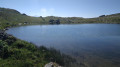
(29) Ignore the path on the left towards the Col de la Sachette. After passing through a rocky gap (elevation 2,174), leave the GR® 5 to the left and take a path on the right, descending towards Lac de la Plagne. Walk alongside the lake and round its far end, then head for the Refuge Entre le Lac (E).
 Visorando Member

 Moderate
 Association / Club / Walk leader
 Tourism professional
 Difficult