Country:

 City:
City:


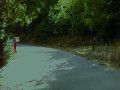
By car, via the D1086 (formerly the RN86 running along the right bank of the Rhône), head towards Chavanay Centre. On the Grande Rue, pass the town hall on your right and turn into the first street on the left, Rue du Chirat, then immediately left to park at the Parking de la Tour.
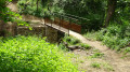
(S/E) From the Parking de la Tour, follow the GR®65. Whilst the bridge is under reconstruction, head south to cross the temporary footbridge over the Valencize stream. At the junction, turn onto the path on the right, then, at the sign (elevation 157), take the street on the left towards the Chapelle du Calvaire. You will soon reach a crossroads.
(1) At the signpost, turn right and follow the same sign along Rue de la Chorerie. At the top, at the junction, take Route de la Ribaudy on the right until you reach a path leading in the opposite direction on the left, marked by a sign for “La Chapelle du Calvaire”.
(2) Leave the road and climb this steep, stony path. After a hairpin bend to the right, along a slight incline, you’ll come to a flight of steps. Climb these to reach the beautifully restored Calvaire Chapel.
(3) Continue up the GR®65 to the left. Walk through vineyards until you reach a junction. Ignore the path branching off to the left and, opposite, you’ll soon rejoin the Route de la Ribaudy. Turn left onto it to reach an X-junction.
(4) At the “La Ribaudy” road sign, ignore the road leading in the opposite direction to the left. Opposite, leave the GR®65 to the left and take the road on the right towards Vintabrin. After 400 m, ignore the road on the right leading to Vintabrin and continue straight on until you reach a Fork in the road.
(5) At the sign for “La Croix des Quatre Chemins”, follow the sign for La Chaize Haute via the Claude Berthier Trail No. 4. Cross the Route de Pélussin, and shortly afterwards, you’ll reach a junction.
(6) At the signpost, go straight ahead, keeping the same destination, La Chaize. After 300 m, at the signpost, keep to the left and, immediately, cross a stream. About 300 m further on, at the next signpost, turn right to join the Chemin de la Souche.
(7) At the sign for “La Truarie”, continue to the right towards La Chaize. Pass two further signposts whilst keeping to the left and continuing in the same direction. Carry on along the Chemin des Lagunes and cross the D19 road. Opposite, take the Montée des Sources. Ignore a road on the right and, on leaving the hamlet, you’ll reach a junction with a path on the right, marked by a signpost reading “La Chaize Haute, alt. 465 m”.
(8) Carry on straight ahead towards Roisey. After 150 m, at the sign for “La Chaize Haute, alt. 475 m” opposite, ignore the sign for La Boucharie and turn left. About 20 m further on, you’ll come to a crossroads.
(9) At the next sign, ‘La Chaize Haute, alt. 475 m’, choose the direction for Beautin on the left, still following path no. 4. On the left-hand side, pass the first house and, at the second house with the white-slatted gate, look out for a path leading off to the right into the woods.
(10) Follow this for about 300 m before joining the Chemin de Beautin. Follow it straight on and you’ll reach a junction in the hamlet of Beautin. Turn right onto the only street and continue along a path until you reach a crossroads.
(11) Carry on straight ahead until you reach a sign behind a ‘No Entry’ sign. Follow the track uphill towards La Rivory and Pataud. You’ll emerge onto the Route de la Rivory at the entrance to the hamlet of the same name.
(12) Turn right onto this road. After a hairpin bend that skirts the hamlet, ignore the side streets leading into it. At the exit of a wide left-hand bend, you’ll see, on the left, a red gate marking the entrance to the Lodge des Deux Ânes and, opposite, the start of a footpath.
(13) Follow the path through the Bois de Blachemard until you reach the Route de la Chanterelle (elevation 653). About 200 m further on, you’ll come to a junction immediately after the Plan du Bief farm.
(14) Leave the road and take the path on the right. Walk past the farm and turn left at the edge of the woods. You’ll rejoin the Route de la Chanterelle. On the way back, look out for the ‘No Vehicles’ sign to help you find the path.
(15) Opposite, ignore the overgrown marked path and take the road on the right. At the junction marked with a cross, turn left. Ignore the lane running alongside the Pataud farm and, 100 m further on, you’ll reach a junction.
(16) Leave the road and climb the path on the right into the woods. Cross the Route de la Chanterelle diagonally. After a few dozen metres, do not go back down opposite but take the sharp hairpin bend to the left. You will come out onto the Route de Sagnemorte.
(17) Head up this road to the right. Pass an imposing house and, shortly afterwards, reach a junction (elevation 894).
(18) At the ‘Les Cévennes’ sign, head towards the Col de l’Œillon via the forest track ascending to the left. Ignore the side paths and continue to a junction (elevation 1005)
(19) At the sign, leave the track and turn right onto the steep, stony path towards the Col de l’Œillon. At the top, join a track (elevation 1045)
(20) At the sign marked ‘Alt. 1050 m’, cross the track and continue straight on towards the Col de l’Œillon and the Trois Dents to reach a track.
(21) At the sign for “Alt. 1090 m”, you have a choice.
- Either follow the sign for Œillon and the Trois Dents straight ahead, where you can see a path climbing up the scree slope, but this splits into branches that disappear into the thicket. So climb straight up the slope as best you can.
- Or, head back down the track to the left, keeping a close eye on the top of the scree slope to the right, and look out for a cairn of large stacked stones, which marks the start of a more distinct path. This is the route shown on the map. Both routes join, amongst the broom, a path marked by posts which follows the foot of the rocky outcrop of the Trois Dents.
(22) Follow the path on the left running along the southern slope of the Trois Dents until you reach a junction (elevation 1164).
(23) At the signpost, ignore the sign for Col du Gratteau on the left and, on the right, follow the sign for Col de l’Œillon. Climb the rocky escarpment, following the well-marked trail. At the top, leave the path on the left and turn onto the marked path on the right, which crosses a scree slope. Descend through a woodland to a junction marked by a signpost. Ignore the path on the right and head straight on up towards the Col de l’Œillon.
(24) At the signpost, ignore the marked paths and, opposite, cross the D63 road diagonally to the right. Take a path to the left of the large sign reading ‘Forêt communale de Roisey’. This climbs straight up through the woods and, almost at the top, go round the scree slope to the right to join a marked path. Take this path to the left and climb the scree slope, then head for the monumental cross at Crêt de l’Œillon and the orientation table (elevation 1364)
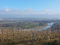
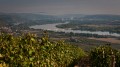
(25) At Crêt de l’Œillon, a superb view opens up over the meandering Rhône Valley with, in fine weather, the Alps in the background. Retrace your steps to return to the car park (S/E).
 Visorando Member

 Moderate
 Easy
Easy