Country:

 City:
City:


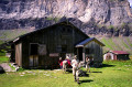
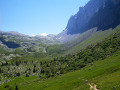
(S) From the Golèse refuge, head west to join the GR®5. Follow this to the left and descend the small VC1 road through a south-west-facing valley, ignoring all the side paths.
(1) At the Chavonnes farm, turn sharply left (south-east). Shortly afterwards, ignore a path coming from the right and arrive at a junction in the forest.
(2) Turn left (east) onto the almost level road. Further on, head down to the right (south-east) to reach a car park.
(3) Continue straight on along the road to the right (south-west), without crossing the car park. You’ll soon reach the hamlet of Les Allamands (Chapelle Notre-Dame des Grâces on the left).
(4) Continue downhill and you’ll soon reach another car park.
(5) At the hiking signpost, leave the road and turn right onto a path that runs alongside it towards Samoëns. Cross a stream via a footbridge.
(6) Cross a small road and continue along the path opposite. Walk alongside the road on your right.
(7) At a Fork in the road, keep to the right (south) and stay parallel to the road (the purple GR®5 route on the IGN map is out of date). Carry on until you reach a T-junction. Turn right and you’ll immediately reach the Route des Fontaines.
(8) Head down the road to the left. Pass the hamlet of Les Fontaines on your right, then that of Chevreret on your left.
(9) You’ll reach the hamlet of Les Moulins; turn left onto the Route des Pleignes. Ignore a small lane on the right and take the one on the left, the Rue du Martinet.
(10) At the crossroads, take the first left, the Route de Chevreret, and cross a stream. On the other side of the bridge, turn right and follow the stream on your right-hand side.
(11) Cross the Route de Sixt (D907), ignore the bridge on the right and continue along the stream. Then cross the Route du Nant D’Ant and stay by the stream.
(12) At the next bridge, take a path on the left. At the junction that appears immediately, continue straight ahead along a footpath. At the next junction, carry on straight ahead.
(13) At a fork in the road, keep to the right. You’ll reach a river (the Giffre) and should follow it on your right-hand side. Ignore the Pont de Revé on the right and continue along the river, ignoring any paths branching off to the left. Join the D907 and reach a bridge at a place called Le Perret.
(14) Take the bridge on the right to cross the Giffre and follow the Route des Faix. Go past the hamlet and continue along the road via a track. Ignore a path on the right and immediately cross the Nant Sec. Pass the access path to Notre-Dame des Grâces on your left (going in the opposite direction) and stay on the track. Head back down to a footbridge at the Gorges des Tines.
(15) Leave the footbridge and head up the path on the right. Pass through the old gorges. Ignore all the turn-offs on the left and head back down. This will take you to the Pont des Streams.
(16) Cross the bridge over the stream, turn immediately right and follow the stream on your right-hand side. Ignore the first bridge. Further on, pass some gravel pits and reach a junction.
(17) Cross a stream to the right and follow a path. Join the D429 and follow it to the right. Cross the Pont de Salles, ignore a turn-off on the right and you’ll soon reach a junction (hiking sign).
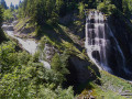
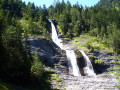
(18) Turn left and follow the GR®5 uphill. Join the D429 again and follow it to the left until you reach the foot of the famous Cascade du Rouget.
(19) Continue uphill along the road. At a hairpin bend to the right, leave the road to cut across the bends. You’ll arrive at the entrance to the hamlet of Les Fardelay.
(20) Leave the road and take a path on the right, leaving the hamlet on your left. Stay on the signposted path and cross the road several times. You will then reach the Lignon car park.
(21) Walk round a restaurant and, at the foot of a sign at the edge of a wood, follow the GR®5 towards the Refuge d’Anterne. Head up the Torrent de Sales valley, pass under a high-voltage power line and come to two waterfalls: the Sauffaz and the Pleureuse on the right.
(22) Turn left onto the GR®5 towards the Collet d’Anterne (let the GR®96 continue straight on). Climb steeply beneath the ridge of the Pointe de Sales, through scrubland. Reach the Collet d’Anterne in open terrain.
(23) Head right (south-south-east then south-east). Cross a stream and climb gently through a wetland area. This will take you to the Refuge d’Anterne Alfred Wills (E).
 Visorando Member
 Easy
Easy 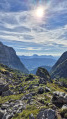
 Very difficult
 Moderate