


 Country:

 City:
City:


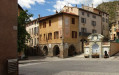
(S) From the ‘Les Marmottes’ stopover lodge in Saint-Dalmas, take the Chemin des Fouans to the left. Immediately, at the signpost at the junction, turn left onto Rue de la Madone. After 100 m, you’ll reach a crossroads.
(1) At the signpost, leave the street on your right and continue straight ahead. At the fork in the road, ignore the Route de l’Avancier on the right and take the path on the left. You’ll reach a Fork in the road 200 m further on.
(2) At the signpost, ignore the path on the right towards the Col de la Madeleine and continue straight ahead along the track. Climb through the woods and join a forest track. Turn left onto it and, immediately after the bend, you’ll reach a junction.
(3) At the signpost, leave the track and take the path on the right. Immediately at the fork, ignore the path on the right and follow the one on the left. Climb the ridge of the Vallon du Lavanchier and reach a T-junction.
(4) At the signpost, continue to the right (south), along the hillside. Ignore a path heading in the opposite direction on the left and, 100 m further on, reach the Col du Varaire
(5) At the signpost, ignore the two paths heading in the opposite direction to the left and climb the ridge to the right (south-west). After 200 m, above a scree cone, leave the ridge and take a path to the right. Climb diagonally through the Bois Noir (north-west) and then (south-west). Follow a few hairpin bends (south) to reach the Col des Deux Caïres.
(6) At the signpost, take the path furthest to the left (east) to climb the ridge of the Caïre Gros. At the junction (alt. 2070 m), just before the summit, head for the path on the right (south), slightly below the ridge. Ignore the path leading down to the left and head for a small pass.
(7) Follow the ridge path and continue almost level (south). Pass beneath the Tête de Clans and reach another small pass. Stay below the ridge. As you approach a third small pass, leave the path and take the path heading in the opposite direction to the right. After a hairpin bend, reach a junction.
(8) At the signpost, continue straight ahead (south). Climb gently up below Mont Chalancha. Go round it (east) and reach the small pass, Le Pertus.
(9) Walk along the undulating slope of Mont La Partissuollo. Pass under a high-voltage power line. Reach the small pass, known as the Baisse de la Combe.
(10) At the signpost, ignore the path leading down to the left and stay on the GR®5 straight ahead (south-east). Pass beneath the Cime de la Combe. Join its ridge and follow it to a fork at the Baisse de Vernanson small pass.
(11) At the signpost, ignore the path on the right, which immediately splits into two. Take the ascending path on the left (south-east) to reach a junction at the Collet des Trous.
(12) At the signpost, ignore the path on the right towards Mont Tournaire and turn left (east). At the Fork in the road, 400 m further on, leave the Col du Fort on your left and turn right to reach the hairpin bend on a forest track.
(13) At the signpost, head down the road to the right and, 200 m further on, leave it to take a shortcut that crosses its hairpin bends several times. rejoin it further down (alt. 1740 m). Ignore a path to the right (alt. 1715 m) and, after two hairpin bends, join the Route des Granges.
(14) At the signpost, follow the road to the right, almost level (westwards) along the upper part of the Riou Figoret valley. Shortly afterwards, at the signpost for Granges de la Brasque, ignore the path leading down to the left. Stay on the road and reach a junction at Plan d’Utelle.
(15) At the signpost, ignore the path leading down to the left. After a wide bend to the left, leave the track heading in the opposite direction to the left towards Le Plan d’Utelle and, following the road (south), head for the Col d’Andrion.
(16) At the signpost, ignore the path to the right and turn left off the Route des Granges (M332). Take the shortcut opposite. Ignore a track to the right and, immediately afterwards, cut across another one (elevation 1593). After 100 m, you’ll come out onto the M332.
(17) Follow it for 150 m and, at the Fork in the road, leave it to take a shortcut to the left. Join the M332 at a hairpin bend. Follow it for 40 m before continuing along the shortcut to the left. Further down, repeat this procedure and reach the junction at the Col des Fournés.
(18) At the signpost, ignore the path and then the track on the right, and the track running in the opposite direction and then the lane on the left. Take the path that runs alongside the lane on your left. On a slight false flat along the hillside, pass beneath the Tête du Planton. Go round the western shoulder of the Cime de Bellegarde and reach the Col de Gratteloup.
(19) At the signpost, ignore the GR®510 path to the right and, opposite, leave the Crête de Cassal. Descend to the left and reach a fork.
(20) At the signpost, leave the GR®510 to the left and stay on the GR®5 to the right. Head up the Vallon des Pras, pass beneath the Petit Brec d’Utelle and reach a small pass.
(21) At the signpost, leave the path on the left which climbs to the Brec d’Utelle and go round it on the right. Descend its ridge (south-west) via numerous hairpin bends. Below the ridge, cross the upper parts of two valleys. Reach a flat section of the Crête de l’Albaréa.
(22) At the signpost, ignore the ridge path opposite (west-north-west) and follow the path heading in the opposite direction to the left (north-east) and then south. On the hillside, below the crest of the steep western slope, cross two small valleys to reach the Col du Castel Ginesté.
(23) At the signpost, switch to the eastern slope of the ridge and then wind your way down the hillside. Pass beneath the Tête du Sac de la Bécasse and the Tête de Parabosquet. Descend steeply to avoid the western ridge of the Tête des Pennes. You will come out onto a path.
(24) At the signpost, follow the path down to the left. At the junction signpost, 50 m further on, ignore a path leading uphill to the left. Continue along the path, which becomes a street, and reach a crossroads at the entrance to Utelle.
(25) At the sign, cross the M32 and follow Rue Massena opposite. Turn left, walk along the north side of the church, then round its apse to the right. The communal lodge is located in the stone building next to it. (E).
 Visorando Member
 Very difficult
 Moderate
 Easy
Easy 
