Country:

 City:
City:


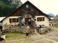
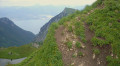
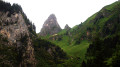
The starting point is the Rue Nationale bus stop in Saint-Gingolph (France). See the ‘Practical Information’ section for details on how to get there by public transport. See the ‘Nearby’ section for the historical background to the existence of two neighbouring municipalities with the same name, one in France and one in Switzerland.
(S) Head east and follow Rue Nationale towards the French-Swiss border.
(1) Just before the bridge over the Morge (the river that forms the border), turn right into Rue de Morge. Pass under the bridge of the old railway line (now disused), leave the church on your right and follow the red and white markings of the GR®5. At the junction with the Route de Novel (D30), continue straight ahead and uphill along Rue des Gaulles. Cross the D30 again with care and continue straight on along Chemin du Crêt.
(2) At the T-junction, turn left into a narrow lane called Chemin des Granges (formerly Route de Novel).
(3) At the sign for “Grand Champ”, carry on straight ahead along the GR®5 (red and white markings) and leave the GRP® Littoral du Léman (red and yellow markings) to your right. Follow the course of the Morge upstream, negotiating a few hairpin bends whilst ignoring a few side trails off to the sides.
(4) Join the D30 and follow it to the left for a good hundred metres. At the entrance to the hamlet of Le Jordy, turn right onto the path overlooking the road.
(5) At the junction by the Novel cemetery, carry on straight ahead. Further on, cross the bridge over a torrent, take a few short bends and arrive in Novel (bar and stopover lodge on the right).
(6) Turn left onto the Chemin des Savignons. You’ll soon rejoin the D30 (Route de l’Église) and follow it to the right (be careful, there are narrow sections through the village). Pass the town hall and, after a hairpin bend to the left, you’ll reach Novel church.
(7) Continue along the D30. On leaving the village, leave the road and take a path on the right (signpost). Further up, rejoin the road and follow it round a hairpin bend to the left.
(8) As you come out of the bend, leave the road and take an ascending path on the right (signpost). Pass an oratory. Then cross a stream, walk past a house and rejoin the D30 at the hamlet of Le Deley.
(9) Follow the road to the right. After about 200 m, leave the road and take a path to the right. Further on, walk alongside the D30 – without joining it – and follow a path opposite. Pass through a group of houses and reach a crossroads.
(10) Follow the GR®5 by taking the second path on the left (leaving the GRP® Balcon du Léman). Cross Rue de La Planche de la Dame and first turn left then right to continue along a path. You’ll reach a car park at the end of the D30 (signposted).
(11) Turn left towards the Col de Bise, enter the forest and cross the Morge. You’ll reach a T-junction on a flat stretch.
(12) Turn right. At the next junction, turn left and continue uphill. At the next junction (elevation 1254), head straight uphill (ignore a path on the right).
(13) At the junction, continue straight on along the GR®5 (ignore the path on the left, which leads into Switzerland). The slope becomes steeper and the path winds its way up in a series of hairpin bends. You will reach a junction directly below the Rochers de Chauffes Floras.
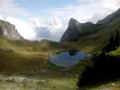
(14) Follow the GR®5 to the left and go round a rocky outcrop on the left. Then head west-south-west into a valley and arrive at the Chalets de Neuteu, above the lake of the same name.
(15) Continue straight on towards the Col de Pavis. You’ll reach another junction well before the pass.
(16) Turn left towards the Col de Bise. Climb whilst heading south-southeast and reach the pass.
(17) Descend steeply down the opposite slope. Further down, you’ll reach a junction (signpost).
(18) Go straight on (south-east) and ignore a path on the right. Cross a small wetland area on roughly level ground. Then descend to reach the Chalets de Bise (water point). Turn left to cross a torrent and immediately reach the Refuge de Bise, the end of this stage (E).

 Visorando Member
 Easy
Easy  Association / Club / Walk leader
 Very difficult
 Moderate