Country:

 City:
City:


(S) From the Camping des Sources, retrace your steps from the previous day. On leaving the campsite, turn right onto the Chemin de Fontanille, and join the Route de Murs, signposted GRP® (elevation 443).
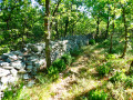
(1) At the signpost, head down the road to the right. At the Fork in the road, keep straight ahead and, at the next Fork in the road, leave the road to take the Chemin de la Gacholle opposite, lined with pretty dry-stone walls. Ignore a hairpin bend to the left and head for a crossroads.
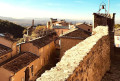
(2) Leave the path that turns right, and ignore the one marked ‘No Entry’ on the left, continuing straight ahead along the Chemin des Barres. Walk past the cemetery. Enter the tourist village of Gordes and reach a crossroads in front of a car park.
(3) Cross the car park straight ahead. Walk past the post office and head down Rue de la Poste on the left to reach Rue Baptistin Picca.
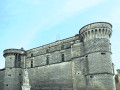
(4) At the sign, turn right onto this street and, after it bends to the right, you’ll reach Place Genty Pantaly, in front of Gordes Castle.
(5) Follow the GR®6/GRP® opposite and you’ll reach a large roundabout. Turn left onto Rue de la Combe (D15), which runs alongside the Chapelle des Pénitents Blanc. Leave Rue des Tanneurs – a dead end – on your left. After the hairpin bend, you’ll come to a junction.
(6) Leave the D15 and take a narrow lane climbing uphill to the right (against the flow of traffic). Further up, continue on the D177 to the right. At the Fork in the road, marked by a ‘No Through Road’ sign, keep left onto the Chemin des Dilais. You’ll reach a junction at its left-hand bend.
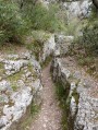
(7) At the sign, turn right onto the track lined with dry-stone walls. Ignore the side paths and, 750 m further on, join a track. Take this to the right, then, at the same time, ignore a path on the right and, at the Fork in the road, keep to the one on the left, leaving the track on the right. Return to the D177.
(8) At the signpost, follow the road to the left. Immediately, at its first bend to the right, ignore the path on the left. At the second bend, leave the road and take a path on the left that runs alongside it, then reach a Fork in the road (elevation 407).
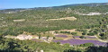
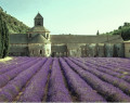
(9) At the signpost, leave the GR®6 and head down the path on the left to reach the private car park at Sénanque Abbey. After visiting this magnificent12th-century Cistercian monastery, with its refined Romanesque style, walk along the lavender fields and take the path (north-east) towards the visitors’ car park. Head back up the road, the D177a, and rejoin the GR®6 and the D177.
(10) Follow it to the left for 100 m before taking the path up to the right. At the top, cross the road and, at the Fork in the road, ignore the path running alongside it to the right. Opposite, follow the GR®6/GRP® path uphill for 50 m until you reach a junction. Ignore the path to the left and, 1.4 km further on, you’ll reach a crossroads (elevation 595).
(11) Turn onto the path on the left. After 30 m, at the Fork in the road, keep to the right. Immediately afterwards, at the next Fork in the road, keep to the left, and at the final Fork in the road, leave the path before it bends left and take the path opposite. Ignore the side paths and, after 1.3 km, you’ll reach a junction at a place called La Basse Pouraque.
(12) Ignore the path on the right, leading towards some buildings, and stay on the path straight ahead. After 60 m, at the junction, turn left. Ignore the side paths and, 500 m further on, cross a footpath. Continue for 100 m before turning left, then right, and joining a track. Take this track to the left and reach the Piste de la Pourraque. Follow it for 50 m to the left, and arrive at a junction.
(13) At the signpost, leave the GR®6 to the left and take the GRP® to the right, via the Piste du Rocher des Trois Luisants. After 350 m, pass a blocked path on the left and, 450 m further on, reach a junction.
(14) At the signpost, ignore the left-hand branch of the GR®91 and continue straight ahead to reach a junction.
(15) At the signpost, leave the GR®91 to the right and stay on the GRP® path to the left. Cross the Piste du Rocher des Trois Luisants (elevation 604), and continue straight ahead for 500 m to reach a fork (elevation 515).
(16) At the signpost, keep to the left. After 400 m, ignore a path on the right and join the Piste du Grand Puymians. Follow it to the left for 200 m until you reach an acute-angled junction.
(17) Opposite, stay on the same track to the left for 100 m. Leave it as it bends to the right and head straight on along the track. Cross another track and, 100 m further on, at the Fork in the road, keep to the GRP® on the left. Ignore the side tracks, then, 1.2 km further on, reach a Fork in the road (alt. 360 m).
(18) Ignore the path opposite, leading towards the houses at Soulian. Take the path on the left and, further down, you’ll reach a junction. Head straight ahead onto Chemin de Saint-Gens and, after 50 m, you’ll reach a Fork in the road.
(19) Keep to the left, following the same path which descends the ridge of a hill. After 500 m, pass a path on the right.
(20) Continue along the road opposite. Cross Chemin des Ferayes, joining the Château car park on the left. Carry on straight ahead and, 200 m further on, you’ll reach a junction in front of a large villa.
(21) At the sign, continue down the slope to the right, along the Montée du Château. Walk past the entrance to the château. Ignore a private road leading in the opposite direction to the right and head for the Cours René Char, in the village of Saumane-de-Vaucluse. Turn left onto it. After the washhouse, turn left, walk past the town hall and go down Rue des Fontaines. Continue straight ahead, ignoring Rue du Petit Barry, which leads in the opposite direction to the right, and reach a junction.
(22) Leave the Chemin du Barry on your right and, opposite, walk 50 m along the Chemin de la Tapy. At the Fork in the road, go down the road on the right and continue along a footpath. Cross the Inrajat stream and, immediately at the junction, head straight ahead uphill. At the left-hand bend, ignore the path branching off to the right and reach a junction.
(23) At the signpost, keep going straight on the GRP®. Cross the Chemin des Pessades (elevation 255). Head down the slope of the Combe de Bériguier, then climb back up on the opposite side, and come out onto the Chemin des Fayardes. Follow this to the left until you reach a junction.
(24) At the signpost, turn left onto the same GRP® path. Stay on this main route, ignoring any side paths. Pass the hamlet of Les Fayardes. At the hairpin bend, leave the Piste des Fayardes to the left and take the Piste de Valescure to the right. You’ll reach a junction at a hairpin bend.
(25) At the signpost, turn right onto the same track which descends into a valley and, immediately, ignore the signposted path on the left. After the last house in the hamlet of La Carredonne, ignore Rue Jean Moulin opposite and turn left to reach a junction.
(26) At the signpost, turn right onto the GR®91/GRP®, via the Chemin des Beaumes Rouges. You’ll reach the Chemin de la Fontaine, which runs alongside the Sorgue de Vellereon.
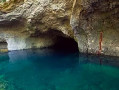
(27) Follow it to the left, then take a path to reach the Fontaine-de-Vaucluse cave, situated at the foot of a high cliff. This resurgence, the largest in France, can reach a flow rate of 90m³/s during floods. It emerges from a chasm over 300 metres deep.
(28) Return to the previous junction.
(27). Continue along the path opposite and head towards a roundabout. Cross the bridge on the left via the Route de Cavaillon (D24) and, immediately afterwards, at the narrowing, take the footpath on the right. After 200 m, opposite the car park, you’ll come to a Fork in the road.
(29) At the sign, leave the D24, which turns right, and, opposite, head up the Chemin du Guérisseur. Join the Route Touristique de Gordes (D100a) and follow it straight ahead. After the ‘end of built-up area’ sign, you’ll find the car park on the left (E).
 Visorando Member
 Easy
Easy 
 Moderate