Country:

 City:
City:


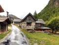
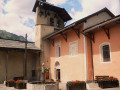
(S) From the Lodge le Teppio, turn left and follow the D 902 (north) towards Brunissard for 40 m. Before the bridge over the Torrent du Rivet, turn right onto Rue d’Amont. Pass the footbridge on your left and follow the GR® 5 to the right. At the end of the street, turn right onto Chemin de la Chapelle. After 50 m, you’ll reach a junction.
(1) At the signpost, take the path leading uphill to the left (south), then continue on level ground. Ignore the side paths and gradually head back down. Cross the Torrent du Pellas, then reach a Fork in the road before the hairpin bend in the road.
(2) At the signpost, head down to the right and reach a car park on the Route des Maisons, D502. At the signpost, follow it to the left, ignoring the Chemin de Roue on the left. At the Fork in the road in the hamlet of Les Maisons, keep to the path on the left. After 200 m, ignore the path heading in the opposite direction to the left and, 150 m further on, reach a junction.
(3) At the signpost, leave the track straight ahead and climb the winding path to the left. Join the track again (elevation 1816) and cross it. Further up, take it to the right and reach a junction.
(4) At the signpost, ignore the track on the left which leads in the opposite direction to the ‘Abri de la Roue’. Continue straight ahead, crossing the spillway of Lac de la Roue. Immediately afterwards, cross a footpath. Ignore the side paths and, straight ahead, continue along a flat stretch until you reach a junction
(5) At the signpost at the junction, ignore the path on the right leading to a viewpoint and, 100 m further on, cross another path. Head straight down (north-east) then (east-south-east) until you reach an X-junction.
(6) At the signpost, cross the track and stay on the path straight ahead (south-southeast). Ignoring the side paths, follow the path as it winds down the steep slope. Pass under a high-voltage power line and, via a series of hairpin bends, emerge onto the D947 road.
(7) Turn left onto it, cross the Torrent de Souliers and enter the remarkable town of Château-Queyras, dominated by its fortified castle. Pass the access ramp to the castle. At the Fork in the road, leave the D947 to the left and continue straight on along Rue Vauban. You’ll reach a junction in front of the town hall.
(8) Ignore the street leading down to the right; continue straight ahead. In front of the church, turn right onto Rue du Pasquet. At the end of the street, turn right onto Route du Guil. After 70 m, you’ll reach a junction on the banks of the Guil.
(9) At the sign, cross the bridge over the river. Immediately at the fork, ignore the road to the right and the path to the left; take the ascending path in the centre. After 50 m, you’ll reach a path (alt. 1360 m). Follow it straight on (south) towards the forest until you reach a junction.
(10) Ignore the tracks to the left. Follow the Bramousse torrent and join a forest road. Take this to the left. Immediately pass a hairpin bend, ignoring the path to the left. At the next bend, you’ll reach a junction.
(11) Leave the road and take the path opposite. Immediately at the Fork in the road, turn right and follow the right bank of the Bramousse torrent at a distance. You’ll rejoin the forest road at a hairpin bend.
(12) Leave this and take the path straight ahead. After 50 m, you’ll come to an X-junction near the Pré Premier chalets. Cross the path and continue along the one opposite into the Bramousse Torrent valley. After 130 m, ignore the path heading left and follow the track to the right (south) for 2 km before reaching the Pré Faure sheepfold on your left.
(13) Continue straight ahead. Pass some paths on the left up the slope. Gradually approach the stream to cross it. Ignore the GRP®-marked path heading in the opposite direction to the right. About 200 m further on, you’ll reach a junction near the Fontaine Rouge.
(14) Leave the Fontaine Rouge forest road to your left. Continue along the path to the right (south). Leave the Torrent de Bramousse valley (south-east) behind. Climb diagonally up its right-hand flank (south), ignoring the side paths. Turn right (north-west) then left (south) and reach the ridge overlooking the Vallon de Riou Vert.
(15) From here, you can see the Col Fromage to the south. Ignore the paths on the right leading to the Chalets de Fontantie. Climb up the hillside above the Ruine Blanche ravine. On a slight incline (south), pass beneath the Pointe de la Selle. Ignore a path heading in the opposite direction to the left. After 400 m, reach a junction
(16) At the signpost, ignore the GR®58 alternative route heading in the opposite direction to the left (elevation 2284). Head (south-south-west) towards the Col Fromage.
(17) At the pass signpost, ignore the two paths on the right and the two on the left. In the centre, head down (south) along the hairpin bends of the steep slope to reach the Ravin de Rasis. Descend its slope diagonally (south-south-west) and reach the hamlet of Le Villard (alt. 1840 m) in the Cristillan valley.
(18) At the signpost, take the road opposite and immediately ignore the paths on the left. You’ll reach a junction 100 m further on.
(19) At the signpost, ignore the path on the right. Opposite, at the Sainte-Barbe Chapel (alt. 1,830 m), leave the path on the left. Head down the road (south-west), pass a path heading in the opposite direction and reach a junction.
(20) Leave the road and ignore the path leading uphill to the right. Take the path on the left to join the Route du Cristillan D206.
(21) At the signpost, head right. At the T-junction, ignore the path leading in the opposite direction to the left and, opposite, the Route du Bois Noir on the right. Keep left on the same road. Enter the village of Ceillac. At the corner by the Town Hall, turn left onto the Route de Sainte-Anne and arrive at the Place du Marché.
(22) Keep to the right (south-west). At the end of the square, turn left and cross the footbridge over the Cristillan. Immediately afterwards, turn right onto the street, Chemin de Laurette, which runs alongside the stream. Pass the primary school. At the end of the street, turn left onto the D60, and after 30 m you’ll reach a wooden bridge.
(23) At the sign, turn right, cross the Torrent du Mélezet and follow the riverside track. After 50 m, turn onto the path on the left. Join a track and follow it to the left (south-east). Return to the track and follow it straight on along the stream until you reach a Fork in the road just before the Les Mélèzes campsite.
(24) Ignore the path straight ahead leading to the campsite and head up the path on the right (south) through the scree. Go round the top of the campsite. Descend (south-south-east) until you reach a Fork in the road.
(25) Leave the GR®5, which climbs the track to the right, and – now off the GR®5 – head down to the left. Cross the stream; at the car park, turn right onto the road running alongside the stream. Pass under a chairlift and cross the stream again. Head up the left bank. At the top, at the junction with a road (elevation 1809), cross the stream one last time and head left to reach the Refuge de la Cime du Mélezet. (E)
 Visorando Member
 Very difficult
 Moderate