Country:

 City:




(S) From the Lodge des Granges in Fouillouse, continue along the ascending road (east) until you reach a junction.
(1) At the sign for the Chapelle Saint-Jean-Baptiste, ignore the path on the right and, opposite, pass the hamlet known as Le Serret. You’ll reach a junction.
(2) At the signpost, ignore the path on the left. Continue straight on along the path, following the Riou de Fouillouse, ignoring any side paths. Move away from the stream as you climb the slope of the valley. You’ll reach a fork at Fort de Plate Lombarde.
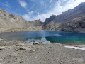
(3) At the signpost, ignore the GRP® path to the left and follow the GR®5 to the right. Approach the Riou du Vallon and cross it via a footbridge. Ascend into the Plate Lombarde valley. Follow the switchbacks up a rocky outcrop to reach the plateau of Lac de Plate Lombarde.
(4) At the junction, ignore the path on the right towards the lake and, opposite, climb the final slope leading to the Col du Vallonnet.
(5) At the signpost, ignore the GRP® path on the left towards the Col de Stroppia, and turn right onto the GR®5 (South), which is almost level. Head into a gully and go round a marshy hollow. Descend to a Fork in the road upstream of the dried-up Lac du Vallonnet Inférieur.
(6) At the signpost, ignore the path to the left (south-east) and, opposite, take the GR® 5 (south), pass the lake and reach a fork.
(7) At the signpost, ignore the GRP® path to the right (west), towards the Abri du Vallonnet. Keep to the left (south-southeast), cross the Riou du Pinet, and emerge onto the Viraysse military road.
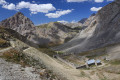
(8) At the signpost, head up the road to the left and make your way to the Viraysse Barracks, where you’ll come to a junction.
(9) At the signposts, ignore the path on the left and, taking the one on the right, go round the ruins of the barracks to reach the nearby Col de Mallemort.
(10) At the signpost, ignore the path on the left and keep to the right (west). Immediately afterwards, ignore the track on the right and descend the hairpin bends to the left (south). Further down, cross two paths running horizontally across the slope and, 30 metres on, reach a junction.
(11) At the junction sign, ignore the path to the right. Continue the descent straight ahead. Ignore the path to the left (alt. 2,030 m). Cut across a track (elevation 1,990) and arrive at a junction in front of the ruins of a blockhouse at Prés Bas.
(12) At the signpost, ignore the path to the right and turn left (north-east). After 60 m, at the next signpost, head down to the right (south). Shortly afterwards, at the junction, turn left (east). Descend via numerous hairpin bends into the Riou de Rouchouse valley. Follow its right bank (south–south-west). Enter the village of Larche and, continuing straight on, join the D900 road.
(13) At the signpost, turn left onto the D900 and cross the bridge over the Riou de Rouchouse. Ignore the two roads on the right and, at the Fork in the road, leave the D900 to take the road on the right towards the Lauzanier valley. At the junction, in front of the campsite, stay on the road opposite. You’ll immediately come to a crossroads.
(14) Ignore the path on the right and carry on straight ahead. At the Fork in the road, keep left and continue to the junction at the corner of the old Maison Méane cemetery.
(15) At the sign, go down the path on the right and cross the footbridge over the Ubayette. Immediately afterwards, take the road on the left, the Chemin du Lauzanier. Follow the left bank of the river and, 3.5 km further on, you’ll reach a car park, then, shortly afterwards, the Pont Rouge.
(16) Ignore the bridge and continue straight ahead along a path (south) into the narrowing valley. After 4.7 km, you’ll reach Lac du Lauzanier and its chapel.
(17) Walk along the lake on your left. Head up the right-hand slope of the valley. Climb the ridge of Lac de Derrière la Croix and reach a fork in the road at the start of the lake.
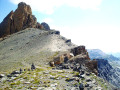
(18) Follow the lakeshore on your right-hand side and head uphill (east). Climb the steep slope towards the Rocher des Trois Évêques (south-east). Pass the scree at the foot of its rock face to reach (south) the Pas de la Cavale.
(19) From the pass, descend via switchbacks down the steep slope of the valley feeding the small Lacs d’Agnel (south-east). At around (alt. 2,440 m), turn off (south) from the bottom of the lakes’ basin to cross (east) the valley ridge. Switch to the Gipière valley and descend it (south) to a junction on a flat area.
(20) At the signpost, ignore the paths to the right and straight ahead. Follow the GR®5 to the right, crossing the scree slope at the bottom of the valley (south-west). Pass the Cabane du Salso Moreno and the ruins of alpine chalets. Cross the Ravin de la Tour. Climb (south-west) to the Col des Fourches.
(21) At the signpost, ignore the side paths along the ridge and continue along the GR®5 straight ahead (west). Further down, at the Fork in the road, leave the path on the left (which joins a hairpin bend on the Route de la Bonnette) and, turning right (west), head for a junction by the roadside.
(22) At the signpost, ignore the path to the right and, straight ahead, head for the Camp des Fourches car park, beside the M64. Turn left (south) to walk through the centre of the camp. Head down through the meadows along the slope of the Tinée valley and cross the road.
(23) Continue straight ahead to cut across a bend in the M64. Further down, walk alongside the road. Ignore two paths on the left and rejoin the M64. Turn left onto the road and follow it for 150 m before leaving it to take a path on the right. In the hamlet of Bousièyas, turn right and head for the municipal stopover lodge (E).
 Visorando Member
 Difficult
 Moderate
 Easy