Country:

 City:
City:


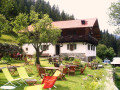
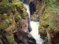
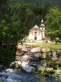
Start from the Michel Fago lodge.
(S) Walk up the steps to the church.
(1) Turn right onto Rue de l’Église. Walk past the town hall and, a little further on, cross the Nant Noir. Continue straight on along the D213 (Rue de l’Essert). Pass through the hamlet of Les Esserts, cross a stream and you’ll come to a fork in the road.
(2) Leave the Route des Traberts on your right and stay on the D213 opposite. Pass throughthe hamlet of Les Trabets and go through a tunnel under a ski run. After a narrowing of the road and just before the Le Fouilly bus stop, you’ll reach a junction.
(3) At the sign, leave the D213 and turn left towards the Les Grands Balcons residential complex. Immediately climb a flight of steps on the left. At the top, continue westwards along a path. When the path turns right, carry on straight ahead along a track and reach a junction.
(4) At the sign, follow the Route des Aillouds to the left. Pass under a high-voltage power line at the entrance to the hamlet of Les Aillouds and head towards a junction.
(5) At the signpost, followthe road to the right. Then take a hairpin bend to the left.
(6) At the signpost, cut across the hairpin bend by taking a path on the right. Return to the road, cross it and follow the path opposite.
(7) Join the road again and follow it to the left. In the hamlet of La Maison Neuve, ignore a dead-end road on the right and head for a junction at the end of the road.
(8) At the signpost, turnright onto the Chemin de la Carbotte and go round the lower station of a chairlift on the right. At a fork (elevation 1233), take the path on the right which leads into a wood. Climb through a series of bends and cross the chairlift line several times. Reach the upper station of the chairlift.
(9) Continue straight on, ignoring the paths branching off to the right. Pass another chairlift line on your right and continue the climb to the left. Cross a stream and reach a Fork in the road.
(10) Take the path leading uphill to the right. As you emerge from the woods, pass under a chairlift line and arrive at a junction. Follow a path to the left to the nearby Col de Voza.
(11) Turn right and cross the Mont Blanc Tramway railway line. At the junction on the other side, head down the Route de Bionnassay opposite. Ignore a path branching off to the left and pass the Refuge du Fioux. Shortly after a car park, you’ll reach a junction.
(12) At the signpost, continue straight on (south) and pass under a high-voltage power line. At the signpost at the next junction, continue straight on again until you reach a T-junction.
(13) At the “Chalère” sign, turn right. In the centre of the hamlet of Bionnassay, ignore the turn-off to the left leading to a car park. Immediately after, at the sign, keep left onto the Chemin des Tétras.
(14) Leave the Chemin des Buses on your right, turn left and walk past the Bionnassay chapel. Head down through the woods. Cross a footbridge over a torrent and head back up the other side, ignoring a path on the right.
(15) At a T-junction, head down to the right along the Chemin de l’Ormey. Stay on the main signposted path and ignore all side paths. Continue to a junction at the entrance to the hamlet of Le Champel.
(16) At the signpost, turn right and leave the GRP® to your left. Walk past the chapel and you’ll soon reach a junction.
(17) At the signpost, turn left onto a small road. When this bends to the right, carry on straight ahead along the Chemin des Chevreuils. Head downhill toreach a junction in the hamlet of La Villette.
(18) At the signpost, turn left. After 50 m, at the Fork in theroad marked by a fountain, turn left. Carry on straight ahead (south-south-east) and ignore the side paths. Pass the ‘Le Quart’ junction sign, cross a stream and reach a crossroads at La Gruvaz.
(19) Head up the Chemin de la Belette on the left.
(20) At the top, follow the Route de la Gruvaz to the left. At the junction sign shortly afterwards, keep to the right. You’ll reach a car park.
(21) Cross a torrent and, as you come off the bridge, turn right. After about fifty metres, you’ll reach a Fork in the road. Leave the road and head down a path on the right. Follow the torrent and then take the winding path up to the hamlet of Tresse d’en Haut.
(22) Head down the Tresse road to the left to join the D902.
(23) Cross the D902 with care. After about 100 metres, at a fork, turn right and cross the Bon Stream. At the roundabout, turn right. In the bend, ignore a path on the right, enter the hamlet of Le Quy, ignore a path on the right and reach a Fork in the road.
(24) Continue to the right along a path. Further on, after a building, take a footbridge over the Nant des Meuniers. Join a road in the hamlet of Les Hoche and follow it straight ahead (south-south-east) until you reach a T-junction.
(25) Follow the road to the left. You’ll come out onto the Route du Plan du Moulin at a hairpin bend and head down it to the left. Cross the bridge over the Bon Stream.
(26) At the signpost, turn right and walk alongside the river on your right-hand side. Much further on, ignore a footbridge and, at the Fork in the road that appears immediately afterwards, continue along the path on the right. Stay alongside the river andhead towards a junction.
(27) At the signpost, leave the bridge on your right and carry on straight ahead. After about fifty metres, turn right and cross the Bon Stream. Turn left and follow the river on your left. At the next bridge, carry on straight ahead.
(28) At the sign by the next bridge, cross the Bon Stream again. On the other side, turn right and follow the stream on your right-hand side. Ignore a footbridge on the right and continue along the Bon Stream.
(29) At the next bridge, follow the D902 to the left. You’ll immediately come to a junction. At the signpost, leave the road and take a straight track on the right. Ignoring any side paths,pass some tennis courts on the right and then a football pitch on the left. Immediately after a wayside shrine, you’ll reach a Fork in the road.
(30) Turn right and cross a stream. Head south-west, ignoring any side paths. You’ll come to a road; pass the turn-off to the bridge on the right and keep to the left.
(31) At the junction, ignore the access to the Notre-Dame de la Gorge chapel via the footbridge on the right. Continue straight on along the Chemin Romain. Further on, you’ll see a natural bridge on the right, then, shortly afterwards on the left, the Pont Romain de la Téna. After about a hundred metres, you’ll reach a junction.
(32) At the signpost, carry on straight ahead (south). Ignore a path on the right, then a track on the left. You’ll reach a junction where the Refuge de Nant Borrant is located.
(33) At the signpost, ignore the path on the right (west), continue south and cross the Nant Bornant stream bridge. Walk south-southeast until you reach a fork in the path (signpost).
(34) At the signpost, carry on straight ahead, due south. After about fifty metres, ignore a path branching off to the right and continue south, then south-south-west. This will take you to the Refuge de la Balme (E).
 Association / Club / Walk leader
 Visorando Member
 Very difficult
 Easy
Easy