Country:

 City:
City:


Park in the Avenue Charles de Gaulle car park in Saint-Laurent-du-Pont.
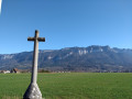
(S/E) Follow Avenue Charles de Gaulle towards the town centre. At the traffic lights, turn right onto Avenue Jean Jaurès until you reach Place Aristide Briand, recognisable by its fountain. Turn left into a pedestrian alleyway, from which you can see the chapel atop a hill.
(1) At the sign for Saint-Laurent-du-Pont, follow the signs for Route de Fontmartin. Opposite, climb the steps and then the winding path leading to the chapel. Pass the chapel on your left and, shortly afterwards, take a path on the right which crosses a flat meadow. This leads onto a road.
(2) At the sign for Route de Fontmartin, head towards Le Mollard by keeping to the left onto the forest track. Pass two hairpin bends and, 150 m further on, you’ll reach a Fork in the road.
(3) At the sign for Le Mollard, hidden behind some scrub, head opposite and leave the road towards La Grande Sure. Turn onto the path on the left towards Côte Vieille, where, after 10 m, you’ll see the sign on the right. Climb a steep, stony slope. You’ll reach a junction (alt. 760 m).
(4) At the ‘Côte Vieille’ sign (whose altitude of 700 m is incorrect), continue to the right towards Folatier. You will reach a fork in the path (elevation 852).
(5) At the ‘Folatier’ signpost, ignore the sign for ‘Sous le Rocher du Pin’ on the right. Continue along the path to the left towards Le Rocher du Pin. Climb up a steep slope via a series of seemingly endless hairpin bends. After a virtually level section, resume the climb until you reach a junction (alt. 1090 m).
(6) At the ‘Le Rocher du Pin’ signpost, take the path straight ahead towards La Terrasse and Le Cul de Lampe. It climbs gradually and, after a wide left-hand bend (alt. 1,300 m), leave the path straight ahead and turn onto the steeply sloping path on the right. After 150 m, you’ll reach a junction with a path heading in the opposite direction to the left (alt. 1,340 m)
(7) At the ‘La Terrasse’ sign, head straight ahead and follow the sign for ‘Cul de Lampe’ along a gently ascending path. You will reach a cirque filled with a vast scree slope, which the path runs along at the top. Cross a steep section through the rocks and reach a junction (alt. 1,400 m).
(8) At the ‘Le Cul de Lampe’ sign, do not take the closed path heading in the opposite direction to the right. Stay on the path opposite, heading towards the Col de la Sure, and arrive at a junction of two marked paths as you emerge from the forest, offering a sweeping panoramic view (alt. 1,490 m).
(9) This junction is not signposted. On the left, ignore the path leading to the Col des Charmilles. Continue straight ahead towards the Col de la Sure, which is clearly visible at the top of the valley (elevation 1,675 m).
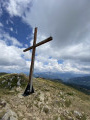
(10) At the signpost, head right towards La Grande Sure. Climb a stony path and over a few rocky slabs. Descend to a small pass before resuming the climb to the summit (alt. 1,920 m).
(11) Turn back and, following the route you took on the way up in reverse, return to the car park on Avenue Charles de Gaulle (S/E).
 Tourist office
 Moderate
 Visorando Member
 Easy
Easy