Country:

 City:


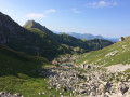
(S) From the Refuge de Bise, head north-east along the GR®5 (red and white markings) towards Chevenne and La Chapelle-d’Abondance. At the corner of the last building, turn right and begin the ascent. The slope is steep and the path winds its way up in several hairpin bends. This leads to the Pas de la Bosse.
(1) Head back down (south) towards La Chapelle-d’Abondance, passing the ruins of the Chalet de la Bosse. At a junction (elevation 1689), ignore the path on the left and continue along the GR®. Pass the Chalets de la Cheneau (actually a single building with a basic shelter open to the public) and you’ll soon reach a Fork in the road.
(2) Keep to the right and ignore the path on the left. Walk alongside a woodland and then through it. On emerging, first turn left then right, then cross a stream to reach a junction immediately. Turn right into a woodland and walk alongside the stream on your right. This will take you to the car park at the Chalets de Chevenne.
(3) Follow the access road to the car park on the left and head downhill with the stream on your right. Cross the stream and you’ll reach a junction.
(4) Carry on straight ahead (do not take the bridge on the left or the road on the right). Continue downhill, ignoring three successive turn-offs on the right. At a Fork in the road at the entrance to the village, go straight on along the Route de Chevenne (ignore the Route des Moulins on the right). You’ll reach a junction at the corner of the town hall (on the right) and a chapel (on the left).
(5) Turn left onto Route des Frasses (D22) , taking care (the road is busy). You’ll come to a junction with a path just before the bridge over the Ruisseau des Thoules.
(6) Take the path on the right and follow the stream on your left.
(7) At the T-junction, turn left to cross the stream. Ignore the bridge that appears immediately on the right and follow the Dranse on your right. Walk for a long stretch along the riverbank. Cross a stream running perpendicular to the river and you’ll immediately reach a junction.
(8) Turn right onto the Chemin de la Guillermine and cross the Dranse. Pass the hamlet of Le Moulin and climb, winding your way up, to the foot of a waterfall.
(9) Continue climbing along the path.
(10) At the next junction, first turn right then left onto a wide path. After about 250 metres, you’ll reach a junction.
(11) Leave the wide path and turn right onto a track that climbs through woodland. Continue climbing steadily, ignoring a few turn-offs to the left. You’ll reach a crossroads in a clearing where the Chalet des Crottes is situated.
(12) Take the first path on the right: leave the main GR®5 route and follow its diversion towards the Refuge de Trébentaz. Pass under a high-voltage power line twice and go round a promontory on the right (the north-eastern ridge of the Pointe des Mattes). Pass under the high-voltage power line again and reach a junction.
(13) Turn left and climb the winding path. Enter a cirque and follow a wide, ascending circular loop towards the west. Cross a torrent and pass in front of the Chalet de Trébentaz. Follow the winding path (west then north) to reach the Refuge de Trébentaz, overlooked by the Mont de Grange (E).

 Visorando Member
 Moderate

 Very difficult