Country:

 City:


By car, via the D1086 (formerly the RN 86 running along the right bank of the Rhône), head towards Chavanay Centre. On the Grande Rue, pass the Town Hall on your right and turn into the first street on the left, Rue du Chirat, then immediately left to park in the Parking de la Tour car park.
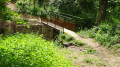
(S/E) With your back to the stairs at the Parking de la Tour, head right towards the footbridge over the Valencize. Follow the GR®65 and the Claude Berthier Trail No. 4. Whilst the bridge is under reconstruction, head south to cross the temporary footbridge over the Valencize stream. At the junction, turn onto the path on the right, then at the sign (elevation 157), take the street on the left towards the Chapelle du Calvaire. You’ll soon reach a crossroads.
(1) At the signpost, leave the return route on your left and follow the same direction sign along Rue de la Chorerie to the right. At the top, at the junction, take Route de la Ribaudy to the right until you reach a path leading in the opposite direction to the left, marked by a sign for La Chapelle du Calvaire.
(2) Leave the road and climb this steep, stony path. After a hairpin bend to the right, along a slight incline, you’ll come to a flight of steps. Climb these to reach the beautifully restored Chapelle du Calvaire.
(3) Continue up the GR®65 to the left. Walk through vineyards until you reach a junction. Ignore the path branching off to the left and, opposite, you’ll soon come to the Route de la Ribaudy. Take this to the left to reach an X-shaped junction (bus stop on the right-hand side).
(4) At the ‘La Ribaudy’ road sign, ignore the one-way road to the left, leave the GR®65 which heads off to the left, and take the road opposite, which climbs gently towards Vintabrin. After 400 m, ignore the road on the right leading to Vintabrin and, continuing straight on, reach the start of a path that veers to the left.
(5) At the ‘La Croix des Quatre Chemins’ sign, follow the route to La Chaize Haute via the Claude Berthier Trail No. 4. Cross the Route de Pélussin and, shortly afterwards, you’ll reach a junction.
(6) At the signpost, keep heading towards the same destination, La Chaize, straight ahead. After 300 m, at the signpost, keep to the left and, immediately, cross a stream. About 300 m further on, at the next signpost, turn right to join the Chemin de la Souche.
(7) At the sign for La Truarie, continue to the right towards La Chaize. Pass two further signposts whilst keeping to the left and continuing in the same direction. Carry on along the Chemin des Lagunes and cross the D19. Opposite, take the Montée des Sources. Ignore a road on the right and, on leaving the hamlet, a few metres after the ‘La Chaize Haute’ signpost, you’ll reach the junction with a footpath on the right.
(8) Carry on straight ahead towards Roisey, pass the pumping station and then, at the sign for La Chaize Haute (Alt. 475 m), ignore the sign for La Boucharie opposite and turn left. About 20 metres further on, you’ll come to a junction.
(9) At the next sign, ‘La Chaize Haute Alt. 475 m’, head left towards Beautin, still following path no. 4 along the edge of the woods. On the left-hand side, pass the first house and, at the second house with the white-slatted gate, look out for a path that veers right into the woods.
(10) Follow this for about 300 m before joining the Chemin de Beautin. Follow it straight on to reach a junction in the hamlet of Beautin. Turn onto the only road on the right, then continue along a track until you reach a crossroads.
(11) Go straight on until you reach a sign behind a ‘no parking on Thursdays’ sign. Follow the track uphill towards La Rivory and Pataud. You’ll come out onto the Route de la Rivory at the entrance to the hamlet of the same name.
(12) Turn right onto it. After a hairpin bend that winds round the hamlet, ignore the side streets leading off it. Leave the hamlet, continuing uphill. At the exit of a wide left-hand bend, you’ll see a red gate on the left leading to the ‘Deux Ânes’ lodge and, on the right, the start of a footpath.
(13) Follow the path through the Bois de Blachemard until you reach the Route de la Chanterelle (IGN elevation 653). Opposite, 200 metres further on, you’ll come to a junction immediately after the Plan du Bief farm.
(14) Leave the road and take the path on the right. Walk past the farm and turn left at the edge of the woods. You’ll rejoin the Route de la Chanterelle.
(15) Opposite, ignore the overgrown signposted path and follow the road to the right. At the junction marked with a cross, turn left. Ignore the lane running alongside the Pataud farm and, about a hundred metres further on, you’ll reach a junction.
(16) Leave the road and climb the path on the right into the woods. Cross the Route de la Chanterelle diagonally. After a few dozen metres, do not go down the road opposite but take the steep hairpin bend to the left. You will come out onto the Route de Sagnemorte.
(17) Follow it uphill to the right. Before a right-hand bend, pass an imposing house and, shortly afterwards, reach a junction (elevation 894).
(18) At the ‘Les Cévennes’ sign, head towards the Col de l’Œillon via the forest track ascending to the left. Ignore the side paths and continue to a junction (elevation 1005)
(19) At the signpost, leave the track and turn right onto the steep, stony path towards the Col de l’Œillon. At the top, join a forest track (elevation 1045)
(20) At the sign for Alt. 1050, take the track to the left towards the Col du Gratteau. After about 150 m, you’ll reach a Fork in the road.
(21) At the signpost, join the Sentier Flore No. 9. Leave it to your left towards the Croix du Trève and follow it straight ahead towards the Col du Gratteau. Stay on the track, ignoring the side paths, and, after a sharp bend to the right, reach the Col du Gratteau (elevation 1,204).
(22) At the signpost, turn right towards the Col de L’Œillon (car park on the right-hand side) and join the D63 road. Follow it uphill and, before the hairpin bend, leave it to take a signposted path on the right. Return to and cross the D63, then take a small path that cuts across the bend to reach the junction at the Col de L’Œillon.
(23) At the signpost, take the path on your left that runs alongside the road and climb up to the Crêt de L’Œillon. Climb up a slope and cross the road just after its hairpin bend. Continue along the path opposite through the woods and arrive at the car park at the end of the road (elevation 1319).
(24) At the signpost, ignore the road on the left towards the Crêt de la Botte and head towards the Crêt de la Perdrix by taking the wide, stony track leading uphill (west). Go round the Crêt de la Botte on the right and reach the Col d’Étançon (elevation 1,365)
(25) At the signpost, opposite, stay on the same track and continue in the same direction until you reach a crossroads.
(26) At the signpost, ignore the track straight ahead and the GR®7 to the right towards the shepherd's hut. Turn onto the GR®7 to the left and, shortly afterwards, reach a junction (altitude 1,400 m).
(27) At the signpost, leave the GR®7 straight ahead and turn right towards the Crêt de la Perdrix. At the summit, there is a beautiful 360° view with a compass rose.
(28) Retrace your steps to the point (27). At the signpost, cross the GR®7 and, opposite, follow the signs for Chalet Bourguisan. You’ll arrive opposite the chalet.
(29) At the signpost, leave the chalet on your right and continue straight ahead towards the Col d’Étançon on the Sentier Flore No. 9. About 400 m further on, you’ll come to a junction. At the signpost, carry on straight ahead for about fifty metres and, at the Fork in the road, leave the marked path to the left and take the unmarked shortcut to the right. After 250 m, rejoin path no. 9.
Alternatively, instead of taking the poorly marked shortcut, continue along the signposted path (Pilat Path) and, at the Col d’Étançon (25), turn right onto the Sentier Flore No. 9 towards Chaumienne.
(30) Descend a stony, narrow path. At the signpost at the La Combe junction (elevation 1194), keep to Trail No. 9 towards Chaumienne. Cross the D63 and, via the Route de Saint-Sabin, pass through the hamlet before reaching a junction at a bend (elevation 1136).
(31) At the signpost, do not take Path No. 9 straight ahead but stay on the unmarked road to the right. This heads south and skirts the Crêt de Peillouté to the east. Ignore any side paths and, at the end of the road, you’ll reach the Auberge de Vert Ânes in Saint-Sabin at the car park entrance on your right.
(32) Pass to the left between the buildings; at the signpost, turn onto the path on the right alongside the inn’s wall and continue along the Chemin de la Ligue. Just before the long farmhouse at La Ligue, take the path going in the opposite direction to the right, then turn left. Walk past the little house at Michodon. Then keep to the right and, after a sharp right-hand bend, you’ll come out onto the wide Chemin de la Croix de la Selle.
(33) Follow it to the left for 150 m. At the junction (elevation 787), leave the signposted path to the left and head down the one opposite. After the stony, slippery descent, turn left, then right to go round the large building at La Camière. Continue along the road until you reach the Cabusson road in the hamlet of La Tronchiat.
(34) Head down this road to the right. Further down at La Serve, in front of a house backing onto a tower, keep to the right to reach the D34 at the entrance to Véranne.
(35) Follow it to the left. At the Fork in the road, with a statue of the Madonna in the centre, keep to the left. At the town hall square, turn right towards Maclas, then immediately left onto Rue du Grand Chemin to reach a crossroads marked by a wooden cross.
(36) Turn right and, immediately at the end of the low stone wall, head down the dirt track to the left. At the end, you’ll reach a road (Chemin des Combes); follow it to the right and join the Route du Buisson, signposted GR®65.
(37) At the signpost, turn left, pass the first street on the right and reach a crossroads. At the signpost, stay on the GR®65, keeping slightly to the left. After the shed, at the Fork in the road, keep to the right and join a road. Follow it to the right and cross the D19.
(38) At the signpost, carry on straight ahead until you reach a bend in Rue des Lavandières. Turn left onto this street and, at the entrance to the hamlet of Goëly, turn right onto Rue de la Croix, then right again onto Route de Göely. Ignore Route des Mésanges on the left and the next road on the right. After 100 m, you’ll reach a junction.
(39) Turn onto the dirt track on the right to join the Route de Roisey at the entrance to Bessey.
(40) At the sign, take the Route de Roissey to the right, then at the large junction, turn left onto the Route de Gencenas and immediately right onto Rue de l’Alambic, which is signposted. After about 400 m, under a power line, turn left and cross the Creux de Rolland. You’ll reach a crossroads in the middle of the fields (elevation 353).
(41) At the signpost, continue straight ahead. At the next junction, follow the GR®65 straight on, then cross the D79. At the signpost, head straight on to a crossroads.
(42) At the signpost, leave the GR®65, which turns left. Continue straight ahead to join the Route de la Petite Gorge and, immediately at the Fork in the road, leave it to take a signposted road on the right (Banc/Yellow). This continues as a dirt track to join the small road to Cuminaille in front of a small farmhouse.
(43) Take this road to the left, ignoring the signposted path heading in the opposite direction to the right. Return to the Route de la Petite Gorge (elevation 221) and follow it down to the right. At the bottom, on the right-hand side, ignore the turn-off to the Vessettes housing estate and then to the Rue du Château de la Gorge. Continue to a junction some 20 metres further on.
(44) Turn left onto Rue de la Petite Gorge. Cross the bridge over the Mornieux and you’ll come out onto the D1086. Walk along the pavement on the opposite side of the road and, about fifty metres further on, at the Fork in the road, take Rue du Chirat up to the left. Ignore two streets on the left. At the bottom, turn left to return to the junction you passed on the way there.
(1) Follow the reverse route of the outward journey to return to the Tour car park (S/E).
 Visorando Member
 Difficult

 Moderate
 Easy