


Refine your search for walks in Vitry-en-Artois
Vitry-en-Artois walks


 Between Vitry and Brebières
 Visorando Member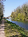
 4.01 mi
 +26 ft
 -26 ft
 1h 50
1h 50
 Easy
Easy
 Departure from Vitry-en-Artois (Pas-de-Calais)
A short, picturesque round trip along the towpath.
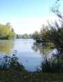
Marsh trail around Biache - Saint-Vaast
 6.28 mi
+26 ft
-26 ft
2h 55
Easy
Departure from Biache-Saint-Vaast (Pas-de-Calais)
6.28 mi
+26 ft
-26 ft
2h 55
Easy
Departure from Biache-Saint-Vaast (Pas-de-Calais)
Hiking through the marshes of Biache - Saint-Vaast, Plouvain Roeux and Pelves.
From Lac Bleu to the Plouvain Marsh
3.42 mi
+59 ft
-59 ft
1h 35
Easy
Departure from Rœux (Pas-de-Calais)
A peaceful, shaded walk around Lac Bleu, along the River Scarpe and through the Plouvain Marshes. Easily accessible and suitable for all seasons.
Lacs et marais depuis Roeux
 Association / Club / Walk leader
 8.18 mi
+66 ft
-66 ft
3h 50
8.18 mi
+66 ft
-66 ft
3h 50
 Moderate
Departure from Rœux (Pas-de-Calais)
Moderate
Departure from Rœux (Pas-de-Calais)
Boucle par Roeux et Biache-Saint-Vaast, entre lacs et marais.
Around the Saudemont marsh
 4.27 mi
+7 ft
-7 ft
2h 00
Easy
Departure from Lécluse (Nord)
4.27 mi
+7 ft
-7 ft
2h 00
Easy
Departure from Lécluse (Nord)
A leisurely walk of less than two hours on flat terrain in a natural, sparsely built-up environment.
It partly follows the route of another walk I really like, but in the opposite direction, which offers a different perspective: Hamel and its marshes, a little piece of Canada
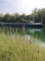
Goeulzin via Petite Sensée river
 3.52 mi
+20 ft
-23 ft
1h 40
Easy
Departure from Gœulzin (Nord)
3.52 mi
+20 ft
-23 ft
1h 40
Easy
Departure from Gœulzin (Nord)
This family trail follows the trails of the Petite Sensée, a small river at the gateway to the Douais urban area, winding through the village of Goeulzin.Easy to navigate, it can be enjoyed all year round, but in wet weather you'll need to wear waterproof footwear.
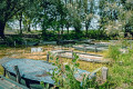
From Hamel to Arleux along the marshes
 2.84 mi
+13 ft
-13 ft
1h 20
Easy
Departure from Hamel (Nord)
2.84 mi
+13 ft
-13 ft
1h 20
Easy
Departure from Hamel (Nord)
A lovely little walk along the beautiful Hamel and Arleux ponds.
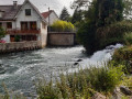
Fampoux from top to bottom
 5.39 mi
+135 ft
-135 ft
2h 35
Easy
Departure from Fampoux (Pas-de-Calais)
5.39 mi
+135 ft
-135 ft
2h 35
Easy
Departure from Fampoux (Pas-de-Calais)
A short walk around Fampoux, best done when the sun isn’t too strong!
Hamel and its marshes, a little Canada
 6.81 mi
+13 ft
-13 ft
3h 10
Moderate
Departure from Hamel (Nord)
6.81 mi
+13 ft
-13 ft
3h 10
Moderate
Departure from Hamel (Nord)
From Hamel, you can explore the marshes of the region - it's like a little Canada! You'll also discover man-made works such as the Église de l'Écluse, an unusual barge, the Canal du Nord with the Palluel lock and nature trails.
Around the Scarpe in Douai
 6.67 mi
+20 ft
-20 ft
3h 05
Moderate
Departure from Douai (Nord)
6.67 mi
+20 ft
-20 ft
3h 05
Moderate
Departure from Douai (Nord)
This walking route follows the Scarpe bypass and the River Scarpe. It ends with a tour of some of Douai’s historic monuments:
- The Douai Belfry (10): a UNESCO World Heritage Site, offering magnificent views if you’re up for climbing its steps.
- Saint-Pierre Collegiate Church (11): an impressive church with remarkable Gothic architecture.
- The Palace of Justice (former Parliament of Flanders) (12): a historic monument steeped in history.
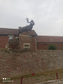
Caribou from Monchy-le-Preux
 6.37 mi
+108 ft
-105 ft
3h 00
Moderate
Departure from Monchy-le-Preux (Pas-de-Calais)
6.37 mi
+108 ft
-105 ft
3h 00
Moderate
Departure from Monchy-le-Preux (Pas-de-Calais)
This walk will take you through the plains and woods of the Arrageois region, which marked the limit of the German advance during the First World War. The marker can be seen on the RD 939. From Monchy, the Germans bombarded Arras, destroying the belfry.
The twenty-foot ditch from Bailleul-Sir-Berthoult
8.04 mi
+148 ft
-151 ft
3h 50
Moderate
Departure from Bailleul-Sir-Berthoult (Pas-de-Calais)
This flat hike will take you from Bailleul-sir-Berthout to the villages of Gavrelle and Oppy, along good paths.
Bailleul was completely destroyed during the First World War.
In 1833, Minister Guizot passed a law requiring all municipalities to have a school.
A stroll around Douai’s marina
2.95 mi
+23 ft
-23 ft
1h 25
Easy
Departure from Douai (Nord)
A short walk along the River Scarpe and the marina. There are a few pieces of street art to discover.
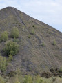
Slag heaps 87 and 92 in Dourges
 3.15 mi
+217 ft
-220 ft
1h 40
Easy
Departure from Dourges (Pas-de-Calais)
3.15 mi
+217 ft
-220 ft
1h 40
Easy
Departure from Dourges (Pas-de-Calais)
A route that will take you to the Sainte-Henriette slag heap, the landmark that marks the entrance to the mining basin when approaching from Paris, visible from the TGV line and the A1 and A21 motorways. You’ll climb its neighbouring ‘little brother’ and enjoy a superb view. Not to be missed.
Around the Bois Duquesnoy forest, starting from Arleux
 5.75 mi
+112 ft
-108 ft
2h 45
Easy
Departure from Arleux (Nord)
5.75 mi
+112 ft
-108 ft
2h 45
Easy
Departure from Arleux (Nord)
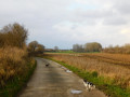
The walk begins along the Canal du Nord and then continues along country lanes. When you arrive in Oisy-le-Verger, you are immediately greeted by the horses at the riding centre. Then we weave our way through to the Bois Duquesnoy. As I can't take my dog on the municipal tidal paths, I turn off early to continue along a quiet, leafy country lane. Finally, we return along the canal to the car park. Enjoy your walk.
Chemin du Marasquay à Athies
8.19 mi
+98 ft
-98 ft
3h 50
Moderate
Departure from Athies (Pas-de-Calais)
Venez découvrir les village de Fampoux, Feuchy et Athies en passant par les bois, étangs et marais.
Short route around Farbus
3.29 mi
+141 ft
-144 ft
1h 40
Easy
Departure from Farbus (Pas-de-Calais)
A circular route around Farbus, allowing you to explore the village and the surrounding countryside.
Brunémont marshes and wildlife observation
6.92 mi
+36 ft
-36 ft
3h 15
Moderate
Departure from Brunémont (Nord)
Starting from Brunémont Town Hall, this easy trail offers the chance to discover the many charms of the Sensée canals, the star river of the area. At the confluence of the Canal du Nord and the Canal de la Sensée, this walk along towpaths and paths bordering the ponds offers a pleasant and safe setting. Along the edges of the ponds, the reed beds and willow groves are home to beautiful populations of marsh ferns. Be mindful of the environment, as the Aubigny and Brunémont marshes are an important heritage site for wildlife, particularly herons, marsh warblers and grass snakes.
The two bridges from Vimy
4.76 mi
+108 ft
-118 ft
2h 15
Easy
Departure from Vimy (Pas-de-Calais)
This short hike around Vimy, between the town, voyettes (small streets in local dialect) and plains, will give you a different perspective on our beautiful region, its heritage and its memory of the Great War
Le Champ des Saints depuis Vimy
 7.95 mi
+289 ft
-308 ft
3h 55
Moderate
Departure from Vimy (Pas-de-Calais)
7.95 mi
+289 ft
-308 ft
3h 55
Moderate
Departure from Vimy (Pas-de-Calais)
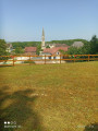
Venez découvrir les villages de l'Artois par Farbus, Willerval et Vimy. Randonnée entre bois et plaine avec vue sur les terrils de Loos-en-Gohelle
Les antennes depuis Vimy
 8.43 mi
+315 ft
-315 ft
4h 10
Moderate
Departure from Vimy (Pas-de-Calais)
8.43 mi
+315 ft
-315 ft
4h 10
Moderate
Departure from Vimy (Pas-de-Calais)
Jolie randonnée qui vous conduira tout d'abord dans la campagne entre Vimy et Farbus, puis vous fera monter à Thelus avant de rejoindre le Mémorial Canadien et la Forêt de Vimy.
Les Voyettes
 4.53 mi
+164 ft
-167 ft
2h 15
Easy
Departure from Vimy (Pas-de-Calais)
4.53 mi
+164 ft
-167 ft
2h 15
Easy
Departure from Vimy (Pas-de-Calais)
This local hike will introduce you to this charming village in the community of Lens-Lievin. It took in the wounded during the Battle of Lens in August 1648 and many other battles, including the Battle of Vimy Ridge from 9 to 12 April 1917. The ponds around Vimy are former shell holes. Even today, unexploded ordnance can still be found.
The Goulot from Vimy
 7.34 mi
+295 ft
-299 ft
3h 40
Moderate
Departure from Vimy (Pas-de-Calais)
7.34 mi
+295 ft
-299 ft
3h 40
Moderate
Departure from Vimy (Pas-de-Calais)
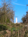
This walk, starting from Place de la République, will take you to the Canadian Memorial. It then follows a descent through Thélus and Farbus via the Bois du Goulot. You will pass by the Saint-Ranulphe Fountain. The whole route is on good paths.
On the banks of the Sensée du Nord canals and the Sensée marshes
13.36 mi
+43 ft
-43 ft
6h 10
Moderate
Departure from Aubigny-au-Bac (Nord)
A hike between the canal and the Sensée marshes.
Visit the old peat bogs to discover the aquatic fauna and boat activity.
During the hike, you will pass through the Palluel lock.
In the heart of the Sensée marshes, between the land of smoked garlic in Arleux and that of shallots in Bugnicourt.
The necropolis from Étang du Brochet
 7.11 mi
+220 ft
-207 ft
3h 30
Moderate
Departure from Noyelles-sous-Lens (Pas-de-Calais)
7.11 mi
+220 ft
-207 ft
3h 30
Moderate
Departure from Noyelles-sous-Lens (Pas-de-Calais)
Starting from Étang du Brochet, this hike will take you up Terril du Lavoir, before crossing the Méricourt mining village and then the necropolis of 10 March 1906, a memorial site following the mining disaster that claimed 1,099 lives.
Le Bois de Florimond et les terrils
 6.21 mi
+246 ft
-249 ft
3h 05
Easy
Departure from Harnes (Pas-de-Calais)
6.21 mi
+246 ft
-249 ft
3h 05
Easy
Departure from Harnes (Pas-de-Calais)
Belle randonnée à faire en famille entre terrils, étangs et points de vue.
Lallaing: starting from the mining estates
 5.71 mi
+13 ft
-13 ft
2h 40
Easy
Departure from Lallaing (Nord)
5.71 mi
+13 ft
-13 ft
2h 40
Easy
Departure from Lallaing (Nord)
I suggest a walk starting from the Cité de la Fosse Bonnel, a route that circles the town through accessible natural areas.A varied walk combining history, nature and landscapes typical of the mining basin. Explore the Germignie Sud slag heap and part of the landscape.
Slag Heaps 83 and 94 - Fouquières marshes
 5.57 mi
+308 ft
-308 ft
2h 50
Easy
Departure from Harnes (Pas-de-Calais)
5.57 mi
+308 ft
-308 ft
2h 50
Easy
Departure from Harnes (Pas-de-Calais)
A route that takes you through the Fouquières marshes. You'll climb the wooded slag heap 83, offering a view of a mysterious artificial valley. You'll then head for slag heap 94 (staircase slag heap), passing the schlamm bins (storage of mining waste) and the Harnes fishing pond. Return along the path that runs alongside the Lens canal.
Bois de l'Offlarde
 9.15 mi
+177 ft
-164 ft
4h 20
Moderate
Departure from Leforest (Pas-de-Calais)
9.15 mi
+177 ft
-164 ft
4h 20
Moderate
Departure from Leforest (Pas-de-Calais)
This walk, starting from Leforest, passes around two slag heaps and along the greenway (GR® 121B). It is well shaded for the first two-thirds of the route (Phalempin National Forest). It is an ideal walk during the hot summer months; however, the paths can become muddy on rainy autumn or winter days.
The route also offers a chance to admire the “ladder tree” in the Bois de l’Offlarde, which served as a German observation post during theFirst World War.
Sentier des Fumerolles and Bois de Florimond
 3.55 mi
+118 ft
-118 ft
1h 45
Easy
Departure from Harnes (Pas-de-Calais)
3.55 mi
+118 ft
-118 ft
1h 45
Easy
Departure from Harnes (Pas-de-Calais)
Slag heaps are not just piles of dead rocks; reactions are still taking place at their core. As evidence of these reactions, gaseous fumaroles escape from them. To see this for yourself, head to Harnes, starting from the Bois de Florimond, and make your way towards the slag heap. Then follow the signposted path known as the “Sentier des Fumerolles” (Fumaroles Trail), marked by concrete posts, which will take you to Slurry Heap 230. It is a surprising journey offering a wide variety of landscapes and points of interest: views of fumaroles, a viewpoint over the south-east of the mining basin, a viewpoint over the canyon, and more.
Le Bossu from Avion
6.85 mi
+167 ft
-171 ft
3h 20
Moderate
Departure from Pas-de-Calais
A lovely urban walk that will take you through places you’d never have imagined.
The 108 and 122 slag heaps in Leforest and Ostricourt
 4.12 mi
+174 ft
-171 ft
2h 05
Easy
Departure from Leforest (Pas-de-Calais)
4.12 mi
+174 ft
-171 ft
2h 05
Easy
Departure from Leforest (Pas-de-Calais)
This route will first take you through the Offlarde and Phalempin forests. The landscape then becomes more lunar as you skirt around slag heap 108 and climb slag heap 122 (viewpoint over the mining basin).
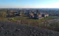
Madame Declercq’s trail
 5.56 mi
+364 ft
-361 ft
2h 50
Moderate
Departure from Oignies (Pas-de-Calais)
5.56 mi
+364 ft
-361 ft
2h 50
Moderate
Departure from Oignies (Pas-de-Calais)
Located in the heart of the mining basin, the Bois des Hautois in Oignies is a preserved site where hiking trails wind their way between slag heaps, ponds and pastures. The suggested route is situated in the immediate vicinity of the former 9-9 bis pithead, listed as a UNESCO World Heritage Site since 30 June 2012, and whose metal headframe is never far from view, helping you to find your way along the route.
The two spoil heaps from Oignies
 6.19 mi
+305 ft
-308 ft
3h 05
Moderate
Departure from Oignies (Pas-de-Calais)
6.19 mi
+305 ft
-308 ft
3h 05
Moderate
Departure from Oignies (Pas-de-Calais)
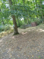
This walk, starting from the 9-9bis Mining Centre, will take you across both slag heaps without much difficulty, offering beautiful views of the slag heap range. The walk follows very good wooded paths on the first slag heap of the route. It is advisable to do the walk in the morning. You can extend the walk by crossing the Bois des Hautois, but there are a great many fallen trees.
Slag heap 75, Pinchonvalles ridge
 3.39 mi
+272 ft
-272 ft
1h 50
Easy
Departure from Pas-de-Calais
3.39 mi
+272 ft
-272 ft
1h 50
Easy
Departure from Pas-de-Calais
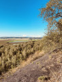
This itinerary takes you to Europe's longest slag heap, which stretches over 2km and fills an ancient valley. You'll enjoy views over the coalfield and the Artois hills. At times, you'll have the impression of walking along a mountain ridge. An entirely wooded terril, it is a reserve for numerous species.
Slag heaps 116–117, 10 in Oignies
 3.63 mi
+141 ft
-141 ft
1h 45
Easy
Departure from Oignies (Pas-de-Calais)
3.63 mi
+141 ft
-141 ft
1h 45
Easy
Departure from Oignies (Pas-de-Calais)
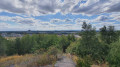
A route that takes you from the former 9-9bis pit in Oignies, with its renovated buildings that will transport you back several decades. You will then cross the Bois de Gosse and stop at the wildlife observatory. The landscape will take on a more lunar appearance as you climb the slag heap, before finally returning to the pit via the old mining sidings (rail tracks).
Match carriers in the Offlarde woods
 8.70 mi
+276 ft
-279 ft
4h 15
Moderate
Departure from Raimbeaucourt (Nord)
8.70 mi
+276 ft
-279 ft
4h 15
Moderate
Departure from Raimbeaucourt (Nord)
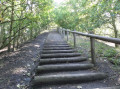
There is nothing monotonous about this route: you run or walk across a huge site, skirting an agricultural area here, old paths lined with sweet peas and wild blackberries there, sheltered by undergrowth or alongside a large pond.
And without even noticing, you arrive at the foot of the old conical slag heap on the border between Nord and Pas-de-Calais.
To reach the top, it takes a little more effort, but it's worth it because once you're at the top, the view is exceptional!
A rejuvenating walk along the River Scarpe
 4.43 mi
+10 ft
-10 ft
2h 05
Easy
Departure from Anhiers (Nord)
4.43 mi
+10 ft
-10 ft
2h 05
Easy
Departure from Anhiers (Nord)
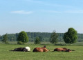
On the edge of the Plaine Scarpe–Escaut Regional Nature Park, explore the commune of Anhiers, where nature is gradually reclaiming the area – a former mining village ravaged by the war between 1914 and 1918. Today, you’ll come across old structures such as the concrete headframe dating from 1920. The post-industrial atmosphere immerses us in this past of social struggle, before we resume our walk along the banks of the Scarpe.
Moncheaux barren lands route
 13.32 mi
+213 ft
-243 ft
6h 20
13.32 mi
+213 ft
-243 ft
6h 20
 Difficult
Departure from Moncheaux (Nord)
Difficult
Departure from Moncheaux (Nord)
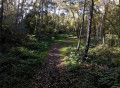
This circular allows you to admire the rich natural landscapes and mining heritage of the region. During this walk in the great outdoors, you will follow "les cavaliers", the old railway tracks of the Compagnie des Mines that connected all the mine shafts and slag heaps in the region when mining was in full swing. An excursion combining nature and history, to be discovered without delay!
Around the golf course, slag heap and Leforest lake
 8.64 mi
+259 ft
-272 ft
4h 10
Moderate
Departure from Moncheaux (Nord)
8.64 mi
+259 ft
-272 ft
4h 10
Moderate
Departure from Moncheaux (Nord)
This hike from Moncheaux passes by the Thumeries golf course, slag heap 122, Leforest lake, and then the greenway. It is fairly shaded, especially in the first part.
The 80 slag heap (Garennes Pont Ampère) along La Souchez
 3.42 mi
+85 ft
-85 ft
1h 40
Easy
Departure from Liévin (Pas-de-Calais)
3.42 mi
+85 ft
-85 ft
1h 40
Easy
Departure from Liévin (Pas-de-Calais)
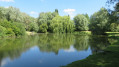
This route will take you to the top of the flat 80 slag heap (shaped like a plateau), offering a beautiful view of the mining basin and the Artois hills. The rest of the route follows the course of the Souchez river in a green and peaceful setting.
Cinq Tailles and Thumeries
 8.12 mi
+98 ft
-98 ft
3h 50
Easy
Departure from Moncheaux (Nord)
8.12 mi
+98 ft
-98 ft
3h 50
Easy
Departure from Moncheaux (Nord)
A walk through the countryside around Mons-en-Pévèle, the Cinq Tailles bird sanctuary, and the town of Thumeries.
Tour du Trou à l’Eau
4.45 mi
+43 ft
-43 ft
2h 05
Easy
Departure from Boyelles (Pas-de-Calais)
A countryside walk that can be enjoyed in all weathers.
Around Bourlon
10.17 mi
+131 ft
-141 ft
4h 45
Moderate
Departure from Bourlon (Pas-de-Calais)
Starting from the village of Bourlon , this walk invites you to discover the typical landscapes of the Cambrésis region as you make your way successively to Sains-lès-Marquion and then Marquion . With a mix of country lanes, wooded sections and unobstructed views over the plains, the route offers a varied, accessible walk full of little local gems to discover. A circular route ideal for enjoying the rural tranquillity and exploring three villages steeped in history and nature.
The slag heaps of Loos-en-Gohelle
 6.98 mi
+381 ft
-381 ft
3h 35
Moderate
Departure from Loos-en-Gohelle (Pas-de-Calais)
6.98 mi
+381 ft
-381 ft
3h 35
Moderate
Departure from Loos-en-Gohelle (Pas-de-Calais)
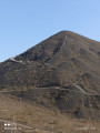
A very beautiful hike to the highest slag heaps in Europe with a view of the Flanders mountains on a clear day.
The fig tree in Loos-en-Gohelle
4.85 mi
+171 ft
-174 ft
2h 25
Easy
Departure from Loos-en-Gohelle (Pas-de-Calais)
This short hike starting from Loos-en-Gohelle will take you to the slag heap and the 11/19 site. On the way back, you will cross the British Military Cemetery and the Canadian Memorial at Hill 70, all on good paths.