Country:

 City:


To get to the start, head towards Oignies and go to Rue Léon Blum. Park near Square Duquesne.
(S/E) At the start, head towards the monument honouring the miners, erected in the small Square Duquesne. Then continue south-east. A sign points towards the ‘Circular Route of the Three Cavaliers’. Continue in this direction for 600 metres, cross the Chemin de Dourges and carry on south-east along the Chemin Rouge, a short path that leads across the fields. Carry on until you reach the junction with Rue de la Justice.
(1) Cross the street and continue south-west along Rue Molière. Carefully cross the railway line at the level crossing, then turn left towards the south onto Rue de la Cuve. Stay on this path, which leads across the fields and runs alongside the railway line until you reach the junction with the Évin-Malmaison road (D161).
(2) At the junction, turn left, cross the railway line, then turn right onto the path signposted ‘Circular Tour of the Three Cavaliers’. Follow the railway line on your right. Just before the canal, the path turns left and moves away from the railway line.
(3) At the junction, head slightly left. Stay on the main, signposted path until you reach the first houses at the pithead of Pit 8.
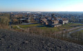
(4) Then turn right, and go through the small passage to the right of the gate. Continue on to the headframe of Pit 8 in Dourges. Please note: the signposting for the ‘Circular Three Cavaliers’ trail is no longer present from this point onwards. After the headframe, continue south-east along the small path, which is clearly marked on the ground. At the top of the short climb, head left (north-east) until you reach a crossroads, then head south-south-east. Ignore the side paths and you will come to a junction.
(5) Turn right and follow the signposting, which becomes visible again. Walk alongside a pond on your left and continue south-west until you reach the junction with the D160E2. Do not take or cross the road; instead, whilst following the signposting, make your way to the bank of the Canal de la Deûle.
(6) Turn left and walk alongside the canal on your left for about 2.5 km.
(7) Shortly after a bridge spanning the canal, leave the towpath to the left and continue along the stony path which runs alongside a small body of water and heads south-east. Please note that there are no signposts at this point. Continue to the junction with Rue Massenet. Cross this street and carry on straight ahead, following the signposts. At the next junction, turn right.
(8) You’ll come out onto Rue Jean-Baptiste Lebas; follow it to the left. At the next junction, turn left onto Rue Mirabeau. Carry on straight ahead along this street. Further on, continue along Rue Lazare Carnot and cross the railway tracks at the level crossing.
(9) Turn right into Rue Salvador Allende and walk past the station. Continue along the narrow path which branches off to the left and then immediately to the right, following the signposts. Cross Rue du Mont Dore and continue north-east along the narrow path that runs through the Cité du Sapin Vert. Cross Rue de Clermont-Ferrand, continue along the path opposite and walk past the pond to reach Rue des Bergeronnettes on the left.
(10) Before reaching this street, turn right onto the signposted path heading north-east. Follow this path until you reach Rue Florent Evrard.
(11) Cross this street and follow Rue de la Potrie. Walk alongside the cemetery on your right. At the roundabout, carry straight on towards Évin-Malmaison.
(12) At the junction in front of the AD garage, turn right and then immediately left. You’ll come back onto the tarmac; continue straight on along Rue des Landes. Cross Rue de Biarritz on the right-hand side and immediately turn right onto a path that crosses the Cité du Bois.
(13) Cross Rue Séraphin Cordier. Carry on to the park and walk round Terril 122 anti-clockwise (you can also climb it via the steps; allow half an hour for the round trip). Head back towards the houses, rejoin Rue Séraphin Cordier and follow it to the right for a few dozen metres.
(14) As you approach a high-voltage power line, leave the road, take a path on the right and pass under the power line. Cross the Bois du Court Digeau, heading north-west then west-north-west.
(15) You’ll emerge onto Rue de la Libération; follow it to the left. At the 90° bend, leave the street and continue straight on towards the west. On the Chemin de Promenade Henri Jankoviak, continue northwards and pass at the foot of a slag heap. Further on, cross Rue Florent Evrard and stay on the path that runs to the left of the roundabout.
(16) Cross the D354 with care, then follow it until you reach Avenue François Mitterrand. About a hundred metres before the LIDL supermarket, turn left onto Avenue François Mitterrand. At the first junction on the right, turn right, then immediately left.
(17) Continue right onto Rue Pierre Brossolette towards the Salle Stanislas and carry on to the roundabout. Cross the roundabout and continue towards the Salle Stanislas along Rue Brossolette until you reach the Cité des Beaux-Arts, where you’ll find a path branching off to the left, signposting the direction of the Trois Cavaliers circular loop.
(18) Leave Rue Pierre Brossolette and take the gravel path heading west-south-west. At the end of the path, cross Rue Léon Jouhaux and continue along Rue Roger Salengro. Carry on until you reach the Salle des Fêtes Robespierre.
(19) Turn left to continue along the path that runs alongside the village hall’s fence, leading you to the monument dedicated to the miners and back to your starting point (S/E).

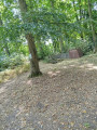
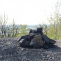
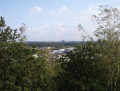
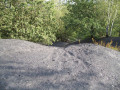
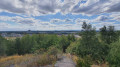
 We went on this walk in the rain; there were lots of lovely stretches, particularly after the headframe, where the spoil heaps were covered in flowers. There were a few long stretches that were a bit monotonous along the Deûle Canal and through the villages of f’Auby, Leforest and Ostricourt. We came across several construction sites; the region is investing in improving this route, with freshly laid gravel and new signposts (unfortunately only in some places). Let’s hope that a few picnic tables and benches will be installed. There weren’t many places to stop for a break; the only café we came across, ‘Le Saint Claude’, is closed on Thursdays, so we had a picnic in the waiting room at Leforest station.
 Visorando Member
 Easy

 Moderate
 Association / Club / Walk leader