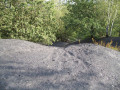
The Estevelles slag heap and the Carvin ‘voyettes’

A route that gently connects town and countryside and invites you to discover the riches of a natural heritage!
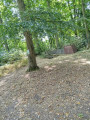
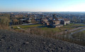
This route, set amongst countryside and mining landscapes, will take you past a slag heap nestled amongst the fields, a slag heap that has been transformed into a nature park with unique scenery, and will take you through Carvin via its backstreets.

Details

n°4431566
Creation:
Last update:
Last review:
  • Walking
    Activity: Walking
  • ↔
    Distance: 10.73 mi
  • ◔
    Average duration: 5h 10 
  • ▲
    Difficulty: Moderate

  • ⚐
    Back to start: Yes
  • ↗
    Ascent: + 246 ft
  • ↘
    Descent: - 246 ft

  • ▲
    Highest point: 331 ft
  • ▼
    Lowest point: 66 ft

Photos

Description of the walk

To get to the start, head to Rue du Pont de la Batterie, 62710 Courrières. Rue de la Batterie is on the D46 between Oignies and Courrières, on the left-hand side before the bridge over the Deule, travelling from Oignies towards Courrières. (GPS coordinates: 50°27'51.5"N 2°58'06.2"E)

(S/E) Start the walk by heading onto the Deule Canal towpath and walking north-west.

(1) Pass the junction of the Deûle Canal and the Lens Canal. Continue for just over 4 km. Pass under the Pont Maudit and walk past the houses lining the canal in the village of Estevelles.

(2) After the last houses, turn right onto the Chemin des Portions de la Poste, then immediately left to join theGRP® trail of the Nord-Pas-de-Calais Mining Basin. Then walk along the left bank of the two ponds, continuing northwards to Rue Georges Clémenceau. On this street, head left, walk past the cemetery, then turn right into Rue Blanche Dupont.
Walk 100 metres along this street, then turn left onto Chemin Ernest Comble (follow the signpost on the gate marking the path). Continue along this path, which joins Chemin des Postes, for 1.2 km, following the medium-voltage power line.

(3) Take the small path on the right, which runs alongside Chemin des Postes for about a hundred metres, then turn right at the junction and head towards the entrance to the slag heap to begin the climb.

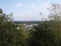
(4) Top of Slope 24/25. After climbing to the top and admiring the view, turn back to rejoin the original path at the foot of the slag heap, then continue walking to the left, heading south-west, to rejoin the Chemin d’Estevelles.

When you reach the first houses of the village of Épinoy, on the Chemin d’Estevelles, you’ll see on your left the pit 4 bathhouse, with its three towers which provided ventilation for the building. Cross the roundabout and continue along Rue Saint Druon.

(5) Before the church, turn left onto the cobbled Ruelle de La Plaine (be sure to follow theGRP® signposting). After 100 metres, turn right onto the narrow lane 5a, the Sentier des Mulets (a ‘voyette’ is the name given to the narrow streets connecting neighbourhoods). At Rue Ga, turn right and then left to rejoin the ‘voyette’ known as the Sentier des Mulets, which then leads onto Rue Ferrer.

Carry on to the right, then left, along Rue François Vitton until you reach Rue Montesquieu. Then continue along the ‘voyette’ that runs alongside Rue Pierre Corneille to reach Rue de la Gare.

(6) On Rue de la Gare, turn left and, 50 metres further on, take the small alley opposite No. 11, which runs between two red-brick houses. At the end of the alley, turn right into Impasse de la Gare, cross Rue Édouard Plachez to the left to reach Rue du 11 Novembre (this street and those that follow are reserved for buses. Take care when walking on the pavement). Then take Rue de Tilloy and head towards the water tower, passing to its right onto Chemin de Willervall, then Chemin Latéral du Vieux Château.

(7) Turn left onto Rue des Hérons, then right at the end of the street onto the path heading south to reach the Tour d’Horloge park. In the park, take one of the paths to reach the right bank of the pond, then head north-east to find the bridge that passes under the D917.

(8) Turn right, go under the D917 and follow the signs for the waterworks. Cross the Route d’Oignies to reach Rue Charles Tellier. Continue to Rue Albert Einstein, then turn left. Walk past the businesses to the end of the street.

(9) Just before the roundabout, turn right onto a path that runs alongside a grey warehouse. Once you reach Chemin du Saint Druon, turn left to rejoin the D46 and return to the starting car park on Rue de la Batterie (S/E).

Waypoints

  1. S/E : mi 0 - alt. 85 ft - On the towpath, heading north-west
  2. 1 : mi 1.14 - alt. 75 ft - Confluence of the Deüle Canal and - Sochez (rivière) - Canal de Lens
  3. 2 : mi 3.18 - alt. 75 ft - Turn right, then left - Deûle (rivière)
  4. 3 : mi 4.5 - alt. 112 ft - A short path to the right
  5. 4 : mi 5.12 - alt. 331 ft - Top of the slag heap 24/25
  6. 5 : mi 6.73 - alt. 82 ft - Turn left before the church
  7. 6 : mi 7.49 - alt. 92 ft - Turn left onto Rue de la Gare opposite No. 1
  8. 7 : mi 8.19 - alt. 89 ft - Turn left onto Rue des Hérons
  9. 8 : mi 9.01 - alt. 72 ft - Turn right to go under the D917
  10. 9 : mi 9.95 - alt. 79 ft - Before the roundabout, turn right
  11. S/E : mi 10.73 - alt. 85 ft - Car park on Rue de la Batterie

Notes

To see the car park and the starting point , click here

Picnic tables in the Tour d’Horloge park. There are no drinking fountains, but there are shops and cafés along the route.
The route is exposed in many places. Make sure you protect yourself from the sun, as even in the Pas-de-Calais it can be quite intense when it’s out.
Take your binoculars for the view of the slag heap.

Worth a visit

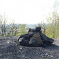
On the former mining site of the Estevelles slag heap, remnants of the past (4)
the shower blocks at Pit 4, with its three towers between the landmarks (4) and (5)
Carvin and its ‘voyettes’ (6)
The Tour d’Horloge park and its slag heap (7)
The water station (9)

Reviews and comments

3.7 / 5
Based on 2 reviews

Reliability of the description
3.5 / 5
Ease of following the route
3 / 5
Route interest
4.5 / 5
Isa62
Isa62

Overall rating : 4 / 5

Date of your route : Oct 23, 2023
Reliability of the description : ★★★★☆ Good
Ease of following the route : ★★★☆☆ Average
Route interest : ★★★★★ Very good
Very busy route : No

Very pleasant, except towards the end – after the Parc de l’Horloge, it gets a bit dodgy (you pass through an illegal rubbish dump, amongst other things) and there aren’t enough signposts.
Otherwise, there are some lovely views from the slag heap. I found Voyettes quite charming as my grandparents used to live in Carvin.
:

Machine-translated

Caron beatrice
Caron beatrice
• Edited:

Overall rating : 3.3 / 5

Date of your route : Oct 22, 2023
Reliability of the description : ★★★☆☆ Average
Ease of following the route : ★★★☆☆ Average
Route interest : ★★★★☆ Good
Very busy route : No

A lovely walk, but the route description is a bit complicated in places.
Reaching the slag heap was tricky. It’s not clear which way to go.
To leave the slag heap after the descent, you have to look for the path and persevere along a very narrow track that ends up in the undergrowth.
The end of the walk isn’t particularly interesting; you cross through the industrial estate and then some fly-tipped rubbish.
Perhaps the return route to the car park could be re-routed via a different path
All in all, a very lovely walk with some lovely little sights in Carvin

Machine-translated

eric boulle
eric boulle

I completed the whole route; it’s a lovely route, though there are two points that could do with some improvement: the entrance to the Estevelles slag heap and the exit from it.

Machine-translated

Other walks in the area

For more walks, use our search engine .

The GPS track and description are the property of this route's author. Please do not copy them without permission.