Moncheaux barren lands route

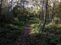
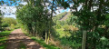
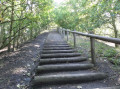
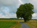
This circular allows you to admire the rich natural landscapes and mining heritage of the region. During this walk in the great outdoors, you will follow "les cavaliers", the old railway tracks of the Compagnie des Mines that connected all the mine shafts and slag heaps in the region when mining was in full swing. An excursion combining nature and history, to be discovered without delay!

Details

10410655
Creation:
Last update:
Last review:
  • Walking
    Activity: Walking
  • ↔
    Distance: 13.32 mi
  • ◔
    Average duration: 6h 20 
  • ▲
    Difficulty: Difficult

  • ⚐
    Back to start: Yes
  • ↗
    Ascent: + 213 ft
  • ↘
    Descent: - 243 ft

  • ▲
    Highest point: 226 ft
  • ▼
    Lowest point: 59 ft

Photos

Description of the walk

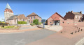
To get to the starting point, head towards Monchaux. At the crossroads in the town centre, head towards Raimbeaucourt. 100 metres after the crossroads, turn right before the chip shop to reach the car park and starting point (GPS coordinates: 50°27'07.7"N 3°04'53.2"E)

(S/E) From the car park, head south-west along the path to the right of the City Stade de Monchaux. Continue in this direction across the fields until you reach Rue du Bouvalot, then turn left towards the south-east. Stay on this road until you reach the Y-junction.

(1) Take the path on the right, heading south-southwest. Walk across the fields for 1.2 km until you reach the first houses of the village of Leforest on Route du Planty.

(2) At the intersection with Rue de Barriac, turn right. Walk to Rue d'Aurrillac, then turn left and then right to find yourself on Rue Florent Evrard. Continue along the street until you reach the Crunelle Matériaux company.

(3) Turn left at the pedestrian crossing and follow the path heading south. Stay on this path for about 700 metres until you reach Rue Saint-Juste.

(4) Just before you reach it, turn left towards the south-east onto the small path that enters the woods and overlooks a small pond on the right. When you leave the woods, continue along the path that leads towards the football pitch, then continue along the path that passes to the right of it and keep going in the same direction until you reach Rue des Fuchsias. Continue left until you reach the roundabout.

(5) At the roundabout, turn right onto Rue des Géraniums, walk 50 metres and follow the path that leads across the fields, following the back of the houses on Rue des Fuchsias. At the end of the path, turn right onto Rue Marcel Sambat. Stay on this street for 400 metres, then turn left after Paintball Aréna 59, heading east on theGRP® du Bassin Minier Nord Pas de Calais. Cross the Plaine du Moulin and continue to the first houses in Roost-Warendin.

(6) At No. 253, turn right and follow the signs for the Pont Pinet reserve on the cycle route to the south-south-west. Turn left onto Rue Léon Blum, then right onto Rue Claude Debussy.

(7) At the stop sign on Rue Debussy, continue right onto Rue Jouveneau. Cross the small stream called La Noire Eau, then turn left onto the route. Cross the Marais du Pont Pinet and then the Annelles-Lains-Pont Pinnet Nature Reserve.

(8) At the crossroads, continue north-east to Rue Émile Zola. Turn left into the street, then right into Rue Lamendin towards the waste collection centre. Pass to the right of the waste collection centre, staying on the left-hand lane reserved for pedestrians. 50 metres before the stop sign, turn right onto the small path to cross the old peat bog. Go around the old slag heap and exit the peat bog to find yourself on Avenue du 8 Mai 1945.

(9) Continue left on the avenue towards the east. At the intersection with Rue Franco Ferrer, turn right and continue to the roundabout.

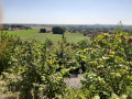
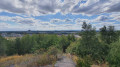
(10) To the left of the roundabout, enter through the gate to cross the Domaine de l'Escapelle. Follow the marked paths around the slag heap and, if you wish, climb up to the top of the Escarpelle! This conical slag heap offers a breathtaking view of the Scarpe valley and the chain of slag heaps.
Continue north-east at the crossroads to exit the park via Rue de la Paturelle.

(11) Cross the street and continue along Rue des Tourbières until you reach the last houses, then continue along the path through the fields to reach Rue Jules Guesdes.

(12) Continue westwards, then turn right onto Avenue Jean-Baptiste Lebas. Continue along Rue Victor Hugo until you reach Avenue des Martyrs de la Résistance.

(13) At the intersection, turn right (you are now on theGRP®), cross the roundabout and you will find yourself on Allée du Château de Bennicourt. Pass to the left of the château, following theGRP® markings until you reach Rue Danton.

(14) At the end of Rue Danton, continue right onto Rue Jean Moulin, followed by Rue Léon Blum.

(15) Turn onto the footpath on the right and follow this footpath, which branches off from the street and continues along the greenway for 1.6 km. Cross Rue des Sœurs Bouquerel and continue to Rue Jules Ferry.

(16) Turn right, then left onto a path. Stay on the path for 200 metres, then turn left to rejoin Rue Jules Ferry. Turn right and continue to the town hall on Place Clémenceau.

(17) Pass to the right of the town hall, go around it to find yourself on Rue de l'Égalité. Pass in front of the cemetery and take theGRP® path that runs alongside thesecond cemetery . Continue along the path through the fields.

(18) Turn right at the crossroads towards the north-east. You are now on theGR®121Band the greenway. Continue in this direction for 1.9 km to return to City Park and your starting point (S/E).

Waypoints

  1. S/E : mi 0 - alt. 223 ft - Take the path to the right of the City Stade.
  2. 1 : mi 0.5 - alt. 197 ft - Fork in the road
  3. 2 : mi 1.27 - alt. 95 ft - Village of Leforest
  4. 3 : mi 1.54 - alt. 95 ft - Fork in the path
  5. 4 : mi 2 - alt. 79 ft - Turn left onto the path
  6. 5 : mi 2.64 - alt. 69 ft - Roundabout
  7. 6 : mi 3.8 - alt. 72 ft - Fork in the road at No. 253.
  8. 7 : mi 4.17 - alt. 66 ft - Stop
  9. 8 : mi 4.83 - alt. 66 ft - Crossroads
  10. 9 : mi 5.96 - alt. 69 ft - Avenue du 8 Mai 1945
  11. 10 : mi 6.53 - alt. 69 ft - Roundabout. Towards - Scarpe (rivière)
  12. 11 : mi 8.19 - alt. 66 ft - Cross Rue de la Paturelle
  13. 12 : mi 8.62 - alt. 62 ft - Rue Jules Guesdes
  14. 13 : mi 9.03 - alt. 66 ft - Avenue des Martyrs de la Résistance
  15. 14 : mi 10.13 - alt. 72 ft - Rue Jean Moulin
  16. 15 : mi 10.29 - alt. 66 ft - Footpath
  17. 16 : mi 11.23 - alt. 85 ft - Rue Jules Ferry
  18. 17 : mi 11.72 - alt. 131 ft - Town hall
  19. 18 : mi 12.13 - alt. 112 ft - Fork in the greenway
  20. S/E : mi 13.32 - alt. 223 ft - City Stadium and car park

Notes

To see the car park and starting point: click here

Remember to take plenty of water with you in hot weather. There are many places to picnic along the route.

Worth a visit

Escapelle slag heap in Roost-Warendin.
Bernicourt Castle in Roost-Warendi.
Parc de la Cité du Sapin Vert.

Always be cautious and plan ahead when you're outdoors. Visorando and the author of this route cannot be held responsible for any accidents occurring on this route.

The GR® and PR® markings are the intellectual property of the Fédération Française de Randonnée Pédestre.

Reviews and comments

4.5 / 5
Based on 10 reviews

Reliability of the description
4.5 / 5
Ease of following the route
4.4 / 5
Route interest
4.6 / 5
Osyval
Osyval

Overall rating : 5 / 5

Date of your route : Mar 29, 2026
Reliability of the description : Not used / Not applicable
Ease of following the route : Not used / Not applicable
Route interest : ★★★★★ Very good
Very busy route : No

We used the GPS route throughout the journey, so we can’t comment on the guidance.
It’s worth noting that a coffee break at the Château de Bernicourt is possible (and very pleasant) at the weekend.

Machine-translated

Marc defontaine
Marc defontaine

Overall rating : 5 / 5

Date of your route : Oct 13, 2025
Reliability of the description : ★★★★★ Very good
Ease of following the route : ★★★★★ Very good
Route interest : ★★★★★ Very good
Very busy route : Yes

Very beautiful route, easy to follow on Visorando, with many parallel paths.
A bit built-up, but beautiful paths in the countryside and on slag heaps. 👌👌

Machine-translated

VAN DE WOESTYNE
VAN DE WOESTYNE

Overall rating : 3.7 / 5

Date of your route : Aug 13, 2025
Reliability of the description : ★★★★☆ Good
Ease of following the route : ★★★☆☆ Average
Route interest : ★★★★☆ Good
Very busy route : No

The route is not particularly difficult, except for finding your way along the paths that lead off in all directions on the slag heap, which we climbed without much difficulty. We couldn't find the way out of the stadium to get to point 5. After going around the slag heap, the GR trail that branches off to the right meets other paths with no signposts or GR markings.
Street names are not always indicated, so it is sometimes difficult to find your way around town.

Machine-translated

Dhellemme Gérard
Dhellemme Gérard

Overall rating : 5 / 5

Date of your route : Mar 31, 2025
Reliability of the description : ★★★★★ Very good
Ease of following the route : ★★★★★ Very good
Route interest : ★★★★★ Very good
Very busy route : No

My wife and I did this route on 25 March and we would like to express our sincere thanks to the person who created it. It was a very beautiful hike with a wide variety of landscapes. We thoroughly enjoyed it and didn't encounter any particular difficulties, except perhaps in rainy weather. I recommend it to everyone. Thank you.

Machine-translated

JPaulo
JPaulo

Overall rating : 5 / 5

Date of your route : Mar 25, 2023
Reliability of the description : ★★★★★ Very good
Ease of following the route : ★★★★★ Very good
Route interest : ★★★★★ Very good
Very busy route : No

1,900 metres of elevation gain over 21 kilometres in the north? I decided to give it a go, and in fact there was only 200 metres of elevation gain, so no need to worry. Completed in 5 hours and 10 minutes, including breaks and the climb up the slag heap, this beautiful walk is well worth the detour. I will do it again this summer to enjoy the more lush vegetation.

Machine-translated

croiseedeschemins
croiseedeschemins

Overall rating : 4.7 / 5

Date of your route : Sep 15, 2022
Reliability of the description : ★★★★☆ Good
Ease of following the route : ★★★★★ Very good
Route interest : ★★★★★ Very good
Very busy route : No

A pleasant route. Completed in 4 hours and 15 minutes.

Machine-translated

Pierre59110
Pierre59110
• Edited:

Overall rating : 4 / 5

Date of your route : May 22, 2022
Reliability of the description : Not used / Not applicable
Ease of following the route : Not used / Not applicable
Route interest : ★★★★☆ Good
Very busy route : No

A varied route in terms of both landscape and terrain (road, path, slag heap, cobblestones).
Enjoy your hike!

Machine-translated

alainc5939
alainc5939

Thank you for your feedback and the information in point 5.
I have checked and corrected it.
Kind regards
Alain

Machine-translated

dancamphin
dancamphin

Overall rating : 3.7 / 5

Date of your route : Aug 26, 2021
Reliability of the description : ★★★★☆ Good
Ease of following the route : ★★★☆☆ Average
Route interest : ★★★★☆ Good
Very busy route : No

Interesting route with little tarmac and therefore little traffic

There is an error in the description: at point 5, after the paintball arena, you should turn left and not right as indicated.

Machine-translated

nenefanfan
nenefanfan

Overall rating : 4 / 5

Date of your route : Aug 05, 2021
Reliability of the description : ★★★★☆ Good
Ease of following the route : ★★★★☆ Good
Route interest : ★★★★☆ Good
Very busy route : No

Hello, we went hiking on Thursday afternoon, a mix of urban and rural areas, and enjoyed the old railway tracks. We got a little lost at the Roost slag heap (follow the route signs?? hidden by vegetation!!) before finding Rue des Tourbières. The return trip via the sugar route was very pleasant. Time for this route: 5½ hours with Patrick.
Kind regards, Néné

Machine-translated

arpioncoutichois
arpioncoutichois

Overall rating : 5 / 5

Date of your route : Jul 27, 2021
Reliability of the description : ★★★★★ Very good
Ease of following the route : ★★★★★ Very good
Route interest : ★★★★★ Very good
Very busy route : Yes

It's surprising to see one of my routes on Viso. But anyway, I wish hikers all the best in their discoveries...
Arpion coutichois

Machine-translated

Other walks in the area

For more walks, use our search engine .

The GPS track and description are the property of this route's author. Please do not copy them without permission.