Country:
 City:
City:


Park in the town hall car park, near the church.
(S/E) With your back to the town hall, turn left and follow Rue d’Hamelincourt without going all the way to the main road.
(1) At the junction, take the track on the right, go under the bridge, turn right immediately and continue alongside the D917, first below it and then on the pavement for 800 m.
(2) At thesecond junction, take the local track on the left, heading towards the water tower.
(3) At the next junction, take the local track on the left, heading towards the water tower.
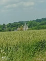
Turn right and continue along the path to the Boileux-Saint-Marc cemetery. Cross the track and carry on straight ahead until you reach the junction with the D35. Join the D35 by going down a flight of steps. At the junction at the bottom of the steps, take the track on the right, which runs alongside the road for 150 m, then cross the road with the chapel 50 m ahead.
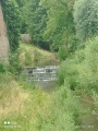
(4) At the junction in front of the chapel, take the track (known as the ‘Chemin rural dit des processions’) which branches off to the right, with the Cojeul on your right.
(5) At the junction with the local track, turn right and enter Boileux-Saint-Marc via Rue de Mercatel, continuing to the fork. Turn left onto the D35 and follow it to the D917. Cross the road carefully and head straight on into Boiry-Becquerelle, staying on Rue de l’Église.
(6) Walk past the church, ignore two streets on the left and turn right onto Rue Saint-Léger.
(7) At the junction (pumping station), take the track on the right and follow it alongside a stream.
(8) At the junction, turn left and enter Boyelles by heading up Rue d’Hénin. At the crossroads, turn right and head back to the car park at Boyelles Town Hall (S/E).

 Visorando Member

 Moderate
  Association / Club / Walk leader