Country:

 City:
City:


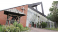
To reach the starting point, head towards the village of Anhiers (59194). On the main street, turn left at the Café des Sports, then turn left again to park in the church car park.
(S/E) On Rue Gabriel Perri, head south (yellow signposts, ‘Circular Route 2 Bridges’ loop). Then turn left onto Rue du Marais. At the left-hand bend, opposite number 193, take the path that leads across the fields towards the south-east (you’ll see the saltire in the distance). Continue across the fields for about 700 m.
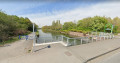
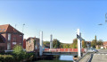
(1) At the Ranch de la Vache Bleue, continue to the right onto Rue du Petit Anhiers. Cross Rue du Moulin and continue along the dead-end road opposite. Follow this road until you reach the Stop sign. Turn right, towards Lallaing, and cross the Lallaing Bridge over the River Scarpe.
(2) As you come off the bridge, turn right and follow the River Scarpe for about 3 km, until you reach the Pont de Râches.
(3) Cross the bridge, then turn right to continue along Rue du Canal. At the ‘no entry’ sign, turn left into a narrow street. Carry on to the end of this street and turn right at the junction, into Rue du Vert Debout. Walk to the last houses.
(4) Carry on across the fields for 400 metres, following the Râches stream. Cross the small stream, then first turn right then left. Walk south-south-east for about 300 metres.
(5) At the T-junction, turn left onto Rue des Maltotes. At the junction with Rue Gabriel Perri, turn right to return immediately to the starting point (S/E).

 Visorando Member
 Moderate
 Difficult