Country:

 City:
City:



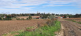

The route starts on Rue de Thumeries (D8), a few dozen metres past the Résidence de la Clorière on the outskirts of Moncheaux. You can park opposite number 610, where there are a few parking spaces.
(S) Head towards Thumeries and take the footpath (GR®121B) which veers to the right towards Mons-en-Pévèle. Stay on this path for about one kilometre.
(1) Carry on straight ahead along Rue de la Vaquerie (Mons-en-Pévèle). When you reach the chapel, turn left into Rue du 8 Mai. Just before the football pitches, take the Voie Verte de la Pévèle (GR® de Pays Bassin Minier Nord) on the left. This path runs parallel to Rue Émile Zola (D954). Cross the D54 carefully, staying on the Voie Verte. You can see the Cité Henri Beghin on your left. Leave the Voie Verte to the right, crossing the D954 to reach the car park at the Cinq Tailles Bird Observatory.
(2) Cross the car park to reach the path leading into the woods. There is a forest information kiosk at the entrance to the woods. Follow the path, then turn left. You’ll cross the Marque. Turn right, then left. You’ll walk alongside the Étang des Cinq Tailles, which is on your right. With a bit of luck, you might spot some ducks or coots. Carry on straight ahead for almost a kilometre, until you reach the first houses.
(3) Take Rue des Tilleuls on the left and join Rue Jean Jaurès. Follow the road to the right for 50 metres and cross it carefully (be careful, there is no pedestrian crossing). At the flowerbed with “Wahagnies” written in large letters, take the path on the left through a small gate. You’ll reach Rue du Général de Gaulle; turn left onto it. Walk down the street (heading south-east) until you reach Chemin des Moulins, which branches off to the left. Stay on this path for about one kilometre, until you reach the end of the road.
(4) When you reach the hamlet of La Fabrique, turn left onto Rue Roger Salengro. Follow this street for about 500 metres until you reach the D54. Head to the Thumeries town hall car park and cut diagonally across it to reach Rue Léon Blum, then Rue Defretin, which runs perpendicular to it. This street is more of a narrow lane. After about 80 metres, turn right onto a path that passes through the Clos du Verger.
(5) You are now at the Résidence des Hortensias and will stay on this path for almost three kilometres; it crosses Thumeries, heading almost straight south-east. You’ll pass the Résidence Desrousseaux, after which the path becomes Rue de la Baverie. You’ll pass through the Résidence les Mésanges, the Résidence les Tourterelles, the Résidence du Paradis and the Résidence du Thélus in turn, then cross Rue Pierre Brossolette at the Café du Thélut. The path veers slightly to the left, becoming Rue Jean Moulin; it runs past the stadium, then becomes Rue de la Ruchonnette. At the end of the street, cross Rue de la Pétrie and you’ll find yourself on a path that crosses the fields. Carry on straight ahead and cross Rue de l’Olizier to reach the Voie Verte du Sucre. This path runs parallel to the D8 and, after about 500 metres and having passed near the Château du Bellincamp, will take you to the finish point (S/E).


 Visorando Member
 Moderate
 Difficult