


 Country:

 City:


To start the route, head to Râches and look for its lock (now out of use) on Route de Tournai, D917.
There is a small car park nearby, about 20 metres away, where you can park.
(S/E) Once at the canal bank, head due east along the greenway beside the canalised Scarpe.
On the path, the Scarpe will be on your left and the fields on your right, all the way to Marchiennes.
(1) Cross the Lallaing bridge (Rue des Poilus – D8) and continue along the canal on the same bank.
(2) Pass by a lock and shortly afterwards reach a metal bridge (Chemin des Tourbières).
(3) Carry on straight ahead. Shortly afterwards, you’ll pass some old peat bogs (on your right).
(4) On the other side of the Scarpe lies the Germigny slag heap. Carry on along the canal.
(5) Cross the bridge leading to Vred and carry on along the canal.
(6) The Rieulay slag heap. Carry on along the canal on the banks of the Scarpe as far as Marchiennes with its lock (which is no longer in use).
(7) Go under the bridge and carry on along the River Scarpe.
(8) At the black-painted metal bridge (formerly a railway bridge), turn left to cross the Scarpe via this iron bridge. Get a running start – the climb is short but steep.
Take the greenway on the left.
(9) Ride past the old station as you enter Marchiennes.
(10) As you leave the cycle path, take the road on the right (D35, Rue d’Elpret) and continue along the D35.
(11) After crossing the Courant du Décours, you’ll reach the hamlet of Elpret.
The road continues; cross over the Courant de Coutiches stream and you’ll find a path starting on the left a few metres further on.
(12) Take the road on the left, just before the Notre Dame d’Elpret wayside shrine. Carry on straight ahead until you enter the Marchiennes Forest.
Carry on straight ahead until you reach the La Croix or Pile pub, and stop (or not) for a drink…
(13) Turn left after the pub onto Chemin du Bon Ballon. Carry on straight ahead until you leave the forest and reach a main road (D957).
(14) Take Rue du Houblon, which veers slightly to the left opposite.
''From here on, you’ll be travelling along country lanes and through villages.
''
(15) At the junction, turn left onto Rue du Pont du Houblon and continue along Rue Neuve. You’ll reach Saint-Maurice Church in Bouvignies.
(16) Head right onto Rue de la Chapelle (D30C).
(17) At the D30, head slightly to the right, then immediately turn left onto the D30 (Rue du Fief). Take the first left.
(18) Follow Rue Haute as far as La Quesnée.
(19) Take thefirst right, Rue du Vert Chemin (the track isn’t great, but thankfully it’s short).
(20) At the end of the track, first turn left then right and carry on straight ahead to the left along Rue du Bru (D230), passing a wayside cross on your left. You’ll soon cross the Courant de Coutiches (red bridge).
(21) In the village of Le Bru, carry on straight ahead. Leave the village, and take care at the next few junctions. Pass the power lines and take the first left.
(22) Take the road on your left, Grand’Rue, and carry on until you reach the Stop sign.
(23) Turn right onto Rue du Parc.
(24) At the junction, carry on to your right onto Rue Pierre Brossolette (D35). Follow this road to the roundabout.
(25) Take thefirst exit on the right (D35A, Chemin du Moulin), thenthe first on the left, Rue Dulieu.
(26) Carry on to the left onto Rue Gabriel Péri, continuing straight ahead, then carry on onto Rue de l’Abbaye. The road curves to the left, still on Rue de l’Abbaye. Carry on, following the road straight ahead.
At the large junction, take Rue de Flines.
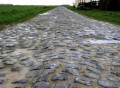
(27) At the roundabout, carry on straight ahead (2nd exit) along Rue du Pont de Baillon to the end (please note: the road is cobbled).
(28) Take thefirst left (country lane) and follow the La Raches stream.
(29) Carry on along the track until you reach Rue du Vert Debout in Râches, then enter the town.
(30) Turn left onto a small road (Quai du Canal). Carry on straight ahead until you reach the canal, then turn right and you’ll come to the lock on the Scarpe (S/E).

 Visorando Member


 Difficult
 Easy

