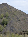
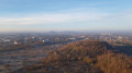
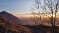
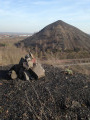
Slag heaps 87 and 92 in Dourges

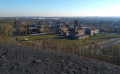
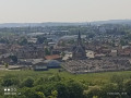
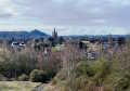
A route that will take you to the Sainte-Henriette slag heap, the landmark that marks the entrance to the mining basin when approaching from Paris, visible from the TGV line and the A1 and A21 motorways. You’ll climb its neighbouring ‘little brother’ and enjoy a superb view. Not to be missed.

Details

1804080
Creation:
Last update:
Last review:
  • Walking
    Activity: Walking
  • ↔
    Distance: 3.15 mi
  • ◔
    Average duration: 1h 40 
  • ▲
    Difficulty: Easy

  • ⚐
    Back to start: Yes
  • ↗
    Ascent: + 217 ft
  • ↘
    Descent: - 220 ft

  • ▲
    Highest point: 289 ft
  • ▼
    Lowest point: 98 ft

Photos

Description of the walk

Head to 171 Rue Émile Zola in Dourges. Park in the Bioshop car park in the shopping area.

(S/E) Leave the car park by taking Rue Émile Zola north-east, turning left as you exit the car park.
Walk up the street until you reach the bend.

(1) Take the path on the left; an embankment has been built at the entrance and may seem off-putting, but it is there to prevent access by motor vehicles.
Continue towards the conical slag heap along the ‘trame verte’, a wide, well-maintained path. You’ll reach a four-way junction.

(2) Take the path on the left towards the small slag heap, walking alongside it whilst keeping it on your right. Continue westwards, moving away from the slag heap. Turn right at the second junction and head back towards the Petit Frère slag heap. You’ll reach a crossroads at the foot of it.

(3) Take the path on the right to climb the slag heap. The path winds its way up to the top. Then head back down the same way to return to the crossroads.

(3) This time, turn right; the path opens out as you head towards the other slag heap.
Further on, cross the greenway and head straight ahead; you’ll very quickly reach another junction.

(4) Take the left-hand path, heading away from the slag heap. The path gradually veers to the right, heading back towards the slag heap.
Stay on the path and walk round the Sainte-Henriette slag heap in a clockwise direction. To the south of the slag heap, you’ll reach the four-way junction you passed earlier.

(2) Follow the same route as on the way there to easily return to the Bioshop car park (S/E).

Waypoints

  1. S/E : mi 0 - alt. 105 ft - Bioshop car park
  2. 1 : mi 0.19 - alt. 108 ft - Junction with Rue Emile Zola, site entrance
  3. 2 : mi 0.37 - alt. 112 ft - Crossroads of the circular loop
  4. 3 : mi 1.77 - alt. 112 ft - Crossroads at the foot of the Petit Frère slag heap
  5. 4 : mi 2.08 - alt. 128 ft - Junction of the circular Grand Terril loop
  6. S/E : mi 3.15 - alt. 105 ft - Bioshop car park

Notes

Please note: Some people regardthe site as a rubbish dump. Do not take this route with people who could get hurt. I am sharing this walk, which may seem a bit disconcerting given how abandoned the place appears, because it is time for walkers to reclaim this historic site.

You are at a UNESCO World Heritage Site; please take your rubbish away with you, and observe but do not disturb the flora and fauna so unique to the mining basin.

Bring your binoculars and camera for the views.

You are in a historic site; respect its heritage and discover the traces of the past.

Worth a visit

If you want to take part in the UNESCO Slope Challenge (51 slag heaps to climb) or just for fun, you can take a selfie at the top of the slag heap and share it using #terrilmania and @terrilmania on Instagram or by emailing defiterril@gmail.com.

You can also add your own stone to the cairn (pile of stones) at the top of the slag heap and mark your visit to the summit for ever.

Reviews and comments

3.7 / 5
Based on 4 reviews

Reliability of the description
3.5 / 5
Ease of following the route
4 / 5
Route interest
3.5 / 5
D.L.
D.L.

Overall rating : 4.7 / 5

Date of your route : Apr 09, 2026
Reliability of the description : ★★★★★ Very good
Ease of following the route : ★★★★☆ Good
Route interest : ★★★★★ Very good
Very busy route : Yes

It’s more of a stroll than a proper hike, but you can combine it with other short walks around the nearby slag heaps. The highlight is that you walk around one of Europe’s tallest slag heaps (the Sainte Henriette slag heap) and climb the adjacent Slag Heap 92, which is not as high but offers some lovely views. The site is a bit isolated, and whilst you do come across people out for a walk, you’ll certainly feel safer if you’re not on your own.

Machine-translated

Michel D2.
Michel D2.

Overall rating : 4 / 5

Date of your route : Sep 08, 2025
Reliability of the description : ★★★★☆ Good
Ease of following the route : ★★★★☆ Good
Route interest : ★★★★☆ Good
Very busy route : No

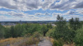
A pleasant walk around the two slag heaps, with quite a few large puddles as the path is made of shale. Beautiful 360° view from the small slag heap over St Henriette and the surrounding area. The route runs alongside the A21 motorway and the TGV line, crossing paths towards Heine station and Cité Bruno.
No more signs of illegal dumping, just a few young people on motorbikes on a tarmac path.

Machine-translated

krysboy
krysboy

Overall rating : 2 / 5

Date of your route : Apr 16, 2021
Reliability of the description : ★☆☆☆☆ Very disappointing
Ease of following the route : ★★★★☆ Good
Route interest : ★☆☆☆☆ Very disappointing
Very busy route : No

Best avoided on your own as it’s quite unsafe. Rubbish and burnt-out cars, all sorts of rubbish…

Machine-translated

Stinette
Stinette

Overall rating : 4 / 5

Date of your route : May 17, 2020
Reliability of the description : ★★★★☆ Good
Ease of following the route : ★★★★☆ Good
Route interest : ★★★★☆ Good
Very busy route : Yes

An interesting walk for anyone wishing to climb the slag heaps. Unfortunately, as mentioned in the description, the site serves as an open-air rubbish tip, which spoils the landscape. It is also a meeting place for motocross riders and quad bikers, who, regrettably, are rather reckless and show little regard for pedestrians. It’s a shame, as the site really deserves to be redeveloped.

Machine-translated

Other walks in the area

For more walks, use our search engine .

The GPS track and description are the property of this route's author. Please do not copy them without permission.