


Refine your search for walks in Saint-Jacques-d'Ambur
Saint-Jacques-d'Ambur walks


 Ambur-La Chazotte Castle
 Tourist office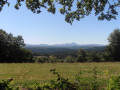
 7.74 mi
 +912 ft
 -915 ft
 4h 20
4h 20
 Moderate
 Departure from Saint-Jacques-d'Ambur (Puy-de-Dôme)
A walk through the heart of the Combrailles with views over the Fades-Besserve reservoir, a vast lake covering 385 ha.
Pont du Bouchet
 5.86 mi
+955 ft
-968 ft
3h 30
Moderate
Departure from Miremont (Puy-de-Dôme) (Puy-de-Dôme)
5.86 mi
+955 ft
-968 ft
3h 30
Moderate
Departure from Miremont (Puy-de-Dôme) (Puy-de-Dôme)
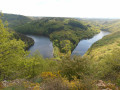
Between steep-sided valleys, unspoilt wilderness and wooded slopes, the Sioule has become a lake thanks to the Fades-Besserve dam. It accompanies us throughout the route with beautiful views of the Sioulet valley and the Combrailles.
La Chartreuse Port-Sainte-Marie
 4.13 mi
+627 ft
-623 ft
2h 25
4.13 mi
+627 ft
-623 ft
2h 25
 Easy
Departure from Les Ancizes-Comps (Puy-de-Dôme)
Easy
Departure from Les Ancizes-Comps (Puy-de-Dôme)
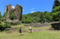
This route will take you to the ruins of the Chartreuse du Port-Sainte-Marie, founded in 1219, passing by the banks of the Sioule and its meanders.
Chartreuse State Forest
 9.87 mi
+938 ft
-938 ft
5h 20
Moderate
Departure from Montfermy (Puy-de-Dôme)
9.87 mi
+938 ft
-938 ft
5h 20
Moderate
Departure from Montfermy (Puy-de-Dôme)
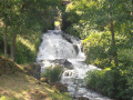
This is a lovely walk through the Sioule Valley, remarkable for its scenery and the diversity of its natural habitats. You’ll enjoy the beautiful Montfermy waterfall and the unobstructed views of the volcanoes of the Chaîne des Puys.
The Chemin Fais'Art
 4.11 mi
+459 ft
-459 ft
2h 15
Easy
Departure from Chapdes-Beaufort (Puy-de-Dôme)
4.11 mi
+459 ft
-459 ft
2h 15
Easy
Departure from Chapdes-Beaufort (Puy-de-Dôme)
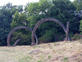
Since 1992, this pleasant walk has invited visitors to stroll among Gilles Perez's monumental contemporary lava stone sculptures, which blend in with the landscape and nature. Additional sculptures have been added over the years.
Les Eaux Minérales in Saint-Priest-des-Champs
 Visorando Member
 3.11 mi
+407 ft
-436 ft
1h 45
Moderate
Departure from Saint-Priest-des-Champs (Puy-de-Dôme)
3.11 mi
+407 ft
-436 ft
1h 45
Moderate
Departure from Saint-Priest-des-Champs (Puy-de-Dôme)
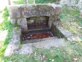
A pleasant, short, shaded walk, mainly through woodland, with a point of interest to discover: the site known as Eaux Minérales (a source of iron-rich water, not commercially exploited but showcased).
No major difficulty; just a slight elevation gain, with a fairly steep slope at the end of the route.
A particularly refreshing walk in summer as it is largely under the cover of trees.
The Sioulet Gorges
 4.49 mi
+387 ft
-390 ft
2h 25
Easy
Departure from Pontaumur (Puy-de-Dôme)
4.49 mi
+387 ft
-390 ft
2h 25
Easy
Departure from Pontaumur (Puy-de-Dôme)
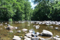
Leaving the village of Pontaumur, you will discover the Sioulet, a tributary of the Sioule and a paradise for trout fishermen. The wild gorges will delight lovers of unspoilt nature.
The solidified lava flow at Pontgibaud
 4.51 mi
+384 ft
-381 ft
2h 25
Easy
Departure from Pontgibaud (Puy-de-Dôme)
4.51 mi
+384 ft
-381 ft
2h 25
Easy
Departure from Pontgibaud (Puy-de-Dôme)
From Pontgibaud and the beautiful medieval architecture of Château Dauphin, you will travel through the mysterious landscapes of the Cheire de Pontgibaud, one of the most beautiful lava flows in the Chaîne des Puys.
La Saunade
 8.13 mi
+791 ft
-797 ft
4h 25
Moderate
Departure from Landogne (Puy-de-Dôme)
8.13 mi
+791 ft
-797 ft
4h 25
Moderate
Departure from Landogne (Puy-de-Dôme)
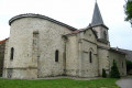
From Landogne church, follow the River Saunade for a pleasant walk through the unspoilt countryside of the Combrailles. After ‘Les Vialles’, walking alongside a pond, you’ll be treated to a stunning 360° panoramic view of the Combrailles and the Chaîne des Puys.
The Gour Saillant waterfall
 2.07 mi
+433 ft
-440 ft
1h 20
Easy
Departure from Saint-Priest-des-Champs (Puy-de-Dôme)
2.07 mi
+433 ft
-440 ft
1h 20
Easy
Departure from Saint-Priest-des-Champs (Puy-de-Dôme)
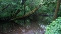
A short round trip to enjoy the beautiful Gour Saillant waterfall.
Besserve and Sioule
 6.10 mi
+1,043 ft
-1,053 ft
3h 45
Moderate
Departure from Sauret-Besserve (Puy-de-Dôme)
6.10 mi
+1,043 ft
-1,053 ft
3h 45
Moderate
Departure from Sauret-Besserve (Puy-de-Dôme)
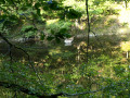
From the charming village of Sauret-Besserve, the route descends to the banks of the Sioule and the pretty Cascade des Trois Cuves waterfall. This walk offers numerous breathtaking views of the valley and ends on the wild plateaus of the Combrailles.
Hamlets in the northern Ursinian countryside
9.84 mi
+722 ft
-735 ft
5h 10
Moderate
Departure from Saint-Ours (Puy-de-Dôme)
A circular route starting from Saint-Ours, through the hamlets of the Saint-Ours countryside between Combrailles and the Chaîne des Puys, featuring a pleasant section through the forest and a visit to an old pozzolan quarry.
The solidified lava flow of Tournebise
 2.25 mi
+49 ft
-49 ft
1h 05
Easy
Departure from Saint-Pierre-le-Chastel (Puy-de-Dôme)
2.25 mi
+49 ft
-49 ft
1h 05
Easy
Departure from Saint-Pierre-le-Chastel (Puy-de-Dôme)
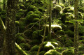
A breathtakingly beautiful walk through the mysterious world of solidified lava flows, with their chaotic piles of slag, mosses and lichens. Here you’ll discover the remains of a mysterious medieval settlement, the Camp des Chazaloux.
Summit and tour of Puy de Louchadière
9.03 mi
+1,631 ft
-1,608 ft
5h 35
Moderate
Departure from Saint-Ours (Puy-de-Dôme)
Contrasting landscapes of meadows and forests for this circular tour to discover the Puy de Louchadière, on the edge of the Combrailles.Please note! A GPS device is useful for following this hike in the forest sections. Also, be sure to follow the map rather than the various markings encountered along the route.
Hamlets in the southern Ursinian countryside
10.78 mi
+758 ft
-758 ft
5h 35
Moderate
Departure from Saint-Ours (Puy-de-Dôme)
A double loop around Saint-Ours-les-Roches to discover the typical hamlets of this region of the Combrailles, at the foot of the Chaîne des Puys.
From the Marais de Paloux to the solidified lava flow of Tournebize
 4.60 mi
+381 ft
-377 ft
2h 25
Easy
Departure from Saint-Pierre-le-Chastel (Puy-de-Dôme)
4.60 mi
+381 ft
-377 ft
2h 25
Easy
Departure from Saint-Pierre-le-Chastel (Puy-de-Dôme)
A lovely walk offering the chance to explore the superb Marais de Paloux, a designated Sensitive Natural Area, and leading to the chaotic solidified lava flow of Tournebize, formed from the lava of the Puy de Côme.
In the Saint-Ours area from Beauloup
6.31 mi
+404 ft
-427 ft
3h 15
Easy
Departure from Saint-Ours (Puy-de-Dôme)
A short hike allowing you to discover many examples of well-preserved built heritage in the hamlets: fountains, wash houses, crosses, and the Louchadière water catchment, passing through woods and meadows.
The Hill and Marshes of Saint-Pierre-le-Chastel
 3.29 mi
+233 ft
-233 ft
1h 45
Easy
Departure from Saint-Pierre-le-Chastel (Puy-de-Dôme)
3.29 mi
+233 ft
-233 ft
1h 45
Easy
Departure from Saint-Pierre-le-Chastel (Puy-de-Dôme)
This Sensitive Natural Area features a variety of habitats. A 50-metre difference in altitude separates the granite hill of Saint-Pierre-le-Chastel from the marsh.
You’ll be able to discover unrivalled flora and fauna.
Take the time to observe and learn more from the information boards along the trail.
La Roche de Sauterre
 2.58 mi
+338 ft
-341 ft
1h 30
Easy
Departure from Manzat (Puy-de-Dôme)
2.58 mi
+338 ft
-341 ft
1h 30
Easy
Departure from Manzat (Puy-de-Dôme)
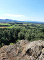
La Roche de Sauterre offers a beautiful location for observing the surroundings and the majestic alignment of the Chaîne des Puys. This basalt peak, the result of volcanic activity, contains inclusions of peridotite, a semi-precious stone.
Former quarry at Puy de l'Espinasse
7.81 mi
+499 ft
-492 ft
4h 00
Moderate
Departure from Saint-Ours (Puy-de-Dôme)
A hike on the Combrailles side of the Chaîne des Puys, an area less frequented by summer crowds, to discover an old pozzolan quarry and its biotope. Along the way, you will encounter the inhabitants of the pastures and the woods.
How to tackle a 1,500-metre climb in the Chaîne des Puys
19.83 mi
+5,236 ft
-4,675 ft
13h 40
 Very difficult
Departure from Saint-Ours (Puy-de-Dôme)
Very difficult
Departure from Saint-Ours (Puy-de-Dôme)
How do you cover a bit over 1,500 metres of elevation gain in the Chaîne des Puys, which, to true mountaineers, are nothing more than hills? By walking just over 30 km from the Louchadière hikers’ car park to the Col de Ceyssat, passing via the summits of eight puys: Louchadière, Jume, Coquille, Gouttes, Goules, Pariou, Cliersou and Dôme. This is therefore a one-way hike, requiring you to leave a vehicle at the Col de Ceyssat before returning to the starting car park. The route is challenging due to its length and elevation gain, but presents no technical difficulties. Some sections on unmarked forest paths require the use of the Visorando app. It would be unwise to get lost over such a long distance.
The Artists’ Forest of Puys de Tressous
7.88 mi
+535 ft
-561 ft
4h 05
Moderate
Departure from Saint-Ours (Puy-de-Dôme)
A circular route mostly through a beautiful beech forest, allowing you to explore the lovely site of the Puy de Tressous sculptures, as well as the old quarry sites. Allow a good hour to visit the ‘artist’s forest’ in addition to the time indicated for the route.
Puy de Louchadière circular country loop
5.66 mi
+1,102 ft
-1,102 ft
3h 35
Moderate
Departure from Saint-Ours (Puy-de-Dôme)
A circular route on the border between the Combrailles and the Chaîne des Puys, in the countryside around Saint-Ours, passing by the summit of Puy de Louchadière, offering a beautiful viewpoint, and the lovely beech forest covering its slopes.
The Visorando app is highly recommended in the Louchadière forest.
The Puys de Jumes and La Coquille
8.03 mi
+1,079 ft
-1,089 ft
4h 40
Moderate
Departure from Saint-Ours (Puy-de-Dôme)
The Sioule Gorges
 11.48 mi
+1,893 ft
-1,893 ft
6h 55
Moderate
Departure from Saint-Gervais-d'Auvergne (Puy-de-Dôme)
11.48 mi
+1,893 ft
-1,893 ft
6h 55
Moderate
Departure from Saint-Gervais-d'Auvergne (Puy-de-Dôme)
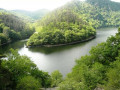
In a sumptuous setting, dominated on one side by the imposing Château de Chouvigny and on the other by the ghostly Château Rocher, you will discover a route that is well worth a detour for its fishing and tourist attractions.
Green markings
A circular route around the Puys de Jume, de la Coquille and des Gouttes, starting from Beauregard
7.15 mi
+1,325 ft
-1,325 ft
4h 25
Moderate
Departure from Saint-Ours (Puy-de-Dôme)
A beautiful and pleasant walk, mostly through woodland at altitudes between 900 and 1,165 metres. The route takes you over the Puys de Jume and Coquille, with their lovely views. Suitable for all seasons and ideal during the warmer months.
Route of the Puys de Louchadière, Jume and La Coquille
 8.38 mi
+1,775 ft
-1,778 ft
5h 25
Moderate
Departure from Saint-Ours (Puy-de-Dôme)
8.38 mi
+1,775 ft
-1,778 ft
5h 25
Moderate
Departure from Saint-Ours (Puy-de-Dôme)
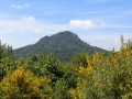
This route allows you to discover three ancient volcanoes in the Chaîne des Puys.
Puy des Gouttes circular route from Beauregard
6.35 mi
+787 ft
-797 ft
3h 35
Moderate
Departure from Saint-Ours (Puy-de-Dôme)
A beautiful and pleasant walk, mostly through woodland at an altitude of between 900 and 1,100 metres. Suitable for all seasons and ideal during hot weather. From the Puy des Gouttes viewpoint, there are breathtaking views of the Puy de Dôme, the Combrailles, Vulcania and the Puy de Lemptéguy (an open-air volcano).
Stream, marsh and village of Mazaye, via Rey de Saint-Pierre
5.71 mi
+581 ft
-581 ft
3h 10
Easy
Departure from Mazaye (Puy-de-Dôme)
Circular loop starting from the village of Mazaye Basse, passing by the Rey de Saint-Pierre, a basalt promontory overlooking the Sioule valley and offering a beautiful panorama of the Sancy Massif and the Chaîne des Puys, then crossing the Marais de Mazaye, a Sensitive Natural Area, via a path built on stilts.
The Mills Route in Saint-Gervais-d’Auvergne
 6.69 mi
+614 ft
-607 ft
3h 35
Moderate
Departure from Saint-Gervais-d'Auvergne (Puy-de-Dôme)
6.69 mi
+614 ft
-607 ft
3h 35
Moderate
Departure from Saint-Gervais-d'Auvergne (Puy-de-Dôme)
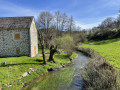
A magnificent route that will take you to the banks of the Chalamont, passing by Neuvialle Castle.
Route of the two ponds in Saint-Gervais d'Auvergne
 5.77 mi
+348 ft
-364 ft
2h 55
Easy
Departure from Saint-Gervais-d'Auvergne (Puy-de-Dôme)
5.77 mi
+348 ft
-364 ft
2h 55
Easy
Departure from Saint-Gervais-d'Auvergne (Puy-de-Dôme)
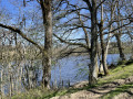
A pleasant route allowing you to discover the Moulin de l’Arche and the Étang du Masmont, before finishing the walk with the relaxing circular loop around Étang Philippe.
⚠️ Between (4) and (5): herd of goats and mountain dogs in a fenced enclosure. Keep pets securely on a lead and avoid any sudden movements.
Tour of Puy de Côme via Bacs de Ceyssat
5.02 mi
+581 ft
-574 ft
2h 50
Easy
Departure from Saint-Ours (Puy-de-Dôme)
A short circular forest loop around Puy de Côme, whose summit is unfortunately not accessible. The route passes by the Bacs de Ceyssat site, a pretty series of drinking troughs (les bacs) fed by a fountain, installed via an aqueduct for sheep.
Solidified lava flow and Tour de Côme via Les Bacs de Ceyssat
6.19 mi
+528 ft
-535 ft
3h 20
Easy
Departure from Saint-Ours (Puy-de-Dôme)
An ideal forest walk for hot days, circling Puy de Côme via the Bacs de Ceyssat, watering holes once used by the sheep that used to graze here. In season, you’ll find raspberries, columbines, gentians, martagon lilies...
The Signed Rock of the Cheire de Côme
8.16 mi
+472 ft
-472 ft
4h 10
Moderate
Departure from Saint-Ours (Puy-de-Dôme)
A hike entirely in the forest, in the unique landscape of the Cheire de Côme. You will be left to your own devices in this mysterious forest, on small unmarked paths for part of the route, wherethe Visorando app is almost essential. The Signed Stone is an enigma, perhaps you can try to solve it.
Puy de Côme via the Comet Route
10.14 mi
+873 ft
-869 ft
5h 25
Moderate
Departure from Saint-Ours (Puy-de-Dôme)
On this comet-shaped route, discover the solidified lava flow of Côme, a remarkable natural area in the Chaîne des Puys. This lava flow from the Puy de Côme, which stretches for almost 10 km, has solidified into extremely chaotic terrain and has been colonised by a beautiful forest of birch and beech trees. To extend this hike, I suggest you then walk around the Puy de Côme, through the beech forest that covers its slopes.
Three small volcanic hills in a row (puys)
8.55 mi
+1,319 ft
-1,309 ft
5h 05
Moderate
Departure from Orcines (Puy-de-Dôme)
"Human noise becomes silent, nature makes volcanoes chatter; whispering landscapes, and whispering a thousand voices of silence". Caption of the beautiful sculpture by Thierry Courtadon that you will encounter on your route, alongside with great viewpoints.
Puy de Jume and Puy de la Coquille
 7.32 mi
+938 ft
-915 ft
4h 10
Moderate
Departure from Orcines (Puy-de-Dôme)
7.32 mi
+938 ft
-915 ft
4h 10
Moderate
Departure from Orcines (Puy-de-Dôme)
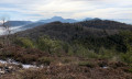
This route starts at the Vulcania crossroads and begins with a long, fairly flat, open path before crossing the forest to reach these two magnificent volcanoes.
The route can be done in either direction.
Springs and banks of the Sioule in Châteauneuf-les-Bains
6.01 mi
+623 ft
-617 ft
3h 20
Easy
Departure from Châteauneuf-les-Bains (Puy-de-Dôme)
Discover Châteauneuf-les-Bains, a little-known spa resort in the Puy-de-Dôme, located on the banks of the Sioule.
The Ceyssat tanks via the solidified lava flow of Côme
8.74 mi
+761 ft
-732 ft
4h 40
Moderate
Departure from Ceyssat (Puy-de-Dôme)
The hike takes place mainly in the woods that cover the cheire, or solidified lava flow, of the Puy de Côme. In addition to the Bacs de Ceyssat, you will discover many other drinking troughs, fountains and wash houses in the village. There are a few views of the Puy de Dôme and Puy de Côme.
White water walk in Ceyssat
1.25 mi
+85 ft
-82 ft
0h 40
Easy
Departure from Ceyssat (Puy-de-Dôme)
In the village of Ceysat, there are numerous hydraulic structures: ponds, fountains, drinking troughs, wash houses, all made of Volvic stone, and even a mineral water spring!
Olby lime tree, Château d'Allagnat, springs and fountains
8.11 mi
+692 ft
-676 ft
4h 20
Moderate
Departure from Ceyssat (Puy-de-Dôme)
A walk mainly along small roads (very quiet) and paths to discover the small-scale heritage linked to water in a few hamlets and villages on the Plateau des Dômes, which are also rich in traditional houses, often beautifully restored. Along the way, you’ll also discover a Sully lime tree and a Troubadour-style castle (which is best seen in winter).
Solidified lava flow of Côme from Ceyssat
10.93 mi
+869 ft
-863 ft
5h 45
Moderate
Departure from Ceyssat (Puy-de-Dôme)
The hike takes place mainly in the forest that covers the solidified lava flow of Puy de Côme, but there are some beautiful views on the outskirts of Ceyssat. In the village of Ceyssat, discover the Foker Spring and a rich heritage of water-related buildings: fountains, drinking troughs and wash houses.
The Montmeyre and Ceyssat ferries
6.42 mi
+564 ft
-564 ft
3h 25
Easy
Departure from Ceyssat (Puy-de-Dôme)
Short hike to discover the bacs, which are drinking troughs built on the solidified lava flow of Côme for the sheep that were once raised on these summer pastures. The Bacs de Montmeyre were also a favourite site for the Ardents, Resistance fighters from the Chaîne des Puys. A sign tells their story and a memorial stone has been erected in their memory. The route crosses countryside and forest and allows you to discover the small heritage linked to water in the village of Ceyssat.
Hills and banks of the Sioule at Ayat
6.16 mi
+807 ft
-833 ft
3h 30
Easy
Departure from Ayat-sur-Sioule (Puy-de-Dôme)
A circular route through the Ayat countryside, overlooking the Sioule valley, with a long section running along a balcony path above the river
The Huit Croix (eight crosses)
 7.31 mi
+850 ft
-856 ft
4h 05
Moderate
Departure from Vergheas (Puy-de-Dôme)
7.31 mi
+850 ft
-856 ft
4h 05
Moderate
Departure from Vergheas (Puy-de-Dôme)
A hike between rivers and woodland hills, in the Combrailles region.
The Four Crosses Route in Vergheas
 3.61 mi
+400 ft
-371 ft
2h 00
Easy
Departure from Vergheas (Puy-de-Dôme)
3.61 mi
+400 ft
-371 ft
2h 00
Easy
Departure from Vergheas (Puy-de-Dôme)
A hike in the Combrailles, amongst valleys and hills – on foot, by bike or on horseback – come and explore this green haven.
The domes loop - Southern section
 15.94 mi
+1,693 ft
-1,686 ft
8h 50
15.94 mi
+1,693 ft
-1,686 ft
8h 50
 Difficult
Departure from Ceyssat (Puy-de-Dôme)
Difficult
Departure from Ceyssat (Puy-de-Dôme)
The southern loop, to be covered on the first day, is easy going except for its length, which is nearly 27 km.
This route passes through numerous hills, beautiful forests and the lovely countryside surrounding the hills. Be careful not to get your feet caught in the strings!
The two-day dome loop
 33.14 mi
+4,088 ft
-4,085 ft
2 days
Difficult
Departure from Ceyssat (Puy-de-Dôme)
33.14 mi
+4,088 ft
-4,085 ft
2 days
Difficult
Departure from Ceyssat (Puy-de-Dôme)
A two-day loop hike with accommodation in a camper van in Allagnat.
The loop of domes - Northern section
 17.19 mi
+2,395 ft
-2,392 ft
10h 00
Difficult
Departure from Ceyssat (Puy-de-Dôme)
17.19 mi
+2,395 ft
-2,392 ft
10h 00
Difficult
Departure from Ceyssat (Puy-de-Dôme)
After a moderate day's hiking, you are now in the most demanding part of the loop of domes, with magnificent views of the Puy de Côme, the Grand Knoll, the Petit Knoll and the Puy de Dôme. You will pass through beautiful forests of beech, conifer and hazel trees, a feast for the eyes!
Circular route of the wells and Sainte-Agathe from Blot-l'Église
12.91 mi
+1,286 ft
-1,283 ft
7h 05
Difficult
Departure from Blot-l'Église (Puy-de-Dôme)
While further south in Auvergne, water is brought to villages by fountains, here it is provided by numerous public and private wells, which you can enjoy discovering in the hamlets along this circular route in the Blot region, on the heights of the Morge. You will also discover an oratory and a chapel, both dedicated to Saint Agatha.
Puy de Dôme - Petit knoll - Le Cliersou - Puy Pariou
6.46 mi
+1,775 ft
-2,113 ft
4h 30
Moderate
Departure from Ceyssat (Puy-de-Dôme)
A pleasant, easy walk in the Chaîne des Puys. There are magnificent views of the Puy de Dôme to admire.This walk requires two cars.
The Puy de Dôme via the Chemin des Chèvres
 4.86 mi
+1,368 ft
-1,368 ft
3h 25
Moderate
Departure from Orcines (Puy-de-Dôme)
4.86 mi
+1,368 ft
-1,368 ft
3h 25
Moderate
Departure from Orcines (Puy-de-Dôme)
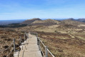
The view is as lovely as ever at the top of this legendary route. A longer climb, but more enjoyable and varied than the ascent via the Sentier des Muletiers.
The Puy de Dôme and Puy Pariou via the Chemin des Chèvres
7.23 mi
+1,955 ft
-1,936 ft
5h 00
Moderate
Departure from Orcines (Puy-de-Dôme)
A stunning view of two of the Puys’ most iconic peaks. The climb is longer from this side, but more pleasant and varied than the ascent via the Sentier des Muletiers.
Puy-de-Dôme passing through the col de Ceyssat
 3.39 mi
+1,286 ft
-1,257 ft
2h 40
Moderate
Departure from Orcines (Puy-de-Dôme)
3.39 mi
+1,286 ft
-1,257 ft
2h 40
Moderate
Departure from Orcines (Puy-de-Dôme)
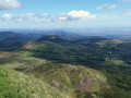
Just above Clermont-Ferrand, the inescapable climb to Puy-de-Dôme through the col de Ceyssat is a short but intense hike with an astonishing view over Clermont-Ferrand, the chaîne des Puys, paragliders and Millevaches.
Caution, it's a very popular walk so be sure to do it during week days for a bit of peace and quiet.
Puy-de-Dôme via the Sentier des Muletiers trail
 2.57 mi
+1,135 ft
-1,135 ft
2h 10
Moderate
Departure from Orcines (Puy-de-Dôme)
2.57 mi
+1,135 ft
-1,135 ft
2h 10
Moderate
Departure from Orcines (Puy-de-Dôme)
The Sentier des Muletiers, comprising fifteen numbered bends spread over the 350-metre climb to the summit of the Puy de Dôme, is the ancient path that led pilgrims to the Temple of Mercury. It offers superb panoramic views throughout the ascent, taking in the entire 45 km stretch of the Chaîne des Volcans.
On the Ardents trails
9.35 mi
+892 ft
-883 ft
5h 05
Moderate
Departure from Orcines (Puy-de-Dôme)
For hot summer days, this route is almost exclusively in the forest, at the foot of the volcanoes, following in the footsteps of the heroes of the Auvergne Resistance. A few crossings of meadows will offer you beautiful views of the Puy de Dôme.
More walks in Saint-Jacques-d'Ambur
Select a point of interest below: