


 Country:

 City:
City:


From Clermont-Ferrand, take the D941 towardsOrcines, then the D942 towards the Puy de Dôme, then on to the Col de Ceyssat. Car park in front of the two restaurants.
Signposting: Yellow, Puy de Dôme via the Chemin des Chèvres.
(S/E) From the car park, take the path that climbs above the two restaurants; leave the Chemin des Muletiers on your right – this is the return route – and head due north, following the stone path which then turns to a dirt track winding through a beech forest. Continue along the natural path due north until you reach a clearing.
(1) Carry on straight ahead along the natural path and enter the forest. At the junction with the GR®4, carry on straight ahead to reach the four-way junction, which includes the GR®441.
(2) Turn left onto the GR®, then leave it to turn right and continue across the Plateau du Traversin until you reach the junction with the return path on the right.
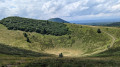
(3) Carry on straight ahead to Puy Pariou.
(4) Retrace your steps and return to the junction you passed earlier.
(3) Turn left, heading due south, and reach a junction with the GR®4. Take a few steps to the right to find the Fontaine du Traversin.
(5) Return to the path and turn right, heading south, onto the Chemin des Chèvres (GR®4 – GR®441). Climb this steep path, ignore the path on the left and continue to the steps.
(6) Climb the steps to the road and the “Panoramique des Dômes” rack railway line. Enjoy the view from the viewpoint.
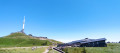
(7) At the road, turn left and walk uphill alongside the track. Just before the station, cross the railway line (watch out for trains), and walk up to the viewing platform above the station.
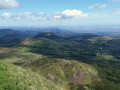
(8) Carry on to the right towards the Temple of Mercury, walk around the site and return to near the viewing platform. Enjoy the panoramic view of the Chaîne des Puys.
(9) To the right of the station, on the western side, the Chemin des Muletiers begins. Follow it; further down, it crosses the railway tracks and the road (take care). Continue straight ahead along the path, cross back over the path you took on the way there and reach the D68, then turn left towards the car park (S/E).
 Visorando Member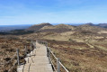

 Difficult
