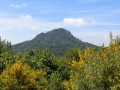
A circular route around the Puys de Jume, de la Coquille and des Gouttes, starting from Beauregard

A beautiful and pleasant walk, mostly through woodland at altitudes between 900 and 1,165 metres. The route takes you over the Puys de Jume and Coquille, with their lovely views. Suitable for all seasons and ideal during the warmer months.

Details

61357430
Creation:
Last update:
Last review:
  • Walking
    Activity: Walking
  • ↔
    Distance: 7.15 mi
  • ◔
    Average duration: 4h 25 
  • ▲
    Difficulty: Moderate

  • ⚐
    Back to start: Yes
  • ↗
    Ascent: + 1,325 ft
  • ↘
    Descent: - 1,325 ft

  • ▲
    Highest point: 3,783 ft
  • ▼
    Lowest point: 2,927 ft

Description of the walk

Village of Beauregard (municipality of Saint-Ours). Car park on the left at the village entrance. Access by car via the D943 then the D576.

(S/E) From the car park, head straight up the path (tarmacked at the start) for about 0.9 km, heading north-east to east, until you reach the crossroads featuring a sculpture (CHUT! by the Volvic-based artist Thierry Courtadon).

(1) Carry on straight ahead in the same direction for 1.7 km to the foot of the Puy de Jume, ignoring all the paths branching off to the left.

(2) At the “Pied de Jume” junction, ignore the path branching off to the right and continue along the path until you reach the junction with theGR®441.

(3) Follow theGR®441to the right and climb to the summit of the Puy de Jume. Enjoy the lovely views marked along the way.

(4) Continue south-west on theGR®, which descends to a pass before climbing again to the summit of the Puy de la Coquille.

(5) Continue south-west downhill.

(6) Go round the Puy de Clermont on the right, still following theGR® markings. At the foot of the Puy Chopine, continue to the right.

(7) For a round trip to the summit of the Puy des Gouttes, follow theGR®441to the left, leaving the path that heads straight on (which you’ll rejoin on the way back). At the viewing point on the Puy des Gouttes, take a moment to admire the sweeping panorama, with the Lemptégy Volcano (leisure park) and Vulcania at the foot of the hill. Behind them lie the Puy de Dôme, the Combrailles and, further in the distance, the Mille Vaches plateau.

(8) Head back down via the same route you took on the way up.

(7) Turn left to join a wide track, which forms part of theGR®4andGR®89routes.

(9) Turn right, ignore the first path on the right and follow the path on the left. Stay on theGR® until you reach Beauregard and the car park (S/E).

Waypoints

  1. S/E : mi 0 - alt. 2,927 ft - Beauregard car park
  2. 1 : mi 0.49 - alt. 3,104 ft - Crossroads – SHHH!
  3. 2 : mi 1.59 - alt. 3,264 ft - Pied de Jume
  4. 3 : mi 1.83 - alt. 3,376 ft - GR junction
  5. 4 : mi 2.35 - alt. 3,783 ft - Puy de Jumes
  6. 5 : mi 2.68 - alt. 3,734 ft - Puy de la Coquille
  7. 6 : mi 3.36 - alt. 3,412 ft - Junction
  8. 7 : mi 4.21 - alt. 3,346 ft - Junction
  9. 8 : mi 4.77 - alt. 3,648 ft - Puy des Gouttes
  10. 9 : mi 5.76 - alt. 3,241 ft - Junction
  11. S/E : mi 7.15 - alt. 2,927 ft - Beauregard car park

Notes

There is no shelter on the route. There are no water points.

Worth a visit

Whilst the Puy des Gouttes balcony offers a lovely panoramic view during the day, it can also be an ideal vantage point for a beautiful ‘sunset’ or for watching the Puy de Lemptégy fireworks from above on certain days (special evening events) during the summer season, or even those at Vulcania, with an easy night-time return journey (45 to 50 mins). Depending on the weather and the season, you may spot hot-air balloons and paragliders around the Puy de Dôme. To catch the sunset, arrive at least 15 to 20 mins before sunset.

Always be cautious and plan ahead when you're outdoors. Visorando and the author of this route cannot be held responsible for any accidents occurring on this route.

The GR® and PR® markings are the intellectual property of the Fédération Française de Randonnée Pédestre.

Reviews and comments

4.8 / 5
Based on 3 reviews

Reliability of the description
5 / 5
Ease of following the route
5 / 5
Route interest
4.3 / 5
DidierE
DidierE

Overall rating : 4.7 / 5

Date of your route : Aug 01, 2026
Reliability of the description : ★★★★★ Very good
Ease of following the route : ★★★★★ Very good
Route interest : ★★★★☆ Good
Very busy route : No

A lovely walk, mostly through woodland. The scenery is at its best at the Puy de la Coquille and the Puy des Gouttes. At the Puy des Gouttes, do make sure to go a little further than the suggested route to really take in the scenery.

Machine-translated

User 3480458

Overall rating : 4.7 / 5

Date of your route : Sep 10, 2025
Reliability of the description : ★★★★★ Very good
Ease of following the route : ★★★★★ Very good
Route interest : ★★★★☆ Good
Very busy route : No

A very pleasant route for hot weather as it is well shaded. We walk through beautiful forests with interesting openings at the highest points.
The highlight is undoubtedly the Puy des Gouttes, which offers a magnificent and sweeping panorama, the perfect place for a picnic break, reading or a nap.

Machine-translated

pierre huraux
pierre huraux

Overall rating : 5 / 5

Date of your route : Jul 09, 2025
Reliability of the description : ★★★★★ Very good
Ease of following the route : ★★★★★ Very good
Route interest : ★★★★★ Very good
Very busy route : No

NB: The car park at the start of the walk is signposted about 1 km before Beauregard: we stopped there. Bear this in mind for the return journey – it’s a wide, easy path, but there’s no shade!
The route is interesting, largely shaded, with a series of climbs and descents, and features numerous wooden steps – mainly on the descent when walking in this direction – on several occasions.
The paths are well-marked, and you must not stray from them. There are several interesting viewpoints. The return journey feels a bit long on this wide path, especially in direct sunlight.
GPS details: 14.8 km, 425 m ascent and descent, 5 hours 30 minutes.

Machine-translated

Other walks in the area

For more walks, use our search engine .

The GPS track and description are the property of this route's author. Please do not copy them without permission.