La Saunade

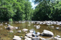
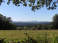
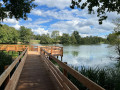
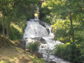
From Landogne church, follow the River Saunade for a pleasant walk through the unspoilt countryside of the Combrailles. After ‘Les Vialles’, walking alongside a pond, you’ll be treated to a stunning 360° panoramic view of the Combrailles and the Chaîne des Puys.

Details

26028831
Creation:
Last update:
Last review:
  • Walking
    Activity: Walking
  • ↔
    Distance: 8.13 mi
  • ◔
    Average duration: 4h 25 
  • ▲
    Difficulty: Moderate

  • ⚐
    Back to start: Yes
  • ↗
    Ascent: + 791 ft
  • ↘
    Descent: - 797 ft

  • ▲
    Highest point: 2,329 ft
  • ▼
    Lowest point: 1,827 ft

Photos

Description of the walk

In Pontaumur (40 km west of Clermont-Ferrand), take the D987 (towards Saint-Gervais-d’Auvergne), then the D206 (towards Montel-de-Gelat) and the D206A as far as Landogne. Car park at the entrance to the village on the left.

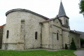
(S/E) Church square, 17th-century church and bell; walk down Rue Principale towards La Borderie. Once you’ve left the village, take the first path on the right to join theGR®4at a footbridge over the Saunade.

(1) Turn right, leaving the footbridge on your left (the return route), stay on the left bank and head up the Saunade valley to the Chabre mill.

(2) Before the bridge, veer right onto the tarmac road and temporarily leave the riverbank. Pass through the hamlet of Viallevelours and continue to the T-junction.

(3) Turn left and leave theGR®4. There is a cross dedicated to the shepherdess Marie Girodon, with a view of the Sancy massif. Head downhill until you rejoin the Saunade, turn right and follow it to a junction near a bridge.

(4) Cross the river over this small bridge. Head uphill and pass through the hamlet of Saunade.

(5) A few dozen metres after leaving Saunade, take the path on the left for over 1 km, until you reach the junction with a small road at the entrance to the village of La Cassière.

(6) Turn right to cross the village, following the tarmac road, and, about 200 m past the last houses, turn left onto a path. View of the Chaîne des Puys. Head down into the woods, cross a stream and head back up to the left until you reach a crossroads in the woods.

(7) At the crossroads, turn right and head towards the hamlet of Les Vialles, then walk through it.

(8) At the next crossroads, turn 90° to the left and head towards a pond. Head back up through the woods to reach a crossroads where five paths meet (cross).

(9) Head left (GR®4) along a wide path. Views of the Chaîne des Puys, the Sancy, Landogne and the Combrailles. Continue on to reach La Borderie, at a bend in a small road.

(10) Continue to the left for about 150 m and, just after the bend to the right, take the path on the left which winds down through the woods to rejoin the Saunade at the footbridge you crossed on the way out.

(1) Cross the Saunade and turn right, retracing your steps along the path you took on the way out to return to Landogne (S/E).

Waypoints

  1. S/E : mi 0 - alt. 1,998 ft - Starting point: Landogne car park
  2. 1 : mi 0.94 - alt. 1,857 ft - Footbridge at the - Saunade (rivière) - Affluent du Sioulet
  3. 2 : mi 2.12 - alt. 1,909 ft - Chabre Mill
  4. 3 : mi 2.65 - alt. 2,096 ft - T-junction
  5. 4 : mi 3.22 - alt. 1,982 ft - Bridge over the Saunade
  6. 5 : mi 3.63 - alt. 2,201 ft - Leaving the hamlet of La Saunade
  7. 6 : mi 4.36 - alt. 2,175 ft - La Cassière
  8. 7 : mi 5.18 - alt. 2,208 ft - Crossroads of paths in the woods
  9. 8 : mi 5.72 - alt. 2,234 ft - Les Vialles - Crossroads
  10. 9 : mi 6.15 - alt. 2,323 ft - La Croix la Bielle
  11. 10 : mi 6.83 - alt. 2,159 ft - La Borderie
  12. S/E : mi 8.13 - alt. 1,998 ft - Car park

Notes

Walk suggested bythe Combrailles Tourist Office
Hike details.

For your safety, always take a bottle of water, a hat, warm and rainproof clothing, and wear suitable walking shoes.
Depending on weather conditions, some routes are not recommended in bad weather (fog) or are impassable, or even off-limits, during the winter season.
Some sites are fragile; please stay on the marked paths. Avoid picking wild flowers and disturbing wildlife. Please take your rubbish with you.
On some routes, pets are not allowed.

Always be cautious and plan ahead when you're outdoors. Visorando and the author of this route cannot be held responsible for any accidents occurring on this route.

The GR® and PR® markings are the intellectual property of the Fédération Française de Randonnée Pédestre.

Reviews and comments

4.3 / 5
Based on 2 reviews

Reliability of the description
4.5 / 5
Ease of following the route
4.5 / 5
Route interest
4 / 5
User 30034151

Overall rating : 4 / 5

Date of your route : Jul 19, 2026
Reliability of the description : ★★★★☆ Good
Ease of following the route : ★★★★☆ Good
Route interest : ★★★★☆ Good
Very busy route : No

Machine-translated

grosputois
grosputois

Overall rating : 4.7 / 5

Date of your route : Nov 02, 2024
Reliability of the description : ★★★★★ Very good
Ease of following the route : ★★★★★ Very good
Route interest : ★★★★☆ Good
Very busy route : No

A pleasant route, even in wet weather. Shaded in hot weather.

Machine-translated

Other walks in the area

For more walks, use our search engine .

The GPS track and description are the property of this route's author. Please do not copy them without permission.