Ambur-La Chazotte Castle

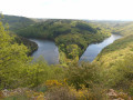
A walk through the heart of the Combrailles with views over the Fades-Besserve reservoir, a vast lake covering 385 ha.

Details

24972978
Creation:
Last update:
Last review:
  • Walking
    Activity: Walking
  • ↔
    Distance: 7.74 mi
  • ◔
    Average duration: 4h 20 
  • ▲
    Difficulty: Moderate

  • ⚐
    Back to start: Yes
  • ↗
    Ascent: + 912 ft
  • ↘
    Descent: - 915 ft

  • ▲
    Highest point: 2,425 ft
  • ▼
    Lowest point: 1,670 ft

Photos

Description of the walk

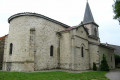
From Pongibaud, take the D941 towards Pontaumur. At La Goutelle, turn right onto the D61 and follow it to Saint-Jacques-d’Ambur. Car park in front of the church.

(S/E) From the starting point sign, take the road towards Les Berthons.

(1) At the fork in the road, continue to the right along the road, then turn left at the next junction.

(2) 150 m past the Auberge de la Hulotte, take a path on the left up into the woods. Follow it to the edge of the woods, ignoring any side paths.

(3) Turn left onto a path between two low walls.
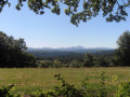
Walk alongside the woodland, passing a grassy path on your right (views of the Chaîne des Puys, the Massif du Sancy and the Banne d’Ordanche). Continue to a junction at the entrance to Les Berthons.

(4) Head down a damp path opposite. At the tarmac road, turn left.

(5) At the junction on leaving the hamlet of Les Berthons (with the riding centre’s stables opposite), follow a path to the left until you reach the first path on the right (GR®).

(6) Take this path to the right and head down into the woods along a wide stony track for about 1.5 km. Turn left onto a path leading to the Chazotte leisure centre. Head up the road opposite until you reach the D121.

(7) Continue along the D121 to the right for 250 m, then turn left uphill (view of the Fades reservoir) and head towards the hamlet of La Chazotte. Pass through it and carry on straight ahead to the hamlet of La Barre.

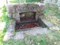
(8) Take the road on the left, follow the path alongside the ‘couderc’ (cross, washhouse, drinking trough) and, at the three-way junction, head down to the left onto the road.

(9) At the entrance to the La Barre section of the forest, follow a wide track to the left. At the Fork in the road, go straight on and, at the four-way junction, head down the path opposite. Cross the Ruisseau des Côtes and head back up its right bank through a coniferous woodland. At the T-junction, turn left onto a wide forest track until you reach the D61 (picnic area).

(10) Cross the road to reach Martinèche.

(11) At the T-junction on leaving the hamlet, turn left, then left again onto a dirt track. At the three-way junction (picnic area), head uphill opposite. Cross a road, follow the D61 for a short distance, then head into the woods. At the first junction, carry on straight ahead

(12) At the second junction, turn left to return to the car park in front of the church in Saint-Jacques-d’Ambur (S/E).

Waypoints

  1. S/E : mi 0 - alt. 2,251 ft - Car park - Église Saint-Jacques (Saint-Jacques-d'Ambur)
  2. 1 : mi 0.1 - alt. 2,251 ft - Fork in the road
  3. 2 : mi 0.51 - alt. 2,260 ft - Fork in the path
  4. 3 : mi 0.76 - alt. 2,405 ft - Path along the edge of the woods
  5. 4 : mi 1.12 - alt. 2,333 ft - Les Berthons
  6. 5 : mi 1.31 - alt. 2,254 ft - Crossroads – Les Berthons exit
  7. 6 : mi 1.48 - alt. 2,228 ft - GR junction
  8. 7 : mi 2.86 - alt. 1,775 ft - D121 road
  9. 8 : mi 4.48 - alt. 2,356 ft - La Barre hamlet
  10. 9 : mi 4.78 - alt. 2,329 ft - La Barre Forest
  11. 10 : mi 5.78 - alt. 2,326 ft - D61 road
  12. 11 : mi 6.06 - alt. 2,293 ft - Martinèche
  13. 12 : mi 7.22 - alt. 2,244 ft - Crossroads
  14. S/E : mi 7.74 - alt. 2,251 ft - Car park - Église Saint-Jacques (Saint-Jacques-d'Ambur)

Notes

For your safety, always take a bottle of water, a hat, warm and waterproof clothing with you, and wear suitable walking shoes.

Some sites are fragile, so please stay on the marked paths. Avoid picking wild flowers and disturbing wildlife. Please take your rubbish with you.

Always be cautious and plan ahead when you're outdoors. Visorando and the author of this route cannot be held responsible for any accidents occurring on this route.

The GR® and PR® markings are the intellectual property of the Fédération Française de Randonnée Pédestre.

Reviews and comments

4.7 / 5
Based on 2 reviews

Reliability of the description
5 / 5
Ease of following the route
4.5 / 5
Route interest
4.5 / 5
Mo63
Mo63

Overall rating : 4 / 5

Date of your route : Jul 15, 2024
Reliability of the description : Not used / Not applicable
Ease of following the route : ★★★★☆ Good
Route interest : ★★★★☆ Good
Very busy route : No

No problem

Machine-translated

ChrisFlo
ChrisFlo

Overall rating : 5 / 5

Date of your route : Jul 14, 2024
Reliability of the description : ★★★★★ Very good
Ease of following the route : ★★★★★ Very good
Route interest : ★★★★★ Very good
Very busy route : No

There aren’t many signposts, but once you’ve done the route, it’s fine 👍

Machine-translated

Other walks in the area

For more walks, use our search engine .

The GPS track and description are the property of this route's author. Please do not copy them without permission.