The solidified lava flow of Tournebise

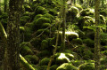
A breathtakingly beautiful walk through the mysterious world of solidified lava flows, with their chaotic piles of slag, mosses and lichens. Here you’ll discover the remains of a mysterious medieval settlement, the Camp des Chazaloux.

Details

24624999
Creation:
Last update:
Last review:
  • Walking
    Activity: Walking
  • ↔
    Distance: 2.25 mi
  • ◔
    Average duration: 1h 05 
  • ▲
    Difficulty: Easy

  • ⚐
    Back to start: Yes
  • ↗
    Ascent: + 49 ft
  • ↘
    Descent: - 49 ft

  • ▲
    Highest point: 2,559 ft
  • ▼
    Lowest point: 2,510 ft

Photos

Description of the walk

To reach Bannières, located 25 km west of Clermont-Ferrand, take the D941; then, at La Courteix, turn left onto the D62 towards Bannières. Turn right onto Rue du Puy de Dôme and, at the wash house and drinking trough, follow the Route des Fermes to the right until you reach the ‘Parking’ sign. Turn right onto a track leading to the start sign.

Yellow butterfly markings

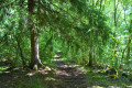
(S/E) From the start sign, take the path leading into the Forêt de la Cheire de Tournebise, part of the Cheire de Côme (information on this can be found 20 m after the start). 150 m further on, the track begins to cross the medieval site of Camp des Chazaloux (a 5-minute round trip from the junction; on the right and left, there are interpretative displays explaining the remains of the buildings). Continue straight on until you reach the Fork in the road at the exit of the site.

(2) Turn right onto theGR® 441 and, at the next Fork in the road, head down to the left. At the third Fork in the road, turn right until you reach a Y-junction.

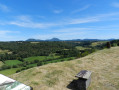
(1) Turn right, and at the next junction, turn left. At the fork, head down to the right and, after 30 m, continue to the right. Walk alongside a clearing with ruined buildings. Ignore the paths to the left and then to the right. Pass a car park at the edge of the forest. Stay on the main path, ignoring the side paths. Before reaching the houses, there are views of the Banne d’Ordanche and, 30 metres further on, the Puys de Dôme and de Côme. Continue to the road.

(3) Turn right, leaving theGR®. At the next road junction (elevation 766), leave Rue des Clidelles and take the road on the right. Walk past some farm buildings, then, at the car park sign, return to the starting point (S/E).

Waypoints

  1. S/E : mi 0 - alt. 2,510 ft - Car park. Signposts
  2. 1 : mi 0.32 - alt. 2,533 ft - Solidified lava flow
  3. 2 : mi 0.8 - alt. 2,549 ft - Junction
  4. 3 : mi 1.44 - alt. 2,549 ft - Route
  5. S/E : mi 2.25 - alt. 2,510 ft - Car park. Signposts

Notes

For your safety, always take a bottle of water, a hat, warm and rainproof clothing with you, and wear suitable walking shoes.
Some sites are sensitive, so please stay on the marked paths. Avoid picking wild flowers and disturbing wildlife. Please take your rubbish with you.

Always be cautious and plan ahead when you're outdoors. Visorando and the author of this route cannot be held responsible for any accidents occurring on this route.

The GR® and PR® markings are the intellectual property of the Fédération Française de Randonnée Pédestre.

Reviews and comments

4.2 / 5
Based on 3 reviews

Reliability of the description
4 / 5
Ease of following the route
4.3 / 5
Route interest
4.3 / 5
grantoine72
grantoine72

Overall rating : 5 / 5

Date of your route : Aug 12, 2024
Reliability of the description : Not used / Not applicable
Ease of following the route : ★★★★★ Very good
Route interest : ★★★★★ Very good
Very busy route : No

A lovely little walk through the woods – very interesting. You almost have to turn back at the edge of the woods and retrace your steps, as the return journey is along the road and therefore rather uninteresting.

Machine-translated

misty63
misty63

Overall rating : 4 / 5

Date of your route : Mar 03, 2024
Reliability of the description : ★★★★☆ Good
Ease of following the route : ★★★★☆ Good
Route interest : ★★★★☆ Good
Very busy route : No

A really lovely walk, through a moss-covered forest in the middle of the solidified lava flow – it feels just like a forest of elves and fairies – and the ruins of the Chalazoux buildings are a real highlight; the information boards are very interesting. An easy walk that isn’t too long, perfect for a breath of fresh air. The only downside is having to walk back along the road.

Machine-translated

Catalabe
Catalabe

Overall rating : 4 / 5

Date of your route : Nov 06, 2022
Reliability of the description : ★★★★☆ Good
Ease of following the route : ★★★★☆ Good
Route interest : ★★★★☆ Good
Very busy route : No

A very pleasant walk

Machine-translated

Other walks in the area

For more walks, use our search engine .

The GPS track and description are the property of this route's author. Please do not copy them without permission.