The Hill and Marshes of Saint-Pierre-le-Chastel

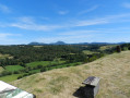
This Sensitive Natural Area features a variety of habitats. A 50-metre difference in altitude separates the granite hill of Saint-Pierre-le-Chastel from the marsh.
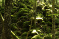
You’ll be able to discover unrivalled flora and fauna.
Take the time to observe and learn more from the information boards along the trail.

Details

24626490
Creation:
Last update:
Last review:
  • Walking
    Activity: Walking
  • ↔
    Distance: 3.29 mi
  • ◔
    Average duration: 1h 45 
  • ▲
    Difficulty: Easy

  • ⚐
    Back to start: Yes
  • ↗
    Ascent: + 233 ft
  • ↘
    Descent: - 233 ft

  • ▲
    Highest point: 2,438 ft
  • ▼
    Lowest point: 2,201 ft

Photos

Description of the walk

45 minutes west of Clermont-Ferrand, towards Pontgibaud (via the D941 or the A89, exit 26). Car park behind the church, opposite the community hall.
Follow the route, passing the information boards.

(S/E) Opposite the community hall, follow the path to the left behind the cemetery until you reachthe first information sign.

(1) Take the first path on the right towards the railway line. Cross the tracks and follow the line until you reach the first road on the right, then cross the railway line again.

(2) Turn left to continue following the railway line.

(3) Pass a small pond on your right. At the next junction, turn right.

(4) At the information sign, take the path on the right.

(5) At the information sign, turn right and walk back along the railway line

(2) Return to the previous fork in the path.

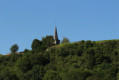
(5) At the information sign, take the road on the right. At the first junction, turn right and, at the bend, take the path on the right towards the hill. When you reach the road, turn left onto it and, immediately afterwards, turn right towards the church. Head to the car park behind the church (S/E).


Waypoints

  1. S/E : mi 0 - alt. 2,434 ft - Car park behind the church
  2. 1 : mi 0.13 - alt. 2,434 ft - Information sign 1
  3. 2 : mi 0.78 - alt. 2,211 ft - Information board 2
  4. 3 : mi 1.01 - alt. 2,205 ft - Information sign 3
  5. 4 : mi 1.33 - alt. 2,205 ft - Information sign 4. Near the - Sioule (la)
  6. 5 : mi 1.79 - alt. 2,208 ft - Information board 5
  7. S/E : mi 3.29 - alt. 2,434 ft - Car park behind the church

Reviews and comments

4.7 / 5
Based on 2 reviews

Reliability of the description
4.5 / 5
Ease of following the route
4.5 / 5
Route interest
5 / 5
User 3176943

Overall rating : 4.3 / 5

Date of your route : Oct 27, 2025
Reliability of the description : ★★★★☆ Good
Ease of following the route : ★★★★☆ Good
Route interest : ★★★★★ Very good
Very busy route : No

The route offers a lovely tour of the hill and its surroundings, with numerous viewpoints. The flooded marshes, following heavy rainfall in October 2025, gave St Pierre Le Chastel an almost island-like character.

Machine-translated

AYRAULT DANIELLE
AYRAULT DANIELLE

Overall rating : 5 / 5

Date of your route : Sep 30, 2024
Reliability of the description : ★★★★★ Very good
Ease of following the route : ★★★★★ Very good
Route interest : ★★★★★ Very good
Very busy route : No

AN INTERESTING WALK, starting from number 1 – a slightly steep descent, followed by a perfect stretch with views over the marshes and the hillock

Machine-translated

Other walks in the area

For more walks, use our search engine .

The GPS track and description are the property of this route's author. Please do not copy them without permission.