The Mills Route in Saint-Gervais-d’Auvergne

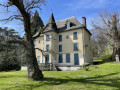
A magnificent route that will take you to the banks of the Chalamont, passing by Neuvialle Castle.

Details

48009130
Creation:
Last update:
Last review:
  • Walking
    Activity: Walking
  • ↔
    Distance: 6.69 mi
  • ◔
    Average duration: 3h 35 
  • ▲
    Difficulty: Moderate

  • ⚐
    Back to start: Yes
  • ↗
    Ascent: + 614 ft
  • ↘
    Descent: - 607 ft

  • ▲
    Highest point: 2,365 ft
  • ▼
    Lowest point: 1,919 ft

Photos

Description of the walk

Public transport
Train: Riom-Châtel-Guyon SNCF station, then bus route P62 – Riom-St-Gervais – St-Gervais Mairie stop
https://www.laregionvoustransporte.fr/li...

Car
Parking spaces are available on Rue du Castel in Saint-Gervais d’Auvergne. Further spaces are also available on Place Raymond Gauvin and Place de la Mairie.

(S/E) Take Rue du Castel heading north-west. At the four-way junction, continue straight ahead onto Rue du Pont aux Canes, then follow Avenue Jules Lécuyer as it continues.

(1) After passing the Lycée Agricole des Combrailles, at the roundabout, take the second exit towards Pionsat and Gouttières, crossing at the pedestrian crossing. Head to the right, then turn left to cross the old railway line. Then turn left onto the D532 and follow it carefully for a few hundred metres. Pass the road leading to the recycling centre on your left and continue for a good hundred metres.

(2) Turn left onto the tarmac road to reach the hamlet of Montarlet. The route offers magnificent views of the Chaîne des Puys and the Monts Dore.

(3) The road continues, veering slightly to the left, then turns into a track and leads to Neuvialle.

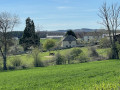
(4) Turn right at the junction, walk past the castle and continue along the grassy path opposite, leaving the road at the bend. You’ll rejoin the tarmac road at the Moulin de Neuvialle (private property).

(5) Continue to the right, cross the bridge over the Chalamont and follow the road to the junction with the road leading to the hamlet of Les Combes.

(6) Carry on to the right along the track.

(7) At the junction further on, turn right onto the track until you reach a crossroads of paths.

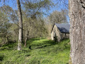
(8) Turn right again onto the track leading to the Moulin de Pierrefort. Pass the mill and cross the Chalamont again.

(9) When you come out onto the RD532, keep to the right and proceed with caution for about 200 m. Then turn right onto the small tarmac road to return to Montarlet.

(3) Turn left and follow the outbound route in the opposite direction to reach Saint-Gervais-d’Auvergne and the car park on Rue du Castel (S/E).

Waypoints

  1. S/E : mi 0 - alt. 2,356 ft - Rue du Castel
  2. 1 : mi 0.4 - alt. 2,310 ft - Roundabout
  3. 2 : mi 0.84 - alt. 2,274 ft - Junction with the road leading to Montarlet
  4. 3 : mi 1.81 - alt. 2,162 ft - Montarlet
  5. 4 : mi 2.44 - alt. 2,067 ft - Neuvialle
  6. 5 : mi 2.89 - alt. 1,919 ft - Neuvialle Mill
  7. 6 : mi 3.05 - alt. 1,982 ft - Les Combes junction
  8. 7 : mi 3.49 - alt. 2,103 ft - Junction, turn right
  9. 8 : mi 4.05 - alt. 2,005 ft - Turn-off towards Moulin de Pierrefort
  10. 9 : mi 4.42 - alt. 2,073 ft - D532
  11. S/E : mi 6.69 - alt. 2,356 ft - Rue du Castel

Notes

Recommended kit: walking shoes or trainers.
Difficulty: an easy route along paths, tracks or roads.
The route can be shortened by approximately 30 minutes to 1 hour by leaving Saint-Gervais-d’Auvergne by car via the Route d’Espinasse (D532), then, after passing the turn-off to the left leading to the recycling centre, park on the next road on the left leading to the hamlet of Montarlet ((3)). Please note: there is no designated car park, so please park in such a way as not to obstruct traffic. This option also allows you to avoid the section of the route that involves walking alongside the D532.

Reviews and comments

4.4 / 5
Based on 3 reviews

Reliability of the description
4.7 / 5
Ease of following the route
5 / 5
Route interest
3.7 / 5
Artisou
Artisou

Overall rating : 4.3 / 5

Date of your route : Apr 27, 2026
Reliability of the description : ★★★★☆ Good
Ease of following the route : ★★★★★ Very good
Route interest : ★★★★☆ Good
Very busy route : No

The first section – that is, the stretch from Saint-Gervais-d'Auvergne – is a bit dull and not very pleasant. I’d recommend starting from point 2 on the route.
The rest is very good.

Machine-translated

User 1382501

Overall rating : 4.7 / 5

Date of your route : May 19, 2025
Reliability of the description : ★★★★★ Very good
Ease of following the route : ★★★★★ Very good
Route interest : ★★★★☆ Good
Very busy route : No

pleasant hike with excellent explanations

Machine-translated

PERRET Marie-Noëlle
PERRET Marie-Noëlle

Overall rating : 4.3 / 5

Date of your route : Aug 24, 2024
Reliability of the description : ★★★★★ Very good
Ease of following the route : ★★★★★ Very good
Route interest : ★★★☆☆ Average
Very busy route : No

The section on the road (as mentioned by the author) is a bit long, but it’s true that finding a place to park in the hamlet isn’t easy. The route is pleasant.

Machine-translated

Other walks in the area

For more walks, use our search engine .

The GPS track and description are the property of this route's author. Please do not copy them without permission.