


Refine your search for walks in Pléhédel
Pléhédel walks


 Kerlandic route to Pléhédel
 Visorando Member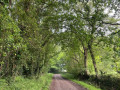
 4.28 mi
 +49 ft
 -49 ft
 2h 00
2h 00
 Easy
Easy
 Departure from Pléhédel (Côtes-d'Armor)
This circular walk of around 7 km takes you on a journey through the Pléhédel countryside, amongst sunken lanes, copses and the typical hedgerow landscapes of Goëlo. Easy and accessible thanks to its gentle gradient, it offers a peaceful break in the heart of an unspoilt setting, dotted with hamlets, tree-lined embankments and sweeping views of the surrounding countryside. An ideal walk for discovering the charm of this little village.
From Kermaria to Bréhec
 4.41 mi
+82 ft
-282 ft
2h 05
Easy
Departure from Plouha (Côtes-d'Armor)
4.41 mi
+82 ft
-282 ft
2h 05
Easy
Departure from Plouha (Côtes-d'Armor)
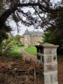
A short, easy walk that takes you through the Goelo countryside and gently down to Bréhec beach.The only requirement is to have two cars. Best undertaken with friends.
Circular from Saint-Jacques Chapel via Lanleff Temple
 5.10 mi
+476 ft
-479 ft
2h 45
Easy
Departure from Tréméven (Côtes-d'Armor)
5.10 mi
+476 ft
-479 ft
2h 45
Easy
Departure from Tréméven (Côtes-d'Armor)
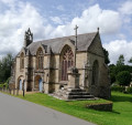
This rural route in Goëlo, along a hilly route, half of which is in the woods, offers the chance to discover elements of heritage of great historical interest, such as the Saint-Jacques Chapel and the Lanleff Temple.Please note that from Crec'h Lanleff onwards, the route is not signposted, so it is essential to use the Visorando app with its GPS pin.
This walk is best done between May and October as the route can be very muddy.
From the Saint-Jacques Chapel to Bois Gelin along the Kerguidoué
 4.60 mi
+341 ft
-348 ft
2h 25
Easy
Departure from Tréméven (Côtes-d'Armor)
4.60 mi
+341 ft
-348 ft
2h 25
Easy
Departure from Tréméven (Côtes-d'Armor)
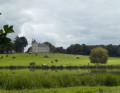
A walk mainly through woodland that leads from the Saint-Jacques Chapel to the heart of the Bois Gelin estate. Partially signposted walk.
Best undertaken from April to October as sections can be muddy in winter.
Pludual countryside route
 Association / Club / Walk leader
 5.30 mi
+66 ft
-66 ft
2h 30
Easy
Departure from Pludual (Côtes-d'Armor)
5.30 mi
+66 ft
-66 ft
2h 30
Easy
Departure from Pludual (Côtes-d'Armor)
A short walk through the Pludual countryside, crossing a wetland known as Le Lan. A pleasant family walk.
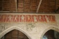
Danse Macabre Route
 6.06 mi
+131 ft
-131 ft
2h 55
Easy
Departure from Pludual (Côtes-d'Armor)
6.06 mi
+131 ft
-131 ft
2h 55
Easy
Departure from Pludual (Côtes-d'Armor)
A walk through the Pludual countryside: chapels, woods, fields, orchards, wash houses, fountains, etc. – there’s plenty of variety to be found everywhere.
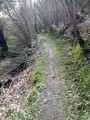
Around the Kergolo between Lanloup and Petit Saint-Loup
 7.81 mi
+423 ft
-423 ft
4h 00
7.81 mi
+423 ft
-423 ft
4h 00
 Moderate
Departure from Lanloup (Côtes-d'Armor)
Moderate
Departure from Lanloup (Côtes-d'Armor)
The Kergolo is a small coastal river that flows into Anse de Bréhec, a pretty sandy beach and a small heritage harbour. Its course and that of its tributaries are dotted with numerous fountains and wash houses. As you explore the Kergolo basin, which has been inhabited for a long time, you’ll discover a wealth of architecture, including manor houses, religious buildings and traditional homes, often restored and set in lovely gardens. Alternate routes to shorten or extend the route are available.
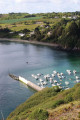
Grand Tour of Bréhec
 5.75 mi
+512 ft
-502 ft
3h 05
Moderate
Departure from Plouézec (Côtes-d'Armor)
5.75 mi
+512 ft
-502 ft
3h 05
Moderate
Departure from Plouézec (Côtes-d'Armor)
From the famous beach at Bréhec, climb up the cliff and follow the route of the narrow-gauge railway to reach the picturesque village of Lanloup.
You’ll then follow a route through the countryside back to Bréhec.
Right at the start of the walk, you’ll come across Anse de Bréhec, a wide opening onto the sea between Pointe de la Tour and the cliffs of Plouézec.
The final stretch is the Bréhec coastal path facing Pointe de la Tour, with the whole beach and bay in full view.
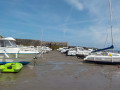
Short Tour of Bréhec
 3.38 mi
+262 ft
-262 ft
1h 45
Easy
Departure from Plouézec (Côtes-d'Armor)
3.38 mi
+262 ft
-262 ft
1h 45
Easy
Departure from Plouézec (Côtes-d'Armor)
This walk, which is of modest length and difficulty, will allow you to appreciate the richness of the seascape and the hinterland of the well-known site of Bréhec.
After passing a cliff overlooking the beach, you’ll reach the picturesque village of Lanloup, and then a long, gently sloping walk will take you back to the starting point.
From Saint Samson to Bréhec
 5.42 mi
+574 ft
-554 ft
3h 00
Moderate
Departure from Plouha (Côtes-d'Armor)
5.42 mi
+574 ft
-554 ft
3h 00
Moderate
Departure from Plouha (Côtes-d'Armor)
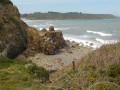
Starting from the Chapelle Saint-Samson, take the famous Shelburn network aviators’ path to reach Brehec Beach.
Saint-Samson to Lanloup circular
 4.04 mi
+381 ft
-374 ft
2h 10
Easy
Departure from Plouha (Côtes-d'Armor)
4.04 mi
+381 ft
-374 ft
2h 10
Easy
Departure from Plouha (Côtes-d'Armor)
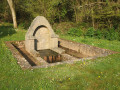
Discover Bréhec Bay from the top of the cliffs, descend to the Red Rocks beach, walk over red, yellow and green stones dating back 600 million years, then climb back up to the plateau to return to your car in Saint-Samson.
From Bréhec to Minard
 5.15 mi
+243 ft
-240 ft
2h 35
Moderate
Departure from Plouézec (Côtes-d'Armor)
5.15 mi
+243 ft
-240 ft
2h 35
Moderate
Departure from Plouézec (Côtes-d'Armor)
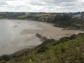
From the coastal road overlooking Bréhec harbour to Pointe de Minard, this route offers breathtaking views of Saint-Brieuc Bay throughout. Once you reach Pointe de Minard, you’ll see Paimpol Bay and the Île de Bréhat. The return journey is along the road with virtually no change in elevation.
Hollow ways and villages in Plouha
 3.95 mi
+138 ft
-164 ft
1h 55
Easy
Departure from Plouha (Côtes-d'Armor)
3.95 mi
+138 ft
-164 ft
1h 55
Easy
Departure from Plouha (Côtes-d'Armor)
Plouha is home to the highest cliffs in Brittany. You can explore them on theGR®®34. Very close to the village centre, starting from the town centre, the first half of this short route follows beautiful sunken paths typical of the Goëlo region and then passes through a few villages with lovely stone houses. Along the route, there are several granite wayside crosses.
Saint-Jean Chapel in Plouha
3.14 mi
+108 ft
-115 ft
1h 30
Easy
Departure from Plouha (Côtes-d'Armor)
Leave the village of Plouha and head for Saint-Jean Chapel along the country lanes. These are tarmac-surfaced, except for a short stretch which is a farm track but is easily passable.
In the footsteps of the Shelburn Network in Plouha
 4.35 mi
+591 ft
-604 ft
2h 30
Moderate
Departure from Plouha (Côtes-d'Armor)
4.35 mi
+591 ft
-604 ft
2h 30
Moderate
Departure from Plouha (Côtes-d'Armor)
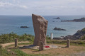
This short hike follows the coastal path (GR®34) and allows you to discover the incredible story of the Shelburn Network. This organisation, rooted in the Plouhatine community, enabled 144 people to escape to England in 1944. You will follow in the footsteps of the airmen who travelled these paths in the dark nights of the occupation.
From Plouézec to the Pointes de Plouézec and Minard
 8.59 mi
+673 ft
-669 ft
4h 30
Moderate
Departure from Plouézec (Côtes-d'Armor)
8.59 mi
+673 ft
-669 ft
4h 30
Moderate
Departure from Plouézec (Côtes-d'Armor)
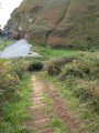
There are exceptional panoramic views along this section of theGR®34long-distance hiking trail, with the Anse de Paimpol, the panorama stretching from Beauport Abbey in the west to Paimpol and Ploubazlanec to Île de Bréhat, Roc'h du Chenel du Dénau, Grand Mez and Petit Mez de Goëlo, ending at Pointe de Plouézec in the east. To the south is Pointe de Minard, which marks the entrance to the Bay of Saint-Brieuc.
On the banks of the Leff and Trieux rivers
 8.84 mi
+525 ft
-525 ft
4h 30
Moderate
Departure from Quemper-Guézennec (Côtes-d'Armor)
8.84 mi
+525 ft
-525 ft
4h 30
Moderate
Departure from Quemper-Guézennec (Côtes-d'Armor)
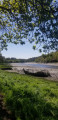
A sometimes uneven walk through the undergrowth along two Breton rivers, offering a different view depending on the tide level.
Circular route between La Trinité and Le Palus
 6.33 mi
+699 ft
-715 ft
3h 30
Moderate
Departure from Plouha (Côtes-d'Armor)
6.33 mi
+699 ft
-715 ft
3h 30
Moderate
Departure from Plouha (Côtes-d'Armor)
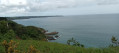
From the Chapel of La Trinité, the route quickly reaches the cliffs. It then follows theGR®34along a fairly rugged section, but with unobstructed views (from Bréhat to Saint-Quay) and numerous possible stopping points. At the lowest point, the beaches of Port Moguer and Gwin zegal are particularly enjoyable. You leave theGR®34before reaching Palus beach, and old sunken paths lead back to small roads that pass through pretty villages to return to the starting point.
Family trail in the woods of Plourivo
 Local authority
 5.89 mi
+249 ft
-256 ft
2h 55
Easy
Departure from Plourivo (Côtes-d'Armor)
5.89 mi
+249 ft
-256 ft
2h 55
Easy
Departure from Plourivo (Côtes-d'Armor)
A walk through the countryside for the whole family. Follow the white signs. Just outside Plourivoù, the trail winds through the fields, across the meadows, and along the green pastures.
This walk takes you along country lanes. You’ll cross the Plourivoù countryside through green valleys, following the streams of Canon and Quinic. Around the3 km mark, on the left, you’ll see the Saint-Ambroise chapel. Do feel free to leave the circular route to explore it. Parts of the route can be muddy at certain times of the year, particularly before and after the Allée des Chevreuils. Large puddles will force you to walk along the embankments. At the Georges Kerbellec rest area, you can take the Pont Min botanical trail for a 1.5 km detour.
Plourivo countryside
 4.61 mi
+141 ft
-157 ft
2h 15
Easy
Departure from Plourivo (Côtes-d'Armor)
4.61 mi
+141 ft
-157 ft
2h 15
Easy
Departure from Plourivo (Côtes-d'Armor)
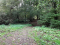
Explore the Plourivo countryside, with its charming little valleys through the woodland in a quiet part of the village.
Between land and river at Quemper-Guézennec
 6.84 mi
+492 ft
-492 ft
3h 35
Moderate
Departure from Quemper-Guézennec (Côtes-d'Armor)
6.84 mi
+492 ft
-492 ft
3h 35
Moderate
Departure from Quemper-Guézennec (Côtes-d'Armor)
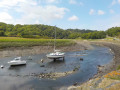
Starting from the heights of the village of Qemper-Guézennec, a long descent through the fields will take you to the Trieux.
Then, from the port of Goas Vilinic, following the towpath for almost two kilometres, you will reach the confluence of the Leff and the Trieux, spanned by a blue viaduct.
Circular walk in Plouézec from Boulgueff beach to Pointe de Minard
8.85 mi
+948 ft
-942 ft
4h 55
Moderate
Departure from Paimpol (Côtes-d'Armor)
This lovely circular walk offers beautiful views of Paimpol Cove and its rocks, then at Pointe de Minard, a stunning view of the Plouha cliffs. You can admire the beautifully restored Craca Mill, the pretty Port de Port Lazo where you can stroll along the beach and, further on, enjoy free access to the statue park. The famous Porz Donan steps will take you to Pointe de Minard. The return journey will take you from hamlet to hamlet along paths that are often agricultural and through very wild valleys.
From Moulin de Craca to Beauport Abbey
 4.97 mi
+407 ft
-417 ft
2h 40
Moderate
Departure from Plouézec (Côtes-d'Armor)
4.97 mi
+407 ft
-417 ft
2h 40
Moderate
Departure from Plouézec (Côtes-d'Armor)
This section ofthe GR®34connects the Moulin de Craca on the heights of Plouézec to Beauport Abbey.
To return to your starting point, take the road back, which offers views of Paimpol Bay and Bréhat Island. Once you have climbed back up to the plateau and passed Sainte-Barbe Chapel, follow the small, flat roads back to the mill.
A peaceful circular route in Plouézec
 3.23 mi
+213 ft
-194 ft
1h 40
Easy
Departure from Plouézec (Côtes-d'Armor)
3.23 mi
+213 ft
-194 ft
1h 40
Easy
Departure from Plouézec (Côtes-d'Armor)
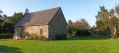
Plouézec is known to local hikers for the many steps onthe GR®34 trailthat crosses the commune. This route avoids almost all of them and allows you to discover, without too much effort, the beautiful views of Paimpol Bay, the built heritage (Saint-Riom Chapel, wash houses, fountains, stone houses), and the fields of flowers and vegetables. The route mostly follows sunken lanes, farm tracks and footpaths.
In short: a short route, the most peaceful you can do in this area of famous Paimpol cliffs, and where you won't get bored because the route crosses very varied areas.
Walk through woods and salt meadows around Beauport Abbey
 3.54 mi
+131 ft
-154 ft
1h 45
Easy
Departure from Paimpol (Côtes-d'Armor)
3.54 mi
+131 ft
-154 ft
1h 45
Easy
Departure from Paimpol (Côtes-d'Armor)
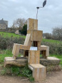
This walk takes you along beautiful sunken paths lined with embankment walls to the heights of Beauport Abbey, where you can discover the deciduous and coniferous woods that dominate the site. You then descend towards the abbey, which you can see from the reed bed accessible via a walkway on stilts. You then reach Cruckin Island via the dyke and salt meadows. From there, you have a superb view of Guilben Point, Saint-Riom Island and the Mez Goëlo Islands.
From Beauport Abbey to the village of Kerfot through the woods
 5.41 mi
+354 ft
-341 ft
2h 50
Easy
Departure from Paimpol (Côtes-d'Armor)
5.41 mi
+354 ft
-341 ft
2h 50
Easy
Departure from Paimpol (Côtes-d'Armor)
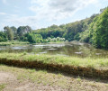
A walk along the Ruisseau du Correc that will take you from Beauport Abbey to the village of Kerfot.
You will walk almost exclusively through woodland on wide paths.
Best undertaken between May and October, as some paths may be muddy in winter and early spring.
From Beauport Abbey to Pointe de Guilben
 5.68 mi
+148 ft
-144 ft
2h 45
Easy
Departure from Paimpol (Côtes-d'Armor)
5.68 mi
+148 ft
-144 ft
2h 45
Easy
Departure from Paimpol (Côtes-d'Armor)
This is an easy hike. Running along the shore, it offers breathtaking views of Beauport and Paimpol bays.
The cliffs of Plouha
 9.81 mi
+1,083 ft
-1,056 ft
5h 25
Moderate
Departure from Plouha (Côtes-d'Armor)
9.81 mi
+1,083 ft
-1,056 ft
5h 25
Moderate
Departure from Plouha (Côtes-d'Armor)
This walk can be split into two sections: a 9km circular route to the north-west, which takes in Bonaparte Beach, and a second 6.5km circular route to the south, offering views of Plouha Head.Both circular loops follow theGR®®34along the coast and each includes ascents and descents that may prove challenging for less experienced walkers.
Plouézec cliff circuit
 5.71 mi
+587 ft
-604 ft
3h 10
Moderate
Departure from Plouézec (Côtes-d'Armor)
5.71 mi
+587 ft
-604 ft
3h 10
Moderate
Departure from Plouézec (Côtes-d'Armor)
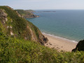
The western part of Saint-Brieuc Bay on the Goëlo coast is known for its cliffs, which are among the highest in Brittany at Plouha (104 m). This coastline begins at Pointe de Plouézec and continues to Pointe de Minard.This loop allows you to walk along theGR®® 34 between these two impressive points, then continues through the valley of the Porz Donan stream and on to the small Saint-Riom chapel.
Currently being revised
The cross-country trails of Plourivo (Orange Trail)
 7.18 mi
+564 ft
-564 ft
3h 50
Moderate
Departure from Plourivo (Côtes-d'Armor)
7.18 mi
+564 ft
-564 ft
3h 50
Moderate
Departure from Plourivo (Côtes-d'Armor)
This walk takes you through deciduous and coniferous woods where you can take the time to enjoy the cool air. You will also walk along farm tracks and past crops. After a few sections of road, which are nevertheless peaceful, you will return to the undergrowth and the coolness of the stream. This first part is fairly easy going. Then you will walk along the Leff river, with a few more technical sections, and the final climb will bring you to an unexpected finish. You will discover another part of the commune, not far from the Penhoat-Lancerf massif.
Along the Trieux via the Penhoat woods
 11.08 mi
+1,063 ft
-1,070 ft
6h 00
Moderate
Departure from Plourivo (Côtes-d'Armor)
11.08 mi
+1,063 ft
-1,070 ft
6h 00
Moderate
Departure from Plourivo (Côtes-d'Armor)
Wander along the eastern bank of the Trieux through heathland, pine forests and magnificent viewpoints. You’ll be immersed in its unique historical and natural heritage: Château de la Roche-Jagu, flax drying sheds, the steam railway line, the Maison de l’Estuaire, and protected flora and fauna.
From Paimpol to Frynaudour
 8.70 mi
+630 ft
-551 ft
4h 35
Moderate
Departure from Paimpol (Côtes-d'Armor)
8.70 mi
+630 ft
-551 ft
4h 35
Moderate
Departure from Paimpol (Côtes-d'Armor)
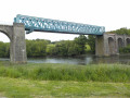
A walk between the sea and the forest offering a wide variety of geographical and historical points of interest: a route along the Trieux beach, a stop at Traounez Manor (a key location in the Seznec affair) and, to finish, the blue Frynaudour viaduct.
A circular walk, returning by TER.
Country walk in Goudelin
 5.59 mi
+240 ft
-249 ft
2h 45
Easy
Departure from Goudelin (Côtes-d'Armor)
5.59 mi
+240 ft
-249 ft
2h 45
Easy
Departure from Goudelin (Côtes-d'Armor)
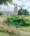
Starting from the Notre-Dame-de-l'Isle Chapel, walk through the countryside towards Leff.
A relatively easy walk which, as you pass through woodland and along rivers and streams, will allow you to discover the typical Breton countryside.
Around Paimpol via the footpaths
 6.03 mi
+371 ft
-364 ft
3h 05
Easy
Departure from Paimpol (Côtes-d'Armor)
6.03 mi
+371 ft
-364 ft
3h 05
Easy
Departure from Paimpol (Côtes-d'Armor)
In Breton, "glaz" refers to a colour found in natural elements, between blue, green and grey. It accompanies us on this route. The grey of the granite houses at the start and the mudflats at low tide. The blue-green of the bay, depending on the weather and the tides, which can be admired from the Kerroc'h tower. After Paimpol, the seaside town, comes Paimpol, the vegetable garden. The green-grey of the cabbage and artichoke fields. The little paths take us back to the old town where we can stroll, refresh ourselves or enjoy a crêpe.
From Plourhan to the sea
 7.02 mi
+371 ft
-371 ft
3h 35
Moderate
Departure from Plourhan (Côtes-d'Armor)
7.02 mi
+371 ft
-371 ft
3h 35
Moderate
Departure from Plourhan (Côtes-d'Armor)
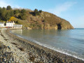
Apart from a few unavoidable sections on tarmac roads, most of the walk follows farm tracks, sometimes through woodland. The reward for this approach route is the walk along Palus Beach, followed by theGR®34 trail.
A somewhat steep route offering views of the cliffs at Plouha and the Pointe de Bec de Vir.
In the countryside between Paimpol and Plounez
 5.26 mi
+154 ft
-177 ft
2h 35
Easy
Departure from Paimpol (Côtes-d'Armor)
5.26 mi
+154 ft
-177 ft
2h 35
Easy
Departure from Paimpol (Côtes-d'Armor)
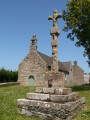
A short route through the countryside from Paimpol to Plounez, a former commune now part of this port made famous by Pierre Loti’s novel “The Fisherman of Iceland”.Beautiful views of the Trieux downstream from Lézardrieux, not to mention the lovely Chapel of Notre-Dame de Kergrist.The route crosses the railway line of the “La Vapeur du Trieux” tourist train in two places.
From the village of Plounez to the Trieux
 4.97 mi
+249 ft
-253 ft
2h 30
Easy
Departure from Paimpol (Côtes-d'Armor)
4.97 mi
+249 ft
-253 ft
2h 30
Easy
Departure from Paimpol (Côtes-d'Armor)
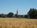
This typical Goëlo landscape perfectly blends land and sea. From the heights of its rich agricultural land (cauliflowers, artichokes, potatoes, etc.), you’ll enjoy a sweeping view of the Trieux estuary with the port and the Lézardrieux bridge, then you’ll walk close to the water between the (6) and the (7).
The Pointe de Loguivy de la Mer
 15.77 mi
+1,066 ft
-1,050 ft
8h 10
15.77 mi
+1,066 ft
-1,050 ft
8h 10
 Difficult
Departure from Paimpol (Côtes-d'Armor)
Difficult
Departure from Paimpol (Côtes-d'Armor)
From the port of Paimpol, once famous as the departure point for the Grand Cod Fishery with the Terre-Neuvas, and now known for its "Sailors' Songs" festival, we set off for Pointe de l'Arcouest, where the pier for the Île de Bréhat is located, and then on to Loguivy-de-la-Mer. We leave the shores of the English Channel for the mouth of the Trieux. Finally, after crossing the Pointe, we return to Paimpol to explore its pedestrianised streets.
Through moors, woods and cliffs in the Goelo region
 8.20 mi
+413 ft
-417 ft
4h 10
Moderate
Departure from Plourhan (Côtes-d'Armor)
8.20 mi
+413 ft
-417 ft
4h 10
Moderate
Departure from Plourhan (Côtes-d'Armor)
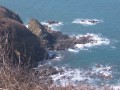
A lovely walk through the countryside and along the coast.
Stop off at the lovely Palus Beach for a refreshing swim and a delicious, energising crêpe!
Street art, the old town and the port of Paimpol
 3.40 mi
+180 ft
-177 ft
1h 45
Easy
Departure from Paimpol (Côtes-d'Armor)
3.40 mi
+180 ft
-177 ft
1h 45
Easy
Departure from Paimpol (Côtes-d'Armor)
During the Meeting of Styles (MOS), 82 international graffiti artists spent three days showcasing their talents on the walls of a block of flats, a secondary school and a shop. This route allows you to discover their work. It also passes through part of Paimpol’s old town, skirts the harbour and leads to Paimpol beach and its seawater swimming pool: Tossen beach. The return to the starting point follows the bay and takes you through the locks
Sea and countryside in Plounez
 6.21 mi
+354 ft
-361 ft
3h 10
Moderate
Departure from Paimpol (Côtes-d'Armor)
6.21 mi
+354 ft
-361 ft
3h 10
Moderate
Departure from Paimpol (Côtes-d'Armor)
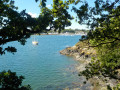
After leaving the town of Paimpol, you’ll head down through the fields to the mouth of the Trieux, opposite the port of Lézardrieux. A walk along the edge of what is effectively a lake at high tide awaits you at the Ledano. Finally, a long climb through the Plounez countryside will take you back to Paimpol. This route combines the agricultural and coastal landscapes typical of this corner of the Goëlo.
From Lancerf to the Trieux
8.16 mi
+636 ft
-636 ft
4h 20
Moderate
Departure from Plourivo (Côtes-d'Armor)
The magnificent Penhoat-Lancerf pine forest and the majestic banks of the Trieux are the two main attractions of this hike. In addition to the Lancerf Chapel, this hike allows you to discover the Maison de l'Estuaire. This is infamous because, in 1924, the Traou-Nez site belonged to Pierre Quemeneur and Guillaume Seznec had agreed to buy it: this is where one of the very first episodes of the Seznec Affair took place...
Circular Pors Even in Ploubazlanec
 5.58 mi
+374 ft
-377 ft
2h 55
Moderate
Departure from Paimpol (Côtes-d'Armor)
5.58 mi
+374 ft
-377 ft
2h 55
Moderate
Departure from Paimpol (Côtes-d'Armor)
This hike is worth doing in any season, given the rich heritage you will encounter. It is even better in spring and summer when the coastline is particularly flowery (agapanthus, hydrangeas, etc.).
From Paimpol to Loguivy de la Mer via Pointe de l'Arcouest
 8.08 mi
+715 ft
-715 ft
4h 20
Moderate
Departure from Ploubazlanec (Côtes-d'Armor)
8.08 mi
+715 ft
-715 ft
4h 20
Moderate
Departure from Ploubazlanec (Côtes-d'Armor)
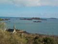
This hike offers fabulous scenery from start to finish, with some particularly remarkable viewpoints.
Requires two vehicles, one in the small car park at the start of Kerpalud, the other at the port of Loguivy de la Mer. Otherwise, return via country roads and an additional 4 km.
The path is accessible in all seasons but requires a good level of fitness due to the five climbs involved.
The three chapels of Plourivo (red route)
 7.19 mi
+446 ft
-440 ft
3h 45
Moderate
Departure from Plourivo (Côtes-d'Armor)
7.19 mi
+446 ft
-440 ft
3h 45
Moderate
Departure from Plourivo (Côtes-d'Armor)
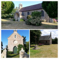
The three chapels of Plourivo are finally united in a single hike! Lancerf overlooks the Trieux, Saint-Ambroise has its miraculous fountain, and Saint-Jean is nestled in the hamlet of Penhoat. Three chapels, three different environments. A modest heritage, but one worth discovering. Hike along the edges of fields, farm tracks and pine woods. Finish your tour by sitting down at a picnic table facing the Trieux, just across the railway line. The setting is peaceful and relaxing.
Trieux Loop part 1 (Boucle du Trieux)
 5.20 mi
+436 ft
-446 ft
2h 45
Moderate
Departure from Paimpol (Côtes-d'Armor)
5.20 mi
+436 ft
-446 ft
2h 45
Moderate
Departure from Paimpol (Côtes-d'Armor)
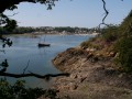
Loop along part of the Trieux river towards the sea and back through the countryside.
From Lédano to Lancerf, following the Trieux
 4.97 mi
+144 ft
-148 ft
2h 25
Easy
Departure from Paimpol (Côtes-d'Armor)
4.97 mi
+144 ft
-148 ft
2h 25
Easy
Departure from Paimpol (Côtes-d'Armor)
An easy walk along the water’s edge through a landscape typical of Goëlo. Half the route follows the banks of the Ria du Trieux, which is flooded by the sea with the tides.In the second part, you’ll walk through fields of vegetables (artichokes, cauliflowers, potatoes...) – crops that are emblematic of this rich agricultural region.Please note that parts of this route may be impassable during high tides.
Along the Trieux de Lézardrieux to Kermouster
8.90 mi
+564 ft
-561 ft
4h 35
Moderate
Departure from Lézardrieux (Côtes-d'Armor)
From the small tourist harbour at Lézardieux, come and explore the Trieux estuary, which is navigable as far as Pontrieux. Here you’ll find the lights that guide night-time navigation on the river, as well as an unobstructed view towards the Île de Bréhat. On the return journey inland, two small chapels line the route.
Lézardrieux and the Trieux
 7.09 mi
+584 ft
-571 ft
3h 45
Moderate
Departure from Lézardrieux (Côtes-d'Armor)
7.09 mi
+584 ft
-571 ft
3h 45
Moderate
Departure from Lézardrieux (Côtes-d'Armor)
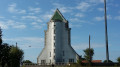
Lézardrieux is situated on the left bank of the Trieux estuary, which, together with the Jaudy, forms the Pleubian peninsula. This extends into the English Channel via the Sillon de Talbert. Furthermore, with the town of Tréguier to the west, Pontrieux to the south and Paimpol to the east, Lézardrieux is the ideal base from which to explore this part of the Trégor region, close to the Île de Bréhat.
This route allows you to discover the Trieux with its lighthouses as well as the Chapel of Kermaria.
Route du Bois de la Salle from Lantic
5.13 mi
+66 ft
-66 ft
2h 25
Easy
Departure from Lantic (Côtes-d'Armor)
Forest paths, often damp; intriguing and mysterious woodland that surely conceals ancient tales; secluded meadows; a fountain. This is a walk in the heart of nature that passes very close to the site of the old Cour, which has not yet revealed all its secrets, and a little further on, ‘la Maison de la Terre’, an educational centre dedicated to environmental protection.
The completely flat and very accessible route will take you to the Chapel of Pabu in the neighbouring commune of Tréguidel and back via the Bois de la Salle, ending at the Chapel of Notre-Dame-de-la-Cour.
The ‘Two Bell Towers’ route from Lantic
7.20 mi
+420 ft
-430 ft
3h 40
Moderate
Departure from Lantic (Côtes-d'Armor)
Just a stone’s throw from the Goëlo coast, this walk through time will introduce you to a rich and varied heritage. As you make your way through woods along narrow, winding and sometimes damp paths, you’ll learn about the history of the watercourses that have always been so important to the local people. This route, which is circular in nature and covers the north and south of the town, will take you from the 15th-century Chapel of Notre-Dame de la Cour to Saint-Oswald’s Church, on to the ponds, and then to the Sentier des Trois Fontaines.