Country:
 City:
City:


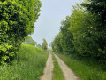
This walk starts at the Pléhédel village hall (22290), at the junction of Place du Printemps and Rue du Ménez Bré. A large car park is available near the village hall. A sign showing the various walking routes in the village can also be found near the building. For this 6.9 km circular route, follow the blue markings.
(S/E) From the village hall on Place du Printemps, head towards the centre of Pléhédel along Rue du Ménez Bré.
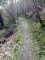
(1) At the end of the street, you’ll reach the roundabout at Place Saint-Fiacre. Go round the roundabout and carry on straight ahead towards Impasse Beauregard l’Hermitage. Follow this track as you gradually leave the village behind. The road then gives way to a winding path through the woodland.
(2) After about 300 metres, you’ll come to a tarmac road; turn right onto it and follow this road until you reach Route de Kerderrien.
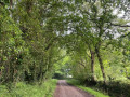
(3) At the Stop sign, turn right and continue along the road. After about 50 m, turn left onto a small, tree-lined dirt track.
(4) A blue signpost pointing at a right angle to the left shows you the way to go. Continue along this track for about 600 m, until you reach a tarmac road cutting through the fields. Turn right here, then cross the road to reach, directly opposite on your left, another dirt track.
(5) Return to the Route de Kerderrien. Turn right and continue north-east, towards the hamlet of Kerthérézien.
(6) The route then passes close to the Kernevez wayside cross. At the end of the track, turn left towards Kernevez, then carry on along the road. Continue along the Route de Kernevez, heading north.
(7) Cross the D54. You’ll pass close to a farm and gradually approach the hamlet of Kerlidic.
(8) At the Kerlidic wash house, turn left onto the path through the fields. This section, which is heavily wooded, makes for a particularly pleasant walk.
(9) Cross a road. The path continues westwards and passes close to the Guélennec wayside cross. Carry on in this direction, following the blue signposts.
(10) After just over 1 km, you’ll come out onto a heavily wooded road at a T-junction. Turn left to head back down towards the village, heading south/south-west, towards the Porz Lan neighbourhood.
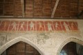
(11) You will then reach a residential area. From this point, the Blue and Red routes follow the same route for a short while. Continue along the shared route, then turn left at the junction towards Route de Kerhamon. Walk past the local football ground before joining Route des Sports. The path gradually descends towards the village centre. Near the Church of Saint-Pierre in Pléhédel, turn right onto the D54 to pass close to the church. At the crossroads, turn left onto the D21. You will then reach Rue du Ménez Bré on your right, which you took at the start of the walk.
(1) Follow it to the right to return to the village hall and its car park (S/E).
 Visorando Member

 Association / Club / Walk leader
 Moderate