Short Tour of Bréhec

This walk, which is of modest length and difficulty, will allow you to appreciate the richness of the seascape and the hinterland of the well-known site of Bréhec.
After passing a cliff overlooking the beach, you’ll reach the picturesque village of Lanloup, and then a long, gently sloping walk will take you back to the starting point.

Details

23912709
Creation:
Last update:
Last review:
  • Walking
    Activity: Walking
  • ↔
    Distance: 3.38 mi
  • ◔
    Average duration: 1h 45 
  • ▲
    Difficulty: Easy

  • ⚐
    Back to start: Yes
  • ↗
    Ascent: + 262 ft
  • ↘
    Descent: - 262 ft

  • ▲
    Highest point: 299 ft
  • ▼
    Lowest point: 20 ft
  • ⚐ Country: France
  • ⚐ City: Plouézec (22470)
  • ⚑
    Start/End: N 48.726983° / W 2.952104°
  • ❏
    IGN map(s): Ref. 0814OT, 0815SB, 0916OT
  • Hour-by-hour weather

Photos

Description of the walk

Park in the large car park at Bréhec beach.

(S/E) Leave the car park on the right and head towards the beach. Turn left onto Impasse de la Plage and start the climb up the steps. Before the final flight of steps, turn left onto Chemin Jean Lanno.

(1) At the start of the platform of the old railway line, follow theGR®34signposts. Pass the ruins of an old holiday camp on your left. At the end of this wide, flat path, head down a tarmac road to a small square.

(2) Head up to the right along Route du Vieux Bréhec. At the second junction, turn left back onto the old railway embankment (GR®34). Pass under a bridge and emerge onto Chemin du Padel. Turn right and continue to the crossroads.

(3) Take the Chemin de Kerjolis straight ahead. Follow this road to the hamlet of Kerjolis. Turn left and, at the first junction, to the right of the mobile phone mast, take the farm track then Rue Saint-Roch, following theGR®34Asignposts to the village of Lanloup.
Before reaching the village, you can follow the sign on the left for Fontaine du Golven, 150 m away. Then return to the road and continue to the village.

(4) Turn right at the church onto the descending road called Route de la Mer.

(5) After the sign for Ar Runiou, turn left onto the grassy path between two buildings. Cross the stream and immediately turn right onto a wide path which, over 1.5 km, gently slopes down to the bottom of the valley at the third pond of the natural wastewater treatment plant.

(6) At the junction, turn right to go round the far end of the reservoir and rejoin the road leading directly to the beach car park (S/E).


Waypoints

  1. S/E : mi 0 - alt. 36 ft - Bréhec beach car park
  2. 1 : mi 0.32 - alt. 121 ft - Chemin Jean Lanno
  3. 2 : mi 0.7 - alt. 154 ft - Route du Vieux Bréhec
  4. 3 : mi 1.03 - alt. 249 ft - Crossroads
  5. 4 : mi 1.99 - alt. 194 ft - The village of Lanloup
  6. 5 : mi 2.17 - alt. 148 ft - Junction on the path
  7. 6 : mi 3.08 - alt. 56 ft - The end of the resort’s lake
  8. S/E : mi 3.38 - alt. 36 ft - Bréhec beach car park

Notes

The only difficulty is the climb up the steps from the beach to reach the cliff.

Worth a visit

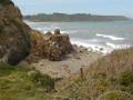
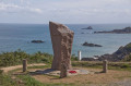
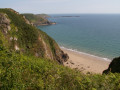
The first section offers a bird’s-eye view of Bréhec and its cove, with Pointe de la Tour to the right.
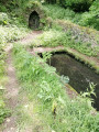
The Golven fountain and its wash house.
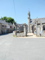
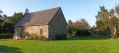
The village of Lanloup with its church surrounded by the cemetery.
The final section is more like a walk through the woods, accompanied by the sound of the Kergolo stream.

Always be cautious and plan ahead when you're outdoors. Visorando and the author of this route cannot be held responsible for any accidents occurring on this route.

The GR® and PR® markings are the intellectual property of the Fédération Française de Randonnée Pédestre.

Reviews and comments

4.4 / 5
Based on 3 reviews

Reliability of the description
4.7 / 5
Ease of following the route
4 / 5
Route interest
4.7 / 5
Taiga13
Taiga13

Overall rating : 4.7 / 5

Date of your route : Oct 16, 2023
Reliability of the description : ★★★★★ Very good
Ease of following the route : ★★★★☆ Good
Route interest : ★★★★★ Very good
Very busy route : No

A lovely route we went on with the children

Machine-translated

Pedibusjambus1956
Pedibusjambus1956

Overall rating : 3.7 / 5

Date of your route : Jul 11, 2023
Reliability of the description : ★★★★☆ Good
Ease of following the route : ★★★☆☆ Average
Route interest : ★★★★☆ Good
Very busy route : No

A very pleasant walk through the woods; the tarmac section wasn’t great, but it was still a nice walk

Machine-translated

kerheol
kerheol

Thank you for your encouragement. I’d recommend the route from Brehec to Mignard, but it’s a lot more challenging.

Machine-translated

Feolin
Feolin

Overall rating : 5 / 5

Date of your route : Jul 18, 2022
Reliability of the description : ★★★★★ Very good
Ease of following the route : ★★★★★ Very good
Route interest : ★★★★★ Very good
Very busy route : No

A very pleasant walk with excellent signposting. An easy route with no difficulties. Full of charm.
Thanks to the author of the guide.
Michel and Marie Moulin, Lyon

Machine-translated

Other walks in the area

For more walks, use our search engine .

The GPS track and description are the property of this route's author. Please do not copy them without permission.