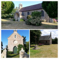
Plourivo countryside

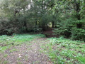
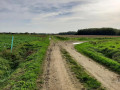
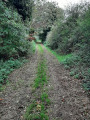
Explore the Plourivo countryside, with its charming little valleys through the woodland in a quiet part of the village.

Details

26568786
Creation:
Last update:
Last review:
  • Walking
    Activity: Walking
  • ↔
    Distance: 4.61 mi
  • ◔
    Average duration: 2h 15 
  • ▲
    Difficulty: Easy

  • ⚐
    Back to start: Yes
  • ↗
    Ascent: + 141 ft
  • ↘
    Descent: - 157 ft

  • ▲
    Highest point: 289 ft
  • ▼
    Lowest point: 174 ft
  • ⚐ Country: France
  • ⚐ City: Plourivo (22860)
  • ⚑
    Start/End: N 48.746263° / W 3.072271°
  • ❏
    IGN map(s): Ref. 0814OT, 0815SB
  • Hour-by-hour weather

Photos

Description of the walk

Parking is available in the car park by the community hall, in the centre of the village.

(S/E) From the car park, head towards the D15 via Allée du Mézou, turning first left onto Route de Paimpol, then right onto Allée Buttevant and left onto Rue Pierre Labbé (incomplete yellow signposting).

(1) After 350 m, turn right onto the road (before the ‘dead end’ sign), then left onto the path 50 m further on.
Head down into the valley, then climb up the other side, following the path towards Le Ruclé.

(2) Turn right onto the small road. After 250 m, at the junction with the D182, take the road opposite.
Walk past the farm and continue along the track.

(3) About a hundred metres past the last farm building, turn onto the path on the right. 450 metres further on, just after the bend in the path, turn left onto the grassy path between two rows of trees and continue to the D82.
Please note: contrary to what is shown on maps, the track opposite is a dead end.

(4) Turn left onto the D82 (a fairly busy road; walk along the left-hand verge and then, at the end of the right-hand bend, cross over to continue along the right-hand verge).
After about 300 m, turn right onto the path with the barrier. At the second barrier, turn right onto the path. Where the path narrows, carry on straight ahead and, after 50 m, turn left onto the path.

(5) At the end of the track, turn right onto the small, partly tarmac-surfaced road, heading towards the hamlet of Lézoën.

(6) Take the sharp left-hand bend onto the D15, then, after 150 m on the right, take Chemin de la Vallée (walk on the left-hand verge if possible). Follow the path to the stream, cross via the footbridge and head up the valley.
At the barrier, turn right onto the local track towards Kerban.

(7) On leaving the hamlet, at the end of the tarmac section, continue along the track. Cross a footbridge and turn left, following the stream for a short while, before heading up the valley along the track on the right, as far as Kerbellec
At the exit, near the hangars, take the path on the right until you reach the tarmac section. Turn right and follow the road until you rejoin the D15.

(8) Turn left, cross the D15 at the pedestrian crossing and follow it to the left to reach the village of Plourivo via the footpath running parallel to the road, then along the pavements.
At the Stop sign, carry on straight ahead, then turn left immediately after the chemist’s to reach the car park (S/E).

Waypoints

  1. S/E : mi 0 - alt. 243 ft - Car park at the community hall
  2. 1 : mi 0.35 - alt. 243 ft - Junction
  3. 2 : mi 0.72 - alt. 246 ft - Le Ruclé
  4. 3 : mi 1.09 - alt. 272 ft - Junction after the farm
  5. 4 : mi 1.71 - alt. 282 ft - D82
  6. 5 : mi 2.32 - alt. 266 ft - Narrow road
  7. 6 : mi 2.7 - alt. 282 ft - Lézoën
  8. 7 : mi 3.55 - alt. 272 ft - Kerban
  9. 8 : mi 4.18 - alt. 253 ft - D15
  10. S/E : mi 4.61 - alt. 243 ft - Car park at the community hall

Notes

In the village, there is a bakery (closed on Wednesdays), a grocery shop (closed on Tuesdays), a bar and a chemist’s.
Before Le Ruclé, the path may be slippery after heavy rain. Sturdy walking shoes are recommended.

Worth a visit

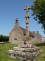
Plourivo Church.

Reviews and comments

3.9 / 5
Based on 3 reviews

Reliability of the description
4.3 / 5
Ease of following the route
4 / 5
Route interest
3.3 / 5
hb28
hb28

Hello
Thank you for your interest in this walk.
As the route has not been mapped out by a local authority or the FFRP, it cannot be signposted. You will need to follow the route using your mobile phone and/or the route description on Visorando.
Henry

Machine-translated

User 25242704

Overall rating : 4 / 5

Date of your route : Sep 21, 2026
Reliability of the description : ★★★★☆ Good
Ease of following the route : ★★★★☆ Good
Route interest : ★★★★☆ Good
Very busy route : Yes

The lack of signage often means you have to use your mobile phone, as the route is not clearly marked

Machine-translated

Patriciadu22
Patriciadu22

Overall rating : 4.7 / 5

Date of your route : Oct 12, 2025
Reliability of the description : ★★★★★ Very good
Ease of following the route : ★★★★★ Very good
Route interest : ★★★★☆ Good
Very busy route : No

Pleasant route with many paths, no difficulty. However, avoid in winter.
Some roads but few vehicles.

Machine-translated

Philippe 22
Philippe 22

Overall rating : 3 / 5

Date of your route : Aug 28, 2023
Reliability of the description : ★★★★☆ Good
Ease of following the route : ★★★☆☆ Average
Route interest : ★★☆☆☆ Disappointing
Very busy route : No

This route lacks points of interest, has a lot of tarmac and some poor-quality paths in the first few kilometres.

Machine-translated

Other walks in the area

For more walks, use our search engine .

The GPS track and description are the property of this route's author. Please do not copy them without permission.