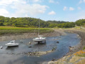
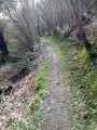
From the Saint-Jacques Chapel to Bois Gelin along the Kerguidoué

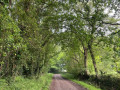
A walk mainly through woodland that leads from the Saint-Jacques Chapel to the heart of the Bois Gelin estate. Partially signposted walk.

Best undertaken from April to October as sections can be muddy in winter.

Details

n°14893408
Creation:
Last update:
Last review:
  • Walking
    Activity: Walking
  • ↔
    Distance: 4.60 mi
  • ◔
    Average duration: 2h 25 
  • ▲
    Difficulty: Easy

  • ⚐
    Back to start: Yes
  • ↗
    Ascent: + 341 ft
  • ↘
    Descent: - 348 ft

  • ▲
    Highest point: 279 ft
  • ▼
    Lowest point: 79 ft
  • ⚐ Country: France
  • ⚐ City: Tréméven (22290)
  • ⚑
    Start/End: N 48.678598° / W 3.041462°
  • ❏
    IGN map(s): Ref. 0815SB
  • Hour-by-hour weather

Photos

Description of the walk

Start from the small car park at the Saint-Jacques Chapel in Trémeven. GPS: N 48.678598°/ W 3.041462°

(S/E) Take the tarmac road leading uphill to the left of the chapel.

(1) After 250 m, take the path leading down to the Kerguidoué stream. Cross the stream on the left and join the wide path leading uphill.

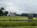
(2) Turn right until you reach a large wayside cross, which turns out to be the tomb of the Bois Gelin family, the estate’s owners. There is a breathtaking view over the Kerguidoué valley, with the castle visible in the distance. Continue along the now flat path and exit the woods.

(3) After 200 m along this stony path, turn right onto a forest track leading downhill until you reach the D96 road. Turn right onto it and follow it to the Moulin du Traou.

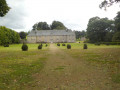
(4) Take the grassy path that runs alongside the mill building (before crossing the bridge). Continue straight on through the castle grounds, following a wide grassy path lined on both sides by young trees, until you reach the gate of a manor house.

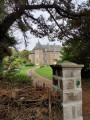
(5) Turn right and walk alongside three ponds offering a stunning view of Bois Gelin Castle and its golf course. At the end of the third pond, cross the dam and continue through the woods, skirting the edge of the golf course. Leave the grounds and reach the tarmac road.

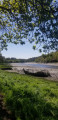
(6) Stay on the riverbank behind the crash barrier. Cross the Kerguidoué and follow an old tarmac road for 100 metres. Turn right onto the dirt track and follow the stream towards Lizelec’h

(7) In the middle of the hamlet of Lizelec’h, turn left, then at the last house, turn right onto a dirt track running alongside a field towards the Chapelle Saint-Jacques. At the road, turn right towards the chapel (S/E).

Waypoints

  1. S/E : mi 0 - alt. 102 ft - Car park at the - Chapelle Saint-Jacques (Tréméven)
  2. 1 : mi 0.26 - alt. 171 ft - Tarmac road x Track
  3. 2 : mi 0.8 - alt. 243 ft - Turn right at the fork
  4. 3 : mi 1.24 - alt. 276 ft - Junction of the stony track with the forest path
  5. 4 : mi 1.98 - alt. 95 ft - Former Traou Mill
  6. 5 : mi 2.27 - alt. 138 ft - Gate to the manor house
  7. 6 : mi 3.27 - alt. 135 ft - Exit from the estate
  8. 7 : mi 4.04 - alt. 180 ft - The hamlet of Lizelec’h
  9. S/E : mi 4.6 - alt. 105 ft - Car park at the - Chapelle Saint-Jacques (Tréméven)

Worth a visit

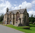
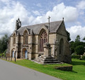
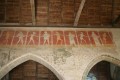
The Saint-Jacques Chapel (open to visitors) boasts a distinctive architectural style due to its imposing size.

The huge Calvary cross in the middle of the woods offers a view of the valley, with Bois Gelin Castle in the distance
The walk takes you through the heart of the estate, offering a truly remarkable view of the château surrounded by its golf course and ponds.

Reviews and comments

4.2 / 5
Based on 2 reviews

Reliability of the description
4 / 5
Ease of following the route
4 / 5
Route interest
4.5 / 5
Rozen
Rozen

Overall rating : 4 / 5

Date of your route : Dec 10, 2025
Reliability of the description : ★★★★☆ Good
Ease of following the route : ★★★★☆ Good
Route interest : ★★★★☆ Good
Very busy route : No

A lovely walk through the woods, with wide paths and a peaceful atmosphere. Thank you!

Machine-translated

Dan_visorando
Dan_visorando

Overall rating : 4.3 / 5

Date of your route : Nov 07, 2021
Reliability of the description : ★★★★☆ Good
Ease of following the route : ★★★★☆ Good
Route interest : ★★★★★ Very good
Very busy route : No

Please note that between points 1 and 2, after crossing the stream on the wide path leading uphill, there is currently roadworks and the path may be closed. (Yesterday, Sunday, there were no problems.)

Machine-translated

Other walks in the area

For more walks, use our search engine .

The GPS track and description are the property of this route's author. Please do not copy them without permission.