Along the Trieux de Lézardrieux to Kermouster

From the small tourist harbour at Lézardieux, come and explore the Trieux estuary, which is navigable as far as Pontrieux. Here you’ll find the lights that guide night-time navigation on the river, as well as an unobstructed view towards the Île de Bréhat. On the return journey inland, two small chapels line the route.

Details

472247
Creation:
Last update:
Last review:
  • Walking
    Activity: Walking
  • ↔
    Distance: 8.90 mi
  • ◔
    Average duration: 4h 35 
  • ▲
    Difficulty: Moderate

  • ⚐
    Back to start: Yes
  • ↗
    Ascent: + 564 ft
  • ↘
    Descent: - 561 ft

  • ▲
    Highest point: 256 ft
  • ▼
    Lowest point: 7 ft
  • ⚐ Country: France
  • ⚐ City: Lézardrieux (22740)
  • ⚑
    Start/End: N 48.787932° / W 3.102926°
  • ❏
    IGN map(s): Ref. 0814OT, 0815SB
  • Hour-by-hour weather

Description of the walk

Car park at Lézardrieux harbour.

Red and white markings ofthe GR® 34

(S/E) Head north-east along the harbour basin, then follow the Route du Trieux, which climbs whilst curving to the left.

(1) Turn right to head down into the landscaped area and join Rue Georges Brassens. At the top of the street, you’ll rejoin Rue du Trieux for 30 metres and continue right into Rue des Perdrix. Ignore all the streets on the right and head towards a hairpin bend.

(2) Leave the lane on your right and carry on straight ahead along the nature trail. Follow the road to the left, passing the Coatmer-Amont beacon on your left, then veer right 50 metres further on.
Follow this path until you reach a road, then turn left.
Off the route: if you carry on straight ahead along this road, you’ll reach the Coatmer Aval lighthouse.

(3) Warning! ‘If the tide is high, the foreshore is inaccessible; see the alternative route below.’

Carry on to the right along Rue du Moulin à Mer. Go down onto the foreshore and head back up to the left towards the houses. Follow the stream and cross it twice to reach the hamlet of Coalan. Follow Impasse de Coalan to the right.

(4) At the end of the cul-de-sac, continue to the right towards Kerhamon. Twenty metres past a road on the left, take the path on the left which winds its way between the houses, bending first to the right then to the left, and ends at the hamlet of Prat.

(5) Take the road on the right for 40 metres and turn onto the path on the left. At the end of the path, turn right.

(6) At the Y-junction, take the left-hand branch. Continue right along the road and stay on it, ignoring the turnings to the right and left. Enter Kermouster via Rue de l’École.

(7) Take thefirst street on the right, then very quickly turn onto the path on the left. Cross Rue du Lavoir and take a sharp right 20 metres further on.
At the T-junction, turn left into Rue de l’Île à Bois.

No further signposting

Leave theGR® behind, turn right and continue along Rue de l’Île à Bois, which merges into Rue Saint-Maudez. Walk through the village to the junction.

(8) Turn left to walk past the cemetery and join the D20 road. Follow it to the left for a hundred metres.

(9) At the crossroads, turn slightly right. Pass the hamlets of Kervranec and Toullan on your right and reach Pont Plouzen.

(10) Follow the path south-south-west for just over a kilometre and, at the T-junction, continue left for a few metres.

(11) Follow the path to the right, then take Rue de Kervoas on the right and continue westwards to the next T-junction. At Coat Halec, turn left and continue along the road.

(12) Turn left onto the path, which becomes a road, to cross Kermaria. Continue until you reach another T-junction. Turn left and head for the Croaz-Hent junction.

(13) Turn left. The road leads to the Kermenguy neighbourhood. At the junction, carry on straight ahead along Rue de Kermenguy, which becomes Rue du Trieux and leads to the port of Lézardrieux (S/E).


Waypoints

  1. S/E : mi 0 - alt. 23 ft - Marina car park - Trieux (fleuve)
  2. 1 : mi 0.3 - alt. 69 ft - Stairs leading down to the right
  3. 2 : mi 0.98 - alt. 52 ft - Carry straight on along the nature trail
  4. 3 : mi 1.49 - alt. 33 ft - Road on the right or start of the alternative route
  5. 4 : mi 2.11 - alt. 194 ft - Road on the right or end of the alternative route
  6. 5 : mi 2.48 - alt. 174 ft - The hamlet of Le Prat
  7. 6 : mi 2.82 - alt. 167 ft - Path on the left
  8. 7 : mi 3.67 - alt. 138 ft - Kermouster
  9. 8 : mi 4.44 - alt. 138 ft - Road on the left
  10. 9 : mi 4.91 - alt. 194 ft - Road on the right
  11. 10 : mi 5.48 - alt. 197 ft - Plouzen Bridge
  12. 11 : mi 6.32 - alt. 220 ft - Path on the right
  13. 12 : mi 7.03 - alt. 240 ft - Path on the left
  14. 13 : mi 7.78 - alt. 253 ft - Road to the left
  15. S/E : mi 8.91 - alt. 23 ft - Marina car park

Notes

The Trieux estuary and, a little further to the west, the Jaudy estuary – estuaries known as ‘abers’ in Brittany, ‘rias’ in Spain and ‘fjords’ in Sweden: valleys flooded by the sea – define the Trégor peninsula of Pleubian. This extends out to sea for several kilometres via the Sillon de Talbert (3 km long and 35 m wide).

Alternative route forthe GR® 34 if the foreshore is inaccessible
(3) Turn left onto Rue du Moulin à Mer. At the Traou Bihan crossroads, take the road on the right (D20) to Croaz Rozel: there is a wayside cross on the right. Turn left and head for the (4).

Worth a visit

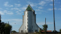
The lighthouses at Coatmer-Aval and Coatmer-Amont: The alignment of these lighthouses provides access to the port of Lézardrieux and, further upstream, the entire Trieux valley.

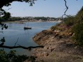
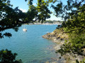
The Trieux estuary

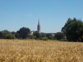
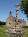
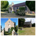
(7) Kermouster Chapel
Taking the short circular loop after (12): Kermaria Chapel

Always be cautious and plan ahead when you're outdoors. Visorando and the author of this route cannot be held responsible for any accidents occurring on this route.

The GR® and PR® markings are the intellectual property of the Fédération Française de Randonnée Pédestre.

Reviews and comments

3.4 / 5
Based on 5 reviews

Reliability of the description
3.4 / 5
Ease of following the route
3.4 / 5
Route interest
3.4 / 5
DidetVero
DidetVero

Overall rating : 2.3 / 5

Date of your route : Mar 08, 2024
Reliability of the description : ★★☆☆☆ Disappointing
Ease of following the route : ★★★☆☆ Average
Route interest : ★★☆☆☆ Disappointing
Very busy route : No

The scenery really wasn’t great – too far from the sea, sections through wooded countryside in 40 cm of water, branches, mud and so on… far too much tarmac afterwards, which wasn’t of any interest to us… A shame.

Machine-translated

Jfrmdr
Jfrmdr

Overall rating : 3.7 / 5

Date of your route : Nov 15, 2021
Reliability of the description : ★★★★☆ Good
Ease of following the route : ★★★☆☆ Average
Route interest : ★★★★☆ Good
Very busy route : No

As I have noticed on other walks elsewhere in France,
parts of the route are impassable as nature has reclaimed the land, but otherwise the route is interesting.

Machine-translated

LE BRETON Randonneur

Overall rating : 4 / 5

Date of your route : Oct 03, 2021
Reliability of the description : ★★★★☆ Good
Ease of following the route : ★★★★☆ Good
Route interest : ★★★★☆ Good
Very busy route : Yes

Excellent

Machine-translated

pct081054
pct081054

Overall rating : 3 / 5

Date of your route : Jun 11, 2021
Reliability of the description : ★★★☆☆ Average
Ease of following the route : ★★★☆☆ Average
Route interest : ★★★☆☆ Average
Very busy route : No

A walk that wasn’t particularly spectacular in terms of scenery.
On the way back, at one point, it was impossible to follow the marked path as it was overgrown with stinging nettles and brambles blocking the way (this was just before reaching the little chapel at Kermaria between points 12 and 13).
Once the GR markings disappeared, it was difficult to find the path by reading the description alone. We had to rely on the GPS, and even then, right at the very end we ended up taking a different path.

Machine-translated

michèle LEBOUVIER
michèle LEBOUVIER

Overall rating : 4 / 5

Date of your route : Jun 28, 2021
Reliability of the description : ★★★★☆ Good
Ease of following the route : ★★★★☆ Good
Route interest : ★★★★☆ Good
Very busy route : No

A lovely walk – the starting point at Lezardrieux is as beautiful as ever! A lovely walk (best done at rising tide), but be sure to take the alternative route (at Moulin de la Mer): at high tide, the ground is very slippery as you head up the GR trail! Take care. Kermouster is magnificent! (A short detour to Île à Bois) is a must! Views of Loguivy-de-la-Mer and Bréhat!

Machine-translated

Other walks in the area

For more walks, use our search engine .

The GPS track and description are the property of this route's author. Please do not copy them without permission.